More From Contributor

£12.99
The Peak District in Crimson’s ‘ Best of Britain’ series, encompassing a range of guides covering Britain’s regions, exploring some of the best places to eat, find organic & local produce, as well as things to do in wet weather, places to stay & local legends, festivals & pubs. The guides are particularly child-friendly, with a range of activities for those visiting with children. Extensive introductory sections cover factual information about the region, with details of when to go, getting there & around, accommodation, food & drink, festivals & annual events, travelling with children, activities, organised holidays & courses & further practical tourist guidance. A background section also offers insights into the area’s history, geography & geology, wildlife & habitats, culture & local heroes. The main guide section of each title is organised geographically by region, with a list of ‘unmissable highlights’ in the region opening each chapter, so readers can see the main highlights at a glance. ‘ What to see & do’ sections are arranged under ‘fair weather’ & ‘wet weather’, to allow visitors the flexibility to plan their trip accordingly. Each guide in the series incorporates a number of themed maps such as recommended restaurants & gastro-pubs, things to do with children & historical experiences. ‘ Photo Essays’ – a series of colour photographs documenting the region’s highlights – are also included, exploring the local landscape, countryside & where appropriate, coastline. ...
Archived Product
£8.50
This guide describes 24 new rides within this superb area of outstanding natural beauty. All rides are circular with descriptions ...
Archived Product
£4.99
Peak District & Derbyshire presented at 1:100, 000 on an indexed Ordnance Survey Tour Map with extensive tourist information including highlighting for national & regional cycle routes. Town navigation maps show main traffic arteries, tourist facilities & sights in Ashbourne, Burton upon Trent, Buxton, Chesterfield, Derby, Matlock
- Matlock Bath, Nottingham & Sheffield. The map

Includes::
lists of restricted motorway junctions, selected places of interest, well dressing locations, market days, & farmers markets. Current edition of this title was published in February 2016. To see the list of titles in this series please click on the series list – Ordnance Survey’s Tour maps have extra clear, uncluttered cartography. Topography is shown by altitude colouring & relief shading, plus names of local hill or mountain ranges & heights of important peaks. Additional colouring indicates woodlands; boundaries of National Parks or designated Areas of Outstanding Natural Beauty are also marked. Road information very clearly distinguishes between different types of roads, from motorways to small local roads, with distances on main routes. Scenic routes are highlighted; motorway services, tolls, gradients on steep roads & level crossings are marked & towns used in motorway signs as Primary Route Destinations are indicated. Railway lines are shown with stations &, where appropriate, ferry routes are marked. Roads which are part of the national or regional cycle network are highlighted & shown with route numbers; the maps also show the National Trail long-distance hiking paths. An extensive range of symbols indicate various places of interest, including campsites/caravan parks & youth hostels/bunkhouses, historic buildings, sport & recreational facilities, country pubs, etc. The maps have lines of the British National Grid. The place names index is supplemented by a list of selected places of interest plus, in most titles, of market days and/or farmers markets. The maps also include city navigation maps, highlighting main traffic arteries, car parks, principal sights & facilities, etc. For more information please see descriptions & coverage images of individual maps.


...
Archived Product
£5.99
Folded map guide of the Peak District & Staffordshire Moorlands from Goldeneye, with a touring map on one side at 1:100, 000 & tourist information on the reverse. Cartography shows A & B, & minor roads, as well as railway lines & stops. Topography is shown through altitude colouring at intervals of 250feet, & spot heights. Points of interest & local facilities are prominently highlighted, such as castles, museums, accommodation, parking, & more. Towns & villages are indexed. The reverse has an introduction to the Peak District & Staffordshire Moorlands, followed by recommended places to visit, with some arranged by particular interest, including Arts & Crafts, Wildlife, Historical, Theaters, & Visitor Centres. ...
Archived Product
£6.99
This attractive & cleverly structured guide gives walkers ten of the finest short, circular, themed walks in the Peak District National Park in a popular pocketable format. With clear information, an overview & introduction for each walk, expertly written numbered directions, large scale Ordnance Survey maps, superb eye-grabbing panoramic photographs, & interpretation of points of interest along the way, these guides set a new standard in clarity & ease-of-use. Featured walks include: Peacock Inn, Bakewell
- pub walk, Dovedale
- dales & valleys, Castleton & Cave Dale
- dales & valleys, Chatsworth
- history walk, Stanage Edge
- rocks & edges, Lud`s Church
- history walk, Three Shires Head
- waterside walk, The Roaches
- rocks & edges, Shutlingsloe
- moors & tors, Edge of Kinder
- moors & tors.


...
Archived Product
£7.95
Peak District: Dark Peak Adventure Atlas at 1:25, 000 in a series of handy A5 size Adventure Atlases from Geographers` A-Z Map Company with cartography from the Ordnance Survey’s Explorer series. Coverage

Includes::
Glossop, Hadfield, Stocksbridge, Chapel-en-le-Frith, Hope, Bamford, New Mills, Castleton, Bradwell, Hayfield, Tintwistle, Greenfield, Diggel, Meltham, Edale – the starting point of the Pennine Way, Kinder Scout, Mam Tor, Bleaklow Hill, Black Hill, Howden & Midhope Moors, etc. To see other titles in this series please click on the series link.A-Z Adventure Atlases have cartography of the Ordnance Survey’s Explorer maps & provide plenty of recreational & tourist information, indicating traditional public rights of way paths, including bridleways & byways restricted or open to motorized traffic. Also shown are other routes with public access, including permissive footpaths & bridleways. Special marking indicates National Trails, Long-distance Routes & Recreational Routes, & for cyclists the maps show traffic-free routes & the National Cycle Network. A wide range of symbols highlights locations of special tourist interest: camping & caravanning sites, youth hostels, information offices & visitors’ centres, parking & picnicking places, historic buildings (indicating where appropriate National Trust, English Heritage, or Cadw), sites for various recreational pursuits, country pubs, public toilets, etc. The mapping provides detailed presentation of the topography with contours at 5 or 10m intervals, numerous spot heights & colouring and/or graphics for different types of terrain or vegetation. Additional colouring shows access l&, including areas managed by the National Trust, Forestry Commission & Woodland Trust. All the standard information expected of high quality survey mapping at this scale is included: finely graded road network, railway lines with stations, cuttings or embankments, individual isolated buildings, etc. For GPS each page as a 1-km British National Grid. Each atlas has an index which

Includes::
geographical features, nature reserves, youth hostels, car parks, etc, & provides additional notes on safety & security when walking, plus QR codes for obtaining by mobile phone information about local weather, danger areas, mountain rescue, map reading, OS National Grid coordinates, etc.


...
Archived Product
£12.95
“ Day Walks in the Peak District” contains 20 circular routes that are between 8 & 12 miles long, recommended more for the experienced walker to complete in a day, taking in the High Moors, the Peak`s hills, tors, edges & the Limestone Country. Each walk is described in detail, with distances given & an alternative ‘optional’ route given. The book is illustrated with over a hundred inspirational photographs, & features simple, boldly coloured maps for each route, showing points of interest & local facilities, such as parking. ...
Archived Product
£11.99
Produced in association with the Ramblers, this walking guide covers the popular Peak District & combines detailed route descriptions with information on the local history & wildlife. The Peak District boasts an unrivalled network of around 1, 400 miles of public rights-of-way, & over 80 square miles of open access on the northern moors. This guide allows the reader to explore the infinite variety of walking opportunities, which range from gentle riverside strolls, to tough moorland treks. The introduction gives information about the topography, geology & history of the area, & describes the flora & fauna inhabiting it. The main section of the book comprises 30 walks. Each walk has a key illustrating principal features, such as level of difficulty & type of terrain, a route profile indicating altitude & distances, & a fact file summarising useful information such as start & finish points, duration, safety advice & points of interest. Illustrated with colour maps from the Ordnance Survey each walk is then described in detail with clear, easy-to-follow instructions. As well as route descriptions, the text gives the history of the main landmarks along the way plus information on the natural history of the area, & is accompanied by stunning colour photographs. Overview map on inside front cover also show start points of the walks. Walks are colour coded to indicate level of difficulty: green for the simpler walks, then amber for moderate walks, then red for the more challenging walks aimed at more experienced walkers. Front cover flap contains the key to symbols used in the text & on the route maps. ...
Archived Product
£7.99
Peak District in the Short Walks guide series, produced in association with Ordnance Survey & published by Crimson; comprising a range of walking guides to popular British destinations. Each title

Includes::
20 varied walks that are suitable for walkers of all ages & abilities & is accompanied by detailed Explorer 1:25, 000 Ordnance Survey mapping with colour-coded marked routes. The guides are structured in three main sections with different levels of difficulty- short & easy walks, those of modest length that may include uphill walking & more challenging routes that may be longer & over more rugged terrain- covering a total of 20 walks. Each walk has a mini summary & an information box with details of starting points, distance, approximate time, parking & any individual route features. There is also information on refreshments, local transport & public toilets en route. Appendices provide further useful information on walking safety, GPS, the Countryside Code, local organisations & Ordnance Survey maps.

...
Archived Product
£8.95
Peak District: White Peak Adventure Atlas at 1:25, 000 in a series of handy A5 size Adventure Atlases from Geographers` A-Z Map Company with cartography from the Ordnance Survey’s Explorer series. Coverage

Includes::
Buxton, Bakewell, Chapel-en-le-Frith, Bollington, Whaley Bridge, Leek, etc, with Matlock just off the atlas. To see other titles in this series please click on the series link.A-Z Adventure Atlases have cartography of the Ordnance Survey’s Explorer maps & provide plenty of recreational & tourist information, indicating traditional public rights of way paths, including bridleways & byways restricted or open to motorized traffic. Also shown are other routes with public access, including permissive footpaths & bridleways. Special marking indicates National Trails, Long-distance Routes & Recreational Routes, & for cyclists the maps show traffic-free routes & the National Cycle Network. A wide range of symbols highlights locations of special tourist interest: camping & caravanning sites, youth hostels, information offices & visitors’ centres, parking & picnicking places, historic buildings (indicating where appropriate National Trust, English Heritage, or Cadw), sites for various recreational pursuits, country pubs, public toilets, etc. The mapping provides detailed presentation of the topography with contours at 5 or 10m intervals, numerous spot heights & colouring and/or graphics for different types of terrain or vegetation. Additional colouring shows access l&, including areas managed by the National Trust, Forestry Commission & Woodland Trust. All the standard information expected of high quality survey mapping at this scale is included: finely graded road network, railway lines with stations, cuttings or embankments, individual isolated buildings, etc. For GPS each page as a 1-km British National Grid. Each atlas has an index which

Includes::
geographical features, nature reserves, youth hostels, car parks, etc, & provides additional notes on safety & security when walking, plus QR codes for obtaining by mobile phone information about local weather, danger areas, mountain rescue, map reading, OS National Grid coordinates, etc.


...
Archived Product

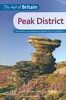
Peak District - Dark Peak

Dark Peak in the Pathfinder Guides series, produced in association with Ordnance Survey and published by Crimson; comprising a range of walking guides to popular British destinations. Each Pathfinder guide includes 28 varied walks ranging from easy strolls to exhilarating hikes and is accompanied by 1:25, 000 Ordnance Survey mapping with marked, colour-coded routes. Introductory sections profile the county or region covered, with recommendations on the best time to visit and a brief explanation of GPS. An
RIP - This product is no longer available on our network. It was last seen on 25.09.2019

This page now acts as a permanent archive for this product. Add more information using the comments box below to ensure it can still be found by future generations.

Use our search facility to see if it is available from an alternative contributor.
  • External links may include paid for promotion
  • Availability: Out Of Stock
  • Supplier: Stanfords
  • SKU: 9781854584946
Availability: In Stock
£11.99

Product Description

Dark Peak in the Pathfinder Guides series, produced in association with Ordnance Survey & published by Crimson; comprising a range of walking guides to popular British destinations. Each Pathfinder guide

Includes::
28 varied walks ranging from easy strolls to exhilarating hikes & is accompanied by 1:25, 000 Ordnance Survey mapping with marked, colour-coded routes. Introductory sections profile the county or region covered, with recommendations on the best time to visit & a brief explanation of GPS. An

Reviews/Comments

Add New

Price History

Vouchers

No voucher codes found.
Do you know a voucher code for this product or supplier? Add it to Insights for others to use.

Facebook

Jargon Buster

GPS - Global Positioning System - Global position using satellites
Dark - A colour which absorbs visable ligt so apears less light than objects that reflect light
Colour - The categorised spectrum of light visable to humans
Popular - Something that is admired and liked by many people.

Supplier Information

Stanfords
Stanfords was established in 1853 and opened their iconic Covent Garden flagship store in 1901. They have become the top retailer of maps, travel books and accessories in the UK and arguably offer the largest selection of maps and travel books worldwide. Famous names such as Captain Robert Falcon Scott, Ranulph Fiennes and Michael Palin have purchased from Stanfords. They now have a shop in Bristol and both stores together with other venues operate a calendar of events including talks, book signings and exhibitions. As a specialist map retailer, the map selection is comprehensive and includes road maps, street maps and walking maps from worldwide destinations, as well as a selection of world atlases and wall maps. Books include travel guides and travel literature. Stanfords also stock globes, from miniatures made of blue marble to magnificent floor-standing globes. The website features a selection of interesting articles on travel topics.
Page Updated: 2023-11-12 20:15:36

Community Generated Product Tags

Oh No! The productWIKI community hasn't generated any tags for this product yet!
Menu