
 United Kingdom
 France
 Germany
 Netherlands
 Sweden
 USA
USA
 Italy
Italy
 Spain
Spain
More From Contributor


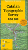


Pallars Jussà
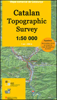
Topographic survey of Catalonia at 1:50, 000 from the Institut Cartogràfic de Catalunya, with vivid presentation of the terrain and an overprint for long-distance GR hiking trails. The series provides an excellent alternative to the much smaller sheets in the civilian or military surveys produced for the whole of Spain. The Catalan 50K series has not only a much larger area per sheet (each map covers one comarca, an administrative division of a province) than the maps from the national surveys, but also has more colourful, elegant and clear cartography with contours at 20m intervals, hill shading and fine graphics to portray the relief, vegetation types and landmarks.Most maps also have more tourist-related information, with an overprint highlighting long-distance GR trails and the
Via Verde routes. Mountain refuges are marked and a range symbols indicate various places of interest including historical monuments, sport and recreational facilities, etc. Four different types of interesting locations are highlighted: picturesque towns or villages, individual isolated building or monuments, natural sites, and hydrographic features such as waterfalls. The maps have a 5km UTM grid, with latitude and longitude values shown for the map corners. Map legend is in Catalan only.To see other titles in this series please click on the series link.
Via Verde routes. Mountain refuges are marked and a range symbols indicate various places of interest including historical monuments, sport and recreational facilities, etc. Four different types of interesting locations are highlighted: picturesque towns or villages, individual isolated building or monuments, natural sites, and hydrographic features such as waterfalls. The maps have a 5km UTM grid, with latitude and longitude values shown for the map corners. Map legend is in Catalan only.To see other titles in this series please click on the series link.

Product Description
Reviews/Comments
Add New
Vouchers
No voucher codes found.
Do you know a voucher code for this product or supplier? Add it to Insights for others to use.
Do you know a voucher code for this product or supplier? Add it to Insights for others to use.
 Denmark