More From Contributor

£11.99
Oman at 1:1, 300, 000 on a road map from the country’s Ministry of Tourism, accompanied by 15 panels showing in more detail popular tourist areas & main towns with lists of principal sights, plus extensive tourist information including general advice, lists of UNESCO World Heritage sites, caves, etc. The main map at 1:1, 300, 000 has altitude colouring & indicates sand dunes, salt marshes & wadis. Road network shows locations of petrol stations. Other symbols mark hotel accommodation, youth hostels, medical facilities, & various places of interest: forts & castles, camel & horse racing tracks, diving sites, etc. Small drawing of local birds & animals indicate best places to find them. Latitude & longitude lines are drawn at 1º intervals. Accompanying index lists main towns, UNESCO World Heritage sites, archaeological remains, forts & castles, & caves, plus provides useful tourist tips. The map clearly indicates the areas shown on the enlargements & street plans which provide more detailed tourist information. Enlargements include the environs of Muscat, popular wadi routes on the coast west of the capital, Ak Jabal Al Akhdar area, mountain roads around Salalah, etc. Muscat is shown on an overall street plan with additional enlargements covering its most visited districts, & other plans cover Salalah, Sur, Suhar, etc. All panels annotated with symbols indicating locations of hotels, important buildings, etc, & are accompanied by lists of main attractions. Map legend & all the text are in English. ...
Archived Product
£5.99
A handy, compact guide to Oman with an indexed, pull-out map. About this series: Pocket-sized guide books of essential information, usually written by residents of the destination. Covering sights, culture, history, activities, the best places for eating & drinking, & much more. Illustrated with full-colour photographs, the mini-guides also contain detailed area maps & dedicated pull-out map attached to the inside cover. ...
Archived Product
£20.00
Explorer Publishing's Oman Off-Road is the ultimate accessory for any 4WD, the Oman Off-Road Explorer helps drivers to discover Oman's 'outback.' It

Includes::
detailed yet easy-to-use maps feature superimposed routes, GPS coordinates & points of interest.

...
Archived Product
£5.99
Oman in the Pocket Guide series from Berlitz; a collection of handy, pocket-sized guides dedicated to an extensive range of cities, regions & countries worldwide. Written in narrative form, individual guides explore the history, main sights & attractions, food & drink, accommodation & local culture of the destination in detail. Each Berlitz pocket guide has a similar format, with colour-coded sections helping readers locate information quickly in addition to distinctive chapters exploring the city or region. An introduction outlines the destination for visitors & a section dedicated to 'A Brief History' actually explores the area in relative depth. A where to go chapter is organized by region & city & is written in prose form with references to individual sites highlighted in bold for clarity. There are also further suggestions on where & when to eat. Recommendations for leisure activities in the region, including sport, nightlife & shopping, are also provided & tailored accordingly for each destination. Handy travel tips are listed alphabetically in a dedicated section, providing practical guidance & helping visitors make the most of their stay. The main hotels, particularly for cities, are also listed in an accommodation section, offering a brief overview with approximate price bandings & relevant contact details. ...
Archived Product
£11.50
Indexed, waterproof & tear-resistant road map of Oman at 1:850, 000 with topographic & tourist information, published by Reise Know-How as part of their highly acclaimed World Mapping Project. The map is double-sided to present the area at best possible scale on a convenient size sheet. Coverage on the northern side of the map

Includes::
Dubai, Sharjah & Al-Ain. Names of larger towns & settlements are also shown in Arabic; all other names are in the Latin alphabet only. Road network is easy to see on a clear base which shows the country’s topography by altitude colouring with contours, spot heights, & names of hill ranges & seasonal rivers. Internal administrative boundaries are shown with names of the provinces. Road network

Includes::
unsurfaced roads & 4WD tracks, indicating locations of border crossings. A range of symbols highlights various places of interest, including UNESCO heritage sites, archaeological remains, selected hotels & youth hostels, oasis, bird sanctuaries & turtle breeding grounds, surfing & diving sites, etc. The map also indicates locations of oil fields & oil wells. The map has a latitude & longitude grid at intervals of 1° & an index of place names. Map legend

Includes::
English.


...
Archived Product
£13.99
The modern coastal city of Muscat provides a gateway to scuba diving, dhow cruising & turtle watching, whilst the ancient inner regions provide ideal terrain to take a 4WD through wadis or desert. Some of the most luxurious hotels in the Middle East are in Oman, so this guide is suitable for up-market travellers & backpackers alike. ...
Archived Product
£15.99
Oman, UAE & Arabian Peninsula in the Countries & Regions series from Lonely Planet, market-leading comprehensive guides aimed at independent travellers & serving a large range of international destinations. Frank & informal in style, the guides explore an extensive range of sights, activities, accommodation, restaurants & nightlife & are designed for practical use while travelling on the road. Written & researched by a team of experts, each book is independent in its recommendations & suggestions, often offering individual takes on individual destinations. Widely recognised for their reliability, each Lonely Planet country & region guide has the same layout. Introductory sections profile the destination with individual chapters on particular highlights, getting started, (including when to go) itineraries, history, culture, arts, food & drink & the environment. Each guide is organised geographically by region, with individual sections detailing an extensive range of sights, places of interest, attractions, restaurants, nightlife, accommodation & any local activities. The guides have detailed explanations of historical context where relevant. There is also practical guidance on ...
Archived Product
£18.99
Discover Oman, UAE, & the Arabian Peninsula
Sneak (legally) into the dunes of Saudi Arabia's Empty Quarter & experience all
...
Archived Product
£14.95
Map No. J-7B in the TPC series: military topographic survey mapping covering the world's land masses & significant islands at 1:500, 000. The maps are useful as general topographical coverage where nothing else is available, although they are designed primarily as flying charts for military aircraft. TPC stands for Tactical Pilotage Chart. Relief is portrayed by a combination of contours (basic interval 500ft, intermediate contours shown where appropriate), elevation tinting & relief shading, plus spot heights. Towns, villages, major roads, railways & airports are shown but please note that many of the smaller settlements are not named & the road information is not necessarily up to date, as compilation & revision dates vary. Some air navigation information also appears on the map, such as radio beacons & restricted flying zones. Each TPC chart has both UTM & latitude/longitude grids overprinted on it, with additional margin ticks. IMPORTANT
- PLEASE NOTE: The series is gradually being withdrawn from sale to the general public & some sheets may no longer be available when ordered by us. Due to the nature of the map projection assembling these sheets to make a larger map is not recommended. in addition, colours used for relief are not constant throughout the series. In some areas of central Africa & South America the maps have blank spaces, reflecting localized deficiencies or inconsistencies in the survey data.
...
Archived Product
£14.95
Map No. J-7D in the TPC series: military topographic survey mapping covering the world's land masses & significant islands at 1:500, 000. The maps are useful as general topographical coverage where nothing else is available, although they are designed primarily as flying charts for military aircraft. TPC stands for Tactical Pilotage Chart. Relief is portrayed by a combination of contours (basic interval 500ft, intermediate contours shown where appropriate), elevation tinting & relief shading, plus spot heights. Towns, villages, major roads, railways & airports are shown but please note that many of the smaller settlements are not named & the road information is not necessarily up to date, as compilation & revision dates vary. Some air navigation information also appears on the map, such as radio beacons & restricted flying zones. Each TPC chart has both UTM & latitude/longitude grids overprinted on it, with additional margin ticks. IMPORTANT
- PLEASE NOTE: The series is gradually being withdrawn from sale to the general public & some sheets may no longer be available when ordered by us. Due to the nature of the map projection assembling these sheets to make a larger map is not recommended. in addition, colours used for relief are not constant throughout the series. In some areas of central Africa & South America the maps have blank spaces, reflecting localized deficiencies or inconsistencies in the survey data.
...
Archived Product

Oman Residents Guide

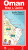
Oman Resident’s guide by Explorer Publishing is an indispensable resource for those living and working or thinking of relocating there. It is packed with information on setting up home, finding employment, exploring the country, shopping and going out. It includes essential practical information, with chapters covering work and finance, family and education, health and wellbeing, history of the country, tourist highlights as well as a detailed section on attractions and activities, short breaks and day trips ideas in and beyond Oman. The guide feature independent reviews of restaurants, bars and cafes and throughout full colour photographs and a pull-out map the country.Ideal for residents, short-term visitors, business people and tourists.
RIP - This product is no longer available on our network. It was last seen on 25.09.2019

This page now acts as a permanent archive for this product. Add more information using the comments box below to ensure it can still be found by future generations.

Use our search facility to see if it is available from an alternative contributor.
  • Availability: Out Of Stock
  • Supplier: Stanfords
  • SKU: 9789948205098
Availability: In Stock
£14.99

Product Description

Oman Resident’s guide by Explorer Publishing is an indispensable resource for those living & working or thinking of relocating there. It is packed with information on setting up home, finding employment, exploring the country, shopping & going out. It

Includes::
essential practical information, with chapters covering work & finance, family & education, health & wellbeing, history of the country, tourist highlights as well as a detailed section on attractions & activities, short breaks & day trips ideas in & beyond Oman. The guide feature independent reviews of restaurants, bars & cafes & throughout full colour photographs & a pull-out map the country. Ideal for residents, short-term visitors, business people & tourists.

Reviews/Comments

Add New

Intelligent Comparison

Oooops!
We couldn't find anything!
Perhaps this product's unique.... Or perhaps we are still looking for comparisons!
Click to bump this page and we'll hurry up.

Price History

Vouchers

No voucher codes found.
Do you know a voucher code for this product or supplier? Add it to Insights for others to use.

Facebook

Jargon Buster

Education - A term used to describe the act of learning a new skill or information
History - Anything that happens in the past. An acedemic subject.
Colour - The categorised spectrum of light visable to humans
Day - The time it takes a planet or other space objects to complete one rotation.
Home - A place of permanent residence for families.
Practical - Weather a task is easy to carry out and realistically succeed.
Feature - An attribute that makes something stand out.
Ideal - Something that satisfies a perfect criteria.
Family - A group of people that live together made up from parents and children.

Supplier Information

Stanfords
Stanfords was established in 1853 and opened their iconic Covent Garden flagship store in 1901. They have become the top retailer of maps, travel books and accessories in the UK and arguably offer the largest selection of maps and travel books worldwide. Famous names such as Captain Robert Falcon Scott, Ranulph Fiennes and Michael Palin have purchased from Stanfords. They now have a shop in Bristol and both stores together with other venues operate a calendar of events including talks, book signings and exhibitions. As a specialist map retailer, the map selection is comprehensive and includes road maps, street maps and walking maps from worldwide destinations, as well as a selection of world atlases and wall maps. Books include travel guides and travel literature. Stanfords also stock globes, from miniatures made of blue marble to magnificent floor-standing globes. The website features a selection of interesting articles on travel topics.
Page Updated: 2023-11-12 20:15:36

Community Generated Product Tags

Oh No! The productWIKI community hasn't generated any tags for this product yet!
Menu