
 United Kingdom
 France
 Germany
 Netherlands
 Sweden
 USA
USA
 Italy
Italy
 Spain
Spain
More From Contributor


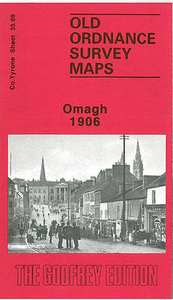
Omagh 1906
Omagh in 1906 in a fascinating series of reproductions of old Ordnance Survey plans in the Alan Godfrey Editions, ideal for anyone interested in the history of their neighbourhood or family. Coverage extends eastward to Tyrone County Hospital. Features include High Street, Market Street, John Street, Church Street, Campsie Road. Court House, Fair Green, Corn Market, RC church, Presbyterian church, Infantry Barracks, County Hospital, Creevenagh House, Campsie Saw Mills, Lisnamallard Mills, Lisnamallard House, Riverdale, Old Barracks, railway with station, goods shed, engine house, Market Goods station and branch, Meetinghousehill area, Dergmoney Lower area, Gortmore House, Coolnagard Lower area, etc. On the reverse are extracts from a street directory, including
Abbey Street, Campsie Avenue, Campsie Road, Castle Street, Church Street, Dublin Road, George`s Street, High Street, John Street, Market Street and Mountjoy Road.About the Alan Godfrey Editions of the 25” OS Series:Selected towns in Great Britain and Ireland are covered by maps showing the extent of urban development in the last decades of the 19th and early 20th century. The plans have been taken from the Ordnance Survey mapping and reprinted at about 15 inches to one mile (1:4, 340). On the reverse most maps have historical notes and many also include extracts from contemporary directories. Most maps cover about one mile (1.6kms) north/south, one and a half miles (2.4kms) across; adjoining sheets can be combined to provide wider coverage.FOR MORE INFORMATION AND A COMPLETE
LIST OF ALL AVAILABLE TITLES PLEASE CLICK ON THE SERIES LINK.

Product Description
Reviews/Comments
Add New
Vouchers
No voucher codes found.
Do you know a voucher code for this product or supplier? Add it to Insights for others to use.
Do you know a voucher code for this product or supplier? Add it to Insights for others to use.
 Denmark