More From Contributor

£3.50
Oakengates South in 1901 in a fascinating series of reproductions of old Ordnance Survey plans in the Alan Godfrey Editions, ideal for anyone interested in the history of their neighbourhood or family. The map covers the southern part of the town & stretches south to include Pudley Hill Colliery & Forge Row just south of Hollinswood. From west to east coverage

Includes::
Mossey Green & Snowhill. Features include Snedhill Barracks, St Peter`s Church, Steel Works, Pudleyhill Colliery, Holy Trinity Church, Oakengates Station & GWR Railway Line. On the reverse is an extract from a commercial directory. About the Alan Godfrey Editions of the 25” OS Series: Selected towns in Great Britain & Ireland are covered by maps showing the extent of urban development in the last decades of the 19th & early 20th century. The plans have been taken from the Ordnance Survey mapping & reprinted at about 15 inches to one mile (1:4, 340). On the reverse most maps have historical notes & many also include extracts from contemporary directories. Most maps cover about one mile (1.6kms) north/south, one & a half miles (2.4kms) across; adjoining sheets can be combined to provide wider coverage.FOR MORE INFORMATION & A COMPLETE LIST OF ALL AVAILABLE TITLES PLEASE CLICK ON THE SERIES LINK.

...
Archived Product
£3.50
Oakenshaw, Low Moor & Wyke in 1905 in a fascinating series of reproductions of old Ordnance Survey plans in the Alan Godfrey Editions, ideal for anyone interested in the history of their neighbourhood or family. The map the southern part of Low Moor & northern part of Wyke, & extends eastward to Oakenshaw. Features include railways with Low Moor station, several mineral lines, Oakenshaw village, St Andrew`s church, Lower Woodlands, Salt Horn, Oakenshaw Mills, The Towers Dyeworks, Low Moor Chemical Works, Fearnley Farm, Pearson Fold, Ben Ing Pit, Raw Nook, Storr Hill, New Works Furnaces, part of Low Moor Iron Works, St Mark`s church, New Road Side, Upper Wyke, City Shed, etc About the Alan Godfrey Editions of the 25” OS Series: Selected towns in Great Britain & Ireland are covered by maps showing the extent of urban development in the last decades of the 19th & early 20th century. The plans have been taken from the Ordnance Survey mapping & reprinted at about 15 inches to one mile (1:4, 340). On the reverse most maps have historical notes & many also include extracts from contemporary directories. Most maps cover about one mile (1.6kms) north/south, one & a half miles (2.4kms) across; adjoining sheets can be combined to provide wider coverage.FOR MORE INFORMATION & A COMPLETE LIST OF ALL AVAILABLE TITLES PLEASE CLICK ON THE SERIES LINK. ...
Archived Product
£3.50
Oakham in 1903 in a fascinating series of reproductions of old Ordnance Survey plans in the Alan Godfrey Editions, ideal for anyone interested in the history of their neighbourhood or family. Though the most important town in Rutl&, Oakham was always relatively small & did not achieve borough status. However, the town did have the attributes of a county town, with the Assizes held in the Castle & a good range of shops & offices. The map captures most of the town &

Includes::
an introduction, along with a good contemporary directory. About the Alan Godfrey Editions of the 25” OS Series: Selected towns in Great Britain & Ireland are covered by maps showing the extent of urban development in the last decades of the 19th & early 20th century. The plans have been taken from the Ordnance Survey mapping & reprinted at about 15 inches to one mile (1:4, 340). On the reverse most maps have historical notes & many also include extracts from contemporary directories. Most maps cover about one mile (1.6kms) north/south, one & a half miles (2.4kms) across; adjoining sheets can be combined to provide wider coverage.FOR MORE INFORMATION & A COMPLETE LIST OF ALL AVAILABLE TITLES PLEASE CLICK ON THE SERIES LINK.

...
Archived Product
£6.50
Oakl&, Berkeley & Richmond in California on an indexed street plan from Rand Mc Nally in their extensive range of maps covering cities in the United States. Insets provide more detailed street plans of downtown Oakland & Berkeley (including the western part of the University campus), a detailed plan of the Oakland International Airport (OAK), plus a road map of Oakland & vicinity. Other communities covered by this map include Alameda, Bay Farm Isl&, Crockett, El Cerrito, Emeryville, Moraga, Orinda, Piedmont, Pinole, Rodeo, San Leandro & San Pablo. Rand Mc Nally street plans provide coverage of cities with their outer suburbs, clearly indicating main traffic arteries: highways (distinguishing between free & toll access), plus primary & secondary routes. Road numbers and/or names are clearly displayed & exit numbers are indicated. Locations of service & rest areas are marked & one way streets are shown. Longer streets are annotated with block numbers for easier identification of addresses. The maps show railway, bus &, where appropriate, metro stations. A range of symbols indicate various places of interest including cultural & academic institutions, various municipal facilities, golf courses, etc. The plans have extensive street indexes, supplemented by lists of points of interest, parks & recreational areas, shopping malls, stations, schools, etc. ...
Archived Product
£13.99
The Oakridge, Oregon trail map from Adventure Maps, Inc. is a waterproof, topographic map that

Includes::


...
Archived Product
£17.99
Topographic mapping from Mexico’s national survey agency, Instituto Nacional de Estadística, Geografía e Informática. The maps have contours at 20m intervals with relief shading & indicate various types of terrain & vegetation, e.g. dense vegetation, cultivated areas, swamps, sand dunes, salt pans, etc. UTM grid is at 10km intervals, with latitude & longitude shown by margin ticks at intervals of 5`. Map legend is in Spanish only. To see the other titles in this series please click on the series link. ...
Archived Product
£9.99
Indexed road map covering these provinces in southern Mexico, with plan of central Oaxaca included. Altitude tinting represents the general relief, with spot heights for major peaks, swamp areas & national parks marked. Road detail

Includes::
some minor roads & tracks, & shows intermediate distances on major routes. Main railways & province boundaries are drawn & a range of symbols show petrol stations, airports, airfields, archaeological sites, places of interest, beaches, etc. Lines of latitude & longitude are at 1° intervals. The clear plan of Oaxaca emphasizes main routes & indicates sites of interest. This title is part of a series of detailed touring maps of Mexico published by ITMB.

...
Archived Product
£5.99
Oaxaca in the Moon Spotlight guide series; covering a range of specific local cities, districts, areas & regions in North, Central & South America & targeted at those seeking to travel to a specific area within a country. Each of the guides has been extracted in full from the relevant country Moon Handbook & individual titles focus on a particular city, region or notable area of the destination. Many of the guides in the series are unique in their coverage, although are limited in putting the destination into its wider geographical context that a more comprehensive guide would provide. Stylistically, Moon ...
Archived Product
£11.99
Seasoned travel writer & Mexico expert Bruce Whipperman knows the best of Oaxaca, from bargaining at the Mercado Jurez to exploring the Castillo de Moctezuma Aztec pyramid. Whipperman also

Includes::
unique trip strategies, such as Best Beaches & Local Festivals & Native Markets. Including experienced advice on visiting craft villages near Ocotlan & enjoying the vistas & fresh seafood of Puerto ngel, Moon Oaxaca gives travelers the tools they need to create a more personal & memorable experience.

...
Archived Product
£12.99
One of the titles in a series of road maps of the administrative states of Mexico, highlighting places of interest. The maps show four different grades of roads, with intermediate driving distances on main routes, railways, local airports, ferry connections & administrative boundaries. Topographic information is limited to names of main mountain ranges, spot heights for main peaks, rivers & lakes. The maps have no geographical coordinates. Map legend is in Spanish only. On the reverse each title has a black & white version of the same map, highlighting places of interest with brief notes in Spanish only. ...
Archived Product

Oarsman`s And Angler`s Map Of The Thames SMALL

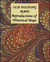
The Thames from its source to London Bridge on a cloth-backed reproduction of an “Oarsman’s and Angler’s” map, published in 1889 by James Reynolds & Sons. The map, 170cm / 67” long, shows locations along the river with the network of roads and railway lines. Locks and bridges are annotated with measurements for clearance, etc, and the map also provides recommendations for nearby hotels. Place names and accompanying notes are easy to read in this size reproduction.Each individual cloth-backed map is sold folded in a colourful case covered with a unique design marbled paper – no two cases are identical.PLEASE NOTE: to see the list of all the titles in this series from the Old Folding Maps please click on the series link.
RIP - This product is no longer available on our network. It was last seen on 25.09.2019

This page now acts as a permanent archive for this product. Add more information using the comments box below to ensure it can still be found by future generations.

Use our search facility to see if it is available from an alternative contributor.
  • Availability: Out Of Stock
  • Supplier: Stanfords
  • SKU: 9786000511340
Availability: In Stock
£20.00

Product Description

The Thames from its source to London Bridge on a cloth-backed reproduction of an “ Oarsman’s & Angler’s” map, published in 1889 by James Reynolds & Sons. The map, 170cm / 67” long, shows locations along the river with the network of roads & railway lines. Locks & bridges are annotated with measurements for clearance, etc, & the map also provides recommendations for nearby hotels. Place names & accompanying notes are easy to read in this size reproduction. Each individual cloth-backed map is sold folded in a colourful case covered with a unique design marbled paper – no two cases are identical.PLEASE NOTE: to see the list of all the titles in this series from the Old Folding Maps please click on the series link.

Reviews/Comments

Add New

Intelligent Comparison

Oooops!
We couldn't find anything!
Perhaps this product's unique.... Or perhaps we are still looking for comparisons!
Click to bump this page and we'll hurry up.

Price History

Vouchers

No voucher codes found.
Do you know a voucher code for this product or supplier? Add it to Insights for others to use.

Facebook

Jargon Buster

Paper - A thin sheet mainly used for writing. Available in a variety of colours. Made mainly from wood pulp.
Size - is the measurement of how big an object is in space.
Network - A link and communication between things. Often computers or people.
Small - something that takes up less space than normal.
Design - A drawing or styles that shows the look and functionality of something before its made.
Individual - A single separate item or person.
Reproduction - A process of making a copy of something.

Supplier Information

Stanfords
Stanfords was established in 1853 and opened their iconic Covent Garden flagship store in 1901. They have become the top retailer of maps, travel books and accessories in the UK and arguably offer the largest selection of maps and travel books worldwide. Famous names such as Captain Robert Falcon Scott, Ranulph Fiennes and Michael Palin have purchased from Stanfords. They now have a shop in Bristol and both stores together with other venues operate a calendar of events including talks, book signings and exhibitions. As a specialist map retailer, the map selection is comprehensive and includes road maps, street maps and walking maps from worldwide destinations, as well as a selection of world atlases and wall maps. Books include travel guides and travel literature. Stanfords also stock globes, from miniatures made of blue marble to magnificent floor-standing globes. The website features a selection of interesting articles on travel topics.
Page Updated: 2023-11-12 20:15:36

Community Generated Product Tags

Oh No! The productWIKI community hasn't generated any tags for this product yet!
Menu