
 United Kingdom
 France
 Germany
 Netherlands
 Sweden
 USA
USA
 Italy
Italy
 Spain
Spain
More From Contributor


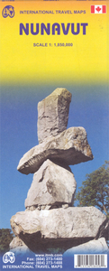
Nunavut ITMB
Double-sided map of Nunavut, part of a series of maps of Canadian provinces from the Vancouver-based ITMB, with topography presented by altitude colouring rather than by relief shading. The map divides the province north/south with Baffin Island shown as inset. Coverage extends north to include all of Ellesmere Island in the Queen Elizabeth Islands archipelago.In the absence of roads and with few settlements, topography is the main feature of the map. Altitude colouring and spot heights are in feet, with additional graphics for glaciers, swamps, salt flats, tundra, etc. Many rivers and numerous lakes are named, with only a small selection of them included in the map index. Protected areas are highlighted.Settlements and their airports are marked and the map also highlights the
course of the Northwest Passage. Latitude and longitude lines are drawn at intervals of 2º.In addition to the large inset covering Baffin Island, three small insets cover smaller groups of islands: Akimiski and Charlton, Mansel and Ottawa, plus Charles and Akpatok. The map also includes brief notes on the province, e.g. total number of communities 28, of which Iqaluit is the largest, etc.
course of the Northwest Passage. Latitude and longitude lines are drawn at intervals of 2º.In addition to the large inset covering Baffin Island, three small insets cover smaller groups of islands: Akimiski and Charlton, Mansel and Ottawa, plus Charles and Akpatok. The map also includes brief notes on the province, e.g. total number of communities 28, of which Iqaluit is the largest, etc.

Product Description
Reviews/Comments
Add New
Vouchers
No voucher codes found.
Do you know a voucher code for this product or supplier? Add it to Insights for others to use.
Do you know a voucher code for this product or supplier? Add it to Insights for others to use.
 Denmark