More From Contributor
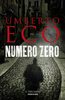
£8.99
An incredibly stylish numbers book
- perfect for children & adults alike. Have fun with numbers with an award-winning illustrator.
...
Archived Product
£14.99
The Numbers Game is a new game concept that resembles the memory game play but with some interesting differences, which makes the game more exciting & flexible. The Numbers Game consists of four sets of 20 cards. Each set has a set of numbers running from 1 to 20. The goal of the game is to collect one set of 20 cards. However, the cards may only be added to your collection in ascending order, if you first pick a number-1 card, or in descending order, if you first pick a number-20 card. The player who first completes a full 1-20 row wins the game. The numbers on the cards have been photographed on the streets of cities around the world, from house numbers to traffic signs & commercial signage. Paul Baars sharp eye for graphic candor resulted in a collection of thousands of street graphics depicting numbers. For this game, he selected 80 striking numbers in surprising settings from his large collection. ...
Archived Product
£12.95
Numbur Cheese Circuit at 1:100, 000 in the Nepa Maps series which provides extensive coverage of trekking areas of Nepal on detailed contoured maps with trekking routes & hiking trails, huts & camp sites, local places of interest & other tourist information. The map covers the same area as the publishers’ “ Jiri to Everest” title & has similar cartography although different geographical features & places of interest are named and/or emphasized. Rather than highlighting the Everest route, the main overprint here presents what the publishers call “ Virgin Circuit Trekking trail in the lap of Everest & Rolwaling Region”. Also indicated are numerous other trekking routes, including the Jiri to Everest Base Camp trail. Contours are at 80m intervals, with bold relief shading & vegetation colouring. Index lists places, peaks, passes & lakes. The map has margin ticks with latitude & longitude at 5` intervals. Additional information

Includes::
a route profile & trekking times along the Numbur Cheese Circuit, plus places of interest & other activities in the region. Titles in this series have cartography is based on the country’s topographic survey, with contours usually at 40m or 50m intervals, enhanced by relief shading, colouring & graphics to show various features of the terrain, including glaciers, forested or cultivated areas, etc. Numerous peaks, with additional spot heights, plus names of glaciers & mountain ranges are prominently shown. The network of rivers, streams & lakes is shown in great detail, with many smaller rivers & lakes named. Overprint highlights main trekking routes & numerous local trails, with symbols indicating various places of interest & tourist facilities. Most maps are indexed & include additional information such as route profiles, glossaries, etc. All the information is in English & heights are given in metres.

...
Archived Product
£55.00
Numerical weather prediction (NWP) has significantly enhanced the accuracy of weather forecasts & enabled the development of services specifically for mariners, including routeing advice & forecasts as ECDIS overlays. This practicalguide opens up the technology that now forms the basis of all modern weather forecasts so that mariners can recognise when they are being presented with NWP, establish its source & the characteristics & performance of the particular NWP model, & make informed judgements on suitability & use. ...
Archived Product
£8.99
The gripping new conspiracy thriller by the bestselling author of The Name of the Rose. 1945, Lake Como. Mussolini & his mistress are captured & shot by local partisans. The precise circumstances of Il Duce`s death remain shrouded in confusion & controversy. 1992, Milan. Colonna takes a job at a fledgling newspaper financed by a powerful media magnate. There he learns the paranoid theories of Braggadocio, who is convinced that Mussolini`s corpse was a body-double & part of a wider Fascist plot. Colonna is sceptical. But when a body is found, stabbed to death in a back alley, & the paper is shut down, even he is jolted out of his complacency. Fuelled by conspiracy theories, Mafiosi, love, corruption & murder, Numero Zero reverberates with the clash of forces that have shaped Italy since the Second World War. This gripping novel from the author of The Name of the Rose is told with all the power of a master storyteller. ...
Archived Product
£5.99
Nuns have had a great run. Ever since Sister Act established they could be cool & fun as well as severe & scary, the habits have been flying into stores & off the shelves. As a great addition to the new trend, this deliciously fun bowling set presents ten praying nun pins, one Satanic fireball, & 32-page introduction to the nun bowling sport. Many adults still have nun-phobia left over from their childhoods. This kit offers a healing experience that, at this price, is the cheapest therapy you can get. ...
Archived Product
£13.95
Topographic survey of Greenland at 1:250, 000 from Sagamaps in a series which along the western coast extends past Thule to the latitude of 78°, plus covers selected areas of the east coast including the Stauning Alps. Relief is shown by contours at 50m intervals, augmented by frequent spot heights. Main peaks are named, along with many other physical features, e.g. bays & islands. Glaciers, moraine & low-lying coastal plains are also indicated & contours continue for a limited extent into the icecap region. The maps show settlements, roads, airstrips & heliports, anchorages & selected other landmarks. Lines of longitude & latitude are drawn at 1° & 15` intervals respectively. Map legend which

Includes::
English is provided in a separate sheet. Saga’s topographic mapping of Greenland at 1:250, 000 is available either as 22 smaller sheets, sold separately or in sets of four maps, plus as three larger maps covering the western coast up to approx 65°. Selected titles are also published with a historical guide on the reverse illustrated with old photos, drawings & maps; all the text is in English. To see the full list of titles in this series please click on the series link.

...
Archived Product
£9.99
Double-sided map of Nunavut, part of a series of maps of Canadian provinces from the Vancouver-based ITMB, with topography presented by altitude colouring rather than by relief shading. The map divides the province north/south with Baffin Island shown as inset. Coverage extends north to include all of Ellesmere Island in the Queen Elizabeth Islands archipelago. In the absence of roads & with few settlements, topography is the main feature of the map. Altitude colouring & spot heights are in feet, with additional graphics for glaciers, swamps, salt flats, tundra, etc. Many rivers & numerous lakes are named, with only a small selection of them included in the map index. Protected areas are highlighted. Settlements & their airports are marked & the map also highlights the course of the Northwest Passage. Latitude & longitude lines are drawn at intervals of 2º. In addition to the large inset covering Baffin Isl&, three small insets cover smaller groups of islands: Akimiski & Charlton, Mansel & Ottawa, plus Charles & Akpatok. The map also

Includes::
brief notes on the province, e.g. total number of communities 28, of which Iqaluit is the largest, etc.

...
Archived Product
£6.39
A detailed topographic map of Nuneaton & Tamworth from the Ordnance Survey Explorer series, covering Lichfield & Atherstone. Edition A1; Publication date January 2006 About this series: These highly detailed maps show all the administrative boundaries, settlements as small as isolated farms, the road network down to unfenced roads & country tracks, & field boundaries (hedges & drystone walls) which make navigation across the countryside much easier. Steep gradients on roads are indicated. Various landmarks, e.g. powerlines, archaeological sites, windmills, churches & lighthouses are shown & additional graphics indicate natural terrain features such as cliffs, scree, mud & vegetation variations. The contour interval is 5 metres in the lower parts of the country & 10 metres in the uplands, & spot heights are marked. Each map covers an area of 30 x 20km (i.e. approx. 19 x 12 miles), with some double-sided maps covering more, as indicated in the individual descriptions. The maps are fully GPS compatible, with the National Grid shown at 1km intervals & latitude & longitude indicated by margin ticks at 1'. The Explorer series has replaced the earlier, green-cover Pathfinder maps. The Explorer series is now complete & covers all of Engl&, Wales & Scotl&. Some sheets for popular areas like the National Parks are still branded as Outdoor Leisure (OL) maps, but are now included in this series as the cartography is the same as that in the Explorer Maps. The Explorer maps offer a substantial improvement on the Pathfinder series, with greater use of colour, larger area per map, & stronger emphasis on information for ramblers & tourists. This series is ideal for walking & other outdoor pursuits & each map shows a large amount of information for ramblers & tourists. Public rights of way are shown (except in Scotland), together with other routes with public access: National Trails & Recreational Paths, permitted paths & bridleways, & selected cycle routes. Open access land created under the Countryside & Rights of Way Act 2000 is marked. Tourist information

Includes::
caravan & campsites, Park & Ride locations, recreation/leisure/sport centres, museums, historic buildings, English Heritage & National Trust sites, rural pubs, etc. The map legend is in English only, except for the tourist information content which is also in French & German.

...
Archived Product
£14.99
Nuneaton, Tamworth, Lichfield & Atherstone area on a detailed topographic & GPS compatible map No. 232, waterproof version, from the Ordnance Survey’s 1:25, 000 Explorer series. MOBILE DOWNLOADS: this title & all the other OS Explorer maps include a code for downloading after purchase the digital version onto your smartphone or tablet for viewing on the OS smartphone app.OS EXPLORER SERIES: to see the list of all the titles in the OS Explorer series, both paper & waterproof versions, please click on the series link. The Explorer series, Ordnance Survey’s most detailed maps recommended for anyone enjoying outdoor activities, provides topographic coverage of Great Britain at 1:25, 000 on GPS compatible maps with hiking trails, cycling routes & extensive tourist information. Each printed map is available either on paper or as a waterproof & tear-resistant OS Active Map, as indicated in its title. Britain’s National Parks & other areas of particular tourist interest are presented on often double-sided OL (Outdoor Leisure) maps, whilst most standard format Explorers cover an area of 30 x 20km (approx. 19 x 12 miles). All three versions (paper, waterproof & digital) are the same & provide plenty of recreational & tourist information, indicating the traditional public right of way paths (except in Scotland where different laws apply), including bridleways & byways. National Trails & other long-distance paths are marked, as well as permissive footpaths or bridleways & on-road or traffic-free cycle routes with, where appropriate, their National/ Regional Cycle Network numbers. Boundaries of access land are clearly marked. A wide range of symbols provides additional tourist information, highlighting camping & caravanning sites, information offices & visitors’ centres, parking & picnicking places, country pubs, sport & recreational facilities including cycle hire locations & mountain biking trails, historic buildings & museums, etc. Exceptionally clear presentation of the landscape is provided by contours at 5m or in the uplands at 10m intervals, with additional spot heights plus colouring and/or graphics for different types of woodlands, orchards, heath, marshl&, scree or boulders, & other topographic features. For GPS users the maps have British National Grid lines at 1km intervals, with latitude & longitude given by margin ticks at 1`. Clearly laid out map legend

Includes::
French & German translations for the tourist information symbols.

...
Archived Product

Numero Zero

1945, Lake Como. Mussolini and his mistress are captured and shot by local partisans. The precise circumstances of Il Duce`s death remain shrouded in controversy. 1992, Milan. Colonna, a depressed hack writer, is offered a fee he can`t refuse to ghost-write a memoir. His subject: a fledgling newspaper financed by a powerful media magnate. As Colonna gets to know the team, he learns the paranoid theories of Braggadocio, who is convinced that Mussolini`s corpse was a body-double and part of a wider Fascist plot. It`s the scoop he desperately needs. The evidence? He`s working on it. Colonna is sceptical. But when a body is found, stabbed to death in a back alley, and the paper is shut down, even he is jolted out of his complacency. Fuelled by media hoaxes, Mafiosi, love, gossip
and murder, Numero Zero reverberates with the clash of forces that have shaped Italy since World War II. This gripping novel from the author of The Name of the Rose is told with all the power of a master storyteller.
RIP - This product is no longer available on our network. It was last seen on 25.09.2019

This page now acts as a permanent archive for this product. Add more information using the comments box below to ensure it can still be found by future generations.

Use our search facility to see if it is available from an alternative contributor.
  • Availability: Out Of Stock
  • Supplier: Stanfords
  • SKU: 9781910701089
Availability: In Stock
£16.99

Product Description

1945, Lake Como. Mussolini & his mistress are captured & shot by local partisans. The precise circumstances of Il Duce`s death remain shrouded in controversy. 1992, Milan. Colonna, a depressed hack writer, is offered a fee he can`t refuse to ghost-write a memoir. His subject: a fledgling newspaper financed by a powerful media magnate. As Colonna gets to know the team, he learns the paranoid theories of Braggadocio, who is convinced that Mussolini`s corpse was a body-double & part of a wider Fascist plot. It`s the scoop he desperately needs. The evidence? He`s working on it. Colonna is sceptical. But when a body is found, stabbed to death in a back alley, & the paper is shut down, even he is jolted out of his complacency. Fuelled by media hoaxes, Mafiosi, love, gossip & murder, Numero Zero reverberates with the clash of forces that have shaped Italy since World War II. This gripping novel from the author of The Name of the Rose is told with all the power of a master storyteller.

Reviews/Comments

Add New

Intelligent Comparison

Oooops!
We couldn't find anything!
Perhaps this product's unique.... Or perhaps we are still looking for comparisons!
Click to bump this page and we'll hurry up.

Price History

Vouchers

No voucher codes found.
Do you know a voucher code for this product or supplier? Add it to Insights for others to use.

Facebook

Jargon Buster

Paper - A thin sheet mainly used for writing. Available in a variety of colours. Made mainly from wood pulp.
Rose - Commonly associated with a light pink colour
Rose - A fragrant garden plant
Milan - A city in Italy
team - A group of people or animals linked by a common purpose.
World - A physical grouping, commonly used to describe earth and everything associated with ti
Love - Someone who shows deep affection for someone else.
Italy - a country in Europe.
Precise - A measurement on the accuracy of something

Supplier Information

Stanfords
Stanfords was established in 1853 and opened their iconic Covent Garden flagship store in 1901. They have become the top retailer of maps, travel books and accessories in the UK and arguably offer the largest selection of maps and travel books worldwide. Famous names such as Captain Robert Falcon Scott, Ranulph Fiennes and Michael Palin have purchased from Stanfords. They now have a shop in Bristol and both stores together with other venues operate a calendar of events including talks, book signings and exhibitions. As a specialist map retailer, the map selection is comprehensive and includes road maps, street maps and walking maps from worldwide destinations, as well as a selection of world atlases and wall maps. Books include travel guides and travel literature. Stanfords also stock globes, from miniatures made of blue marble to magnificent floor-standing globes. The website features a selection of interesting articles on travel topics.
Page Updated: 2023-11-12 20:15:36

Community Generated Product Tags

Oh No! The productWIKI community hasn't generated any tags for this product yet!
Menu