
 United Kingdom
 France
 Germany
 Netherlands
 Sweden
 USA
USA
 Italy
Italy
 Spain
Spain
More From Contributor


Nova Gorica Pocket Map
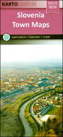
Nova Gorica on a pocket size, indexed street plan from the Ljubljana based Kartografija publishers with on the reverse bilingual Slovenian/English descriptions of the town’s best sights accompanied by colour photos.Kartografija pocket street plans shows main traffic routes, one way streets and car parks. Important buildings are highlighted and named. Also marked are hotels, petrol stations, bus and railway stations, tourist offices, etc. Each plan is indexed and has on the reverse bilingual notes on the town’s history and places of interest, accompanied by colour photos. Also provided are contact numbers for important services and selected hotels.Map legend and all the text include English.

Product Description
Reviews/Comments
Add New
Vouchers
No voucher codes found.
Do you know a voucher code for this product or supplier? Add it to Insights for others to use.
Do you know a voucher code for this product or supplier? Add it to Insights for others to use.
 Denmark