
 United Kingdom
 France
 Germany
 Netherlands
 Sweden
 USA
USA
 Italy
Italy
 Spain
Spain
More From Contributor

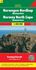
Norway Nordeca Road Map
Norway at 1:1, 000, 000 on an indexed road map from Nordeca, showing locations of petrol and various types of vehicle charging stations, national tourist routes, locations of tourist huts, etc, plus and enlargement of the Oslo area. The whole country is divided into two panels with a small overlap.Topography is presented by altitude colouring with plenty of names of mountain ranges, valleys, fjords, etc. The map has no geographical coordinates. The index is on the reverse, accompanied by a distance table. Map legend includes English.PLEASE NOTE: the map shows a large number of towns and villages but does not indicate their locations by a dot or a similar marker, so in many cases it is impossible to tell where along a road, or even on which road they are situated. Similarly,
locations of petrol and charging stations are not precisely marked, and tourist huts do not indicate from which road they can be best accessed.
locations of petrol and charging stations are not precisely marked, and tourist huts do not indicate from which road they can be best accessed.
Product Description
Reviews/Comments
Add New
Vouchers
No voucher codes found.
Do you know a voucher code for this product or supplier? Add it to Insights for others to use.
Do you know a voucher code for this product or supplier? Add it to Insights for others to use.
 Denmark