
 United Kingdom
 France
 Germany
 Netherlands
 Sweden
 USA
USA
 Italy
Italy
 Spain
Spain
More From Contributor


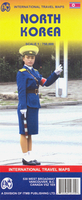
North Korea ITMB
Indexed road map with Pyongyang street plan, personally researched by the president of ITMB, and complemented by a selection of his holiday photos! On the general map road detail shows highways, national roads and provincial roads. Main railways, sea ferry links, ports, international and domestic airports are also indicated. Further detail includes provincial boundaries and names, national parks and a range of symbols denoting beaches, golf courses, hot springs, tombs, temples and other sites of interest. The general relief is indicated by altitude tinting, with some peak and pass altitudes marked. Latitude and longitude lines are drawn at 1° intervals. Nb. There is no detail north of the border with China, but the coverage extends south to include Seoul.Included is a clear
street map covering a substantial part of Pyongyang. The detail includes railways, subway lines, bus terminals, hospitals, banks, post offices and other useful landmarks and sites of interest. There is also a diagram of the Pyongyang metro network, and some useful advice for tourists is provided.
street map covering a substantial part of Pyongyang. The detail includes railways, subway lines, bus terminals, hospitals, banks, post offices and other useful landmarks and sites of interest. There is also a diagram of the Pyongyang metro network, and some useful advice for tourists is provided.

Product Description
Reviews/Comments
Add New
Intelligent Comparison
Archived Product

North Korea Stanfords
£29.95
Vouchers
No voucher codes found.
Do you know a voucher code for this product or supplier? Add it to Insights for others to use.
Do you know a voucher code for this product or supplier? Add it to Insights for others to use.
 Denmark