More From Contributor

£10.99
A selection of thirty walks of different length & difficulty around the region of Ben Nevis & Glen Coe. Each route is illustrated with extracts from Harvey maps & fully described & graded according to distance, approximate time. Information is given on the presence of wildlife, particularly beautiful scenery, buildings of historical interest, which maps to use & refreshments. Full colour photos are used to emphasize the beauty of the region. ...
Archived Product
£9.99
Colour photography & authoritative text make this guide the ideal companion to Ben Nevis & Glen Coe. It

Includes::


...
Archived Product
£7.95
Ben Nevis & Glen Coe Adventure Atlas at 1:25, 000 in a series of handy A5 size Adventure Atlases from Geographers` A-Z Map Company with cartography from the Ordnance Survey’s Explorer series. Coverage

Includes::
the final section of the West Highland Way from the Ba Bridge to Fort William & the western section of the Great Glen Way along the Caledonian Canal. To see other titles in this series please click on the series link.A-Z Adventure Atlases have cartography of the Ordnance Survey’s Explorer maps & provide plenty of recreational & tourist information, indicating traditional public rights of way paths, including bridleways & byways restricted or open to motorized traffic. Also shown are other routes with public access, including permissive footpaths & bridleways. Special marking indicates National Trails, Long-distance Routes & Recreational Routes, & for cyclists the maps show traffic-free routes & the National Cycle Network. A wide range of symbols highlights locations of special tourist interest: camping & caravanning sites, youth hostels, information offices & visitors’ centres, parking & picnicking places, historic buildings (indicating where appropriate National Trust, English Heritage, or Cadw), sites for various recreational pursuits, country pubs, public toilets, etc. The mapping provides detailed presentation of the topography with contours at 5 or 10m intervals, numerous spot heights & colouring and/or graphics for different types of terrain or vegetation. Additional colouring shows access l&, including areas managed by the National Trust, Forestry Commission & Woodland Trust. All the standard information expected of high quality survey mapping at this scale is included: finely graded road network, railway lines with stations, cuttings or embankments, individual isolated buildings, etc. For GPS each page as a 1-km British National Grid. Each atlas has an index which

Includes::
geographical features, nature reserves, youth hostels, car parks, etc, & provides additional notes on safety & security when walking, plus QR codes for obtaining by mobile phone information about local weather, danger areas, mountain rescue, map reading, OS National Grid coordinates, etc.


...
Archived Product
£15.95
Waterproof mountain map of Ben Nevis & Glen Coe from Harvey at 1:40, 000, with a geological map of the region on the reverse, an enlargement of Ben Nevis` summit, & advice on navigating the region safely.*MAIN MAP:* Topography is shown through clear altitude shading, spot heights, contours at 15m intervals, & index contours at 75m intervals. A variety of symbols are used to show terrain detail, such as caves/mines, major & climbing crags, shafts, sinkholes, cairns, & large boulders. The map is GPS compatible, with the National Grid overprinted on the cartography. Rights of way shown include tracks, long distance & intermittent paths. Road detail

Includes::
minor, residential & forest roads; railway lines & stops are marked, as are chairlifts & ski tows. Points of interest & facilities such as campsites, information points, & mountain rescue post are prominently highlighted.*ENLARGEMENTS:* The summit of Ben Nevis is shown at 1:15, 000, with a description of how to get to & from the summit.*GEOLOGICAL MAP:* The reverse shows a geological map of the region from the British Geological Survey, with detailed relief shading & colours used to denote different types of rock. There is additional written geological information, as well as a geological timeline of the region.*ADDITIONAL INFORMATION:* There is also information on emergency procedures, navigating the region safely, & useful contact numbers are provided. There are also lists of local climbing venues, mountaineering club huts, & mountain bothies. Printed on tough, hard-wearing polyethylene, the map is waterproof, tear-resistant, & comes in a clear plastic wallet.

...
Archived Product
£14.95
Ben Nevis & Glen Coe is Ronald Turnbull’s Cicerone guide to the best walking opportunities in Lochaber & its two mighty peaks. The guide covers Lochaber’s summits as well as mid-level walks & gentle strolls through empty glens & tent or bothy treks through remote scenic landscapes. The area from Ben Nevis southwards towards Glen Coe offers some of the finest mountain walking in the UK & the authors explore an array of diverse routes throughout the region. The guide is structured in 10 main parts
- Fort William & Glen Nevis, Ben Nevis & the Aonachs, Grey Corries & Spean Bridge, Mamores, Kinlochleven, Glen Coe, Bidean nam Bian, Glen Etive, Black Mount & Ben Cruachan & Oban
- encompassing a total of 100 walks. There is also a section on the longer routes in the region
- the West Highland Way, Through Routes & the Three Ridges. Each walk has a general overview & an Information Box with details of starting & finish points, distance, ascent, approximate walking time, maximum altitude & the terrain. A informative introduction provides practical guidance on walking conditions, when to go, weather & snow conditions, safety in the mountains, recommended maps & compass & GPS. Detailed route descriptions are accompanied by Ordnance Survey extracts mapping the route in addition to colour photographs illustrating some of the highlights of the mountains.


...
Archived Product
£12.95
Ben Nevis with the Mamores & Grey Corries ranges at 1:25, 000 on a double-sided, waterproof & tear-resistant map from Harvey Map Services in their Superwalker series, with the peak area also shown in greater detail at 1:12, 500. The map divides the area north/south, with a good overlap between the sides, extending from Fort William past Loch Treig to Chno Deang, plus south to Loch Leven & the Blackwater Reservoir. The enlargement highlights the bad visibility descent route including instructions. The main map at 25K also highlights recommended mountain bike trails.PLEASE NOTE: this title is also available as a pocket-size Ultramap with its scale reduced to 1:40, 000
- to see the list of titles available in this series please click on the series link. Maps in Harvey’s Superwalker series have contours at 15m intervals, with additional graphics for various types of terrain (crags, large boulders, scattered rocks) & colouring for different kinds of land use or vegetation (pastures, bogs, forests or woodl&, etc). The maps show local hiking paths, indicating where appropriate long-distance routes, & boundaries of national parks or other protected areas. Scottish titles also indicate Munro, Corbett & Graham hills. Some maps in addition highlight local cycle routes. A range of symbols mark various facilities for walkers including youth or independent hostels, campsites & caravan sites, information points, etc. Each map has a 1-km British or Irish national grid.
...
Archived Product
£9.95
Ben Nevis with the Mamores & Grey Corries ranges at 1:40, 000 on a waterproof & tear-resistant, pocket-size Ultramap from Harvey Map Services with the same cartography as their Superwalker map of this area. The peak of Ben Nevis is also shown in greater detail at 1:20, 000. The map divides the area north/south, with a good overlap between the sides, extending from Fort William past Loch Treig to Chno Deang, plus south to Loch Leven & the Blackwater Reservoir. The enlargement highlights the bad visibility descent route including instructions. The main map at 40K also shows recommended mountain bike trails.PLEASE NOTE: this title is also available as a Superwalker map at 1:25, 000
- to see the list of titles available in this series please click on the series link. Maps in Harvey’s Superwalker series have contours at 15m intervals, with additional graphics for various types of terrain (crags, large boulders, scattered rocks) & colouring for different kinds of land use or vegetation (pastures, bogs, forests or woodl&, etc). The maps show local hiking paths, indicating where appropriate long-distance routes, & boundaries of national parks or other protected areas. Scottish titles also indicate Munro, Corbett & Graham hills. Some maps in addition highlight local cycle routes. A range of symbols mark various facilities for walkers including youth or independent hostels, campsites & caravan sites, information points, etc. Each map has a 1-km British or Irish national grid.
...
Archived Product
£27.50
This 2nd edition of ” Ben Nevis: Britain`s Highest Mountain” brings the history of Ben Nevis right up to date from the 1st edition, by adding the period from 1986 to 2008. This is a highly illustrated & painstakingly researched history of a mountain whose global status far outstrips its modest altitude; a story of climbers, poets, geologists, map makers & pioneering meteorologists. For more than 100 years, mountaineers have honed their skills & equipment on its flanks & ridges & applied them to dazzling effect in the Alps & Greater Ranges. Today, climbing on Ben Nevis is more popular than ever & the mountain`s international reputation continues to grow, as its cliffs offer up some of the most challenging traditional summer & winter climbs in the world. This title offers fully updated history of Britain`s most famous mountain from 1585
- 2008. It is highly illustrated with more than 400 (mostly colour) photographs, diagrams & maps. It features significant new research & historical photographs, &

Includes::
chapters on: Ben Nevis Observatory, Ben Nevis Distillery, Ben Nevis Aluminium Smelter, Ben Nevis Hill Race, Environment & Conservation, Gaelic Place Names, Geology & Mapping.


...
Archived Product
£14.95
This guidebook details 100 walking routes around Ben Nevis & Glen Coe, centred in 10 areas including Fort William & Glen Nevis, the Aonachs, the Mamores, Kinlochleven, Glen Coe, Glen Etive, Black Mount & Ben Cruachan. Routes are graded according to difficulty, & range between short, easy strolls & long, challenging walks with overnight bothy stays. The region`s 44 Munro summits are covered, including 2 easy scrambles & the formidable traverse of Aonach Eagach`s iconic jagged ridge. Alongside step-by-step route descriptions & mapping, the guide presents practical advice on transport, access, safety & where to stay plus background information on the area`s fascinating geology. Many of the routes reflect the author`s belief that the best rewards often lie off the popular tourist trails. Yet the highlights are all there: Buachaille Etive Mor, Aonach Eagach, the Mamores, the Grey Corries, Bidean nam Bian, Ben Starav, Carn Mor Dearg & of course, the mighty Ben Nevis. The book
- like Glen Coe itself
- encourages exploration &

Includes::
a helpful `summit summary` to show different options & assist with route-planning.


...
Archived Product
£19.95
About this series: Specialist climbers' guides, each title consisting of descriptions of climbs in the mountains of Scotl&. Climbs are graded in terms of difficulty.

Includes::
ascent diagrams of ridges & peaks. Compact format with vinyl covers for durability.

...
Archived Product

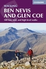
Ben Nevis & Glen Coe Winter Climbs

Experienced climber Alan Kimber’s Cicerone guide to Winter Climbs – Ben Nevis and Glen Coe – is the definitive introduction to exploring some of Scotland’s leading winter climbing. The book covers all that is best on Ben Nevis, as well as Carn Dearg, Aonachs Mor and Beag, Bidean nam Bian and its related summits, Buachaille Etive Mor and the outlying peaks in Glen Coe. Now in its sixth edition, this book is a proven and reliable guide. The guide is organized into four sections on Ben Nevis, Glen Coe and their two surrounding areas and provides a wealth of climbing opportunities for different standards of climber. Each chapter has diagrams showing the general topographical area of the mountains concerned and provides information on the most accessible places for ascents and
descents. Labelled diagrams also indicate the path that each route takes in relation to each other. An extensive introduction provides important information on Weather and Avalanches, Equipment and Safety Precautions, Rescue Facilities and Amenities in the area. Detailed climbing route descriptions are accompanied by detailed line drawings mapping each route and also hand-drawn cliff diagrams; in addition to colour photographs illustrating some of the breathtaking highlights of the highest climbs.
RIP - This product is no longer available on our network. It was last seen on 25.09.2019

This page now acts as a permanent archive for this product. Add more information using the comments box below to ensure it can still be found by future generations.

Use our search facility to see if it is available from an alternative contributor.
  • External links may include paid for promotion
  • Availability: Out Of Stock
  • Supplier: Stanfords
  • SKU: 9781852846206
Availability: In Stock
£16.95

Product Description

Experienced climber Alan Kimber’s Cicerone guide to Winter Climbs – Ben Nevis & Glen Coe – is the definitive introduction to exploring some of Scotland’s leading winter climbing. The book covers all that is best on Ben Nevis, as well as Carn Dearg, Aonachs Mor & Beag, Bidean nam Bian & its related summits, Buachaille Etive Mor & the outlying peaks in Glen Coe. Now in its sixth edition, this book is a proven & reliable guide. The guide is organized into four sections on Ben Nevis, Glen Coe & their two surrounding areas & provides a wealth of climbing opportunities for different standards of climber. Each chapter has diagrams showing the general topographical area of the mountains concerned & provides information on the most accessible places for ascents & descents. Labelled diagrams also indicate the path that each route takes in relation to each other. An extensive introduction provides important information on Weather & Avalanches, Equipment & Safety Precautions, Rescue Facilities & Amenities in the area. Detailed climbing route descriptions are accompanied by detailed line drawings mapping each route & also h&-drawn cliff diagrams; in addition to colour photographs illustrating some of the breathtaking highlights of the highest climbs.

Reviews/Comments

Add New

Intelligent Comparison

Oooops!
We couldn't find anything!
Perhaps this product's unique.... Or perhaps we are still looking for comparisons!
Click to bump this page and we'll hurry up.

Price History

Vouchers

No voucher codes found.
Do you know a voucher code for this product or supplier? Add it to Insights for others to use.

Facebook

Jargon Buster

Hand - A part of the body at the end of the arm
Hand - A pointer which indicates time on a clock face
Colour - The categorised spectrum of light visable to humans
Weather - is the change of an atmospheres conditions.
Safety - prevents damage being caused.
Equipment - A product or good that is tactile.
Winter - The fourth season of a year that comes between Spring and Autumn
Reliable - Something that is consistently good and can be trusted.

Supplier Information

Stanfords
Stanfords was established in 1853 and opened their iconic Covent Garden flagship store in 1901. They have become the top retailer of maps, travel books and accessories in the UK and arguably offer the largest selection of maps and travel books worldwide. Famous names such as Captain Robert Falcon Scott, Ranulph Fiennes and Michael Palin have purchased from Stanfords. They now have a shop in Bristol and both stores together with other venues operate a calendar of events including talks, book signings and exhibitions. As a specialist map retailer, the map selection is comprehensive and includes road maps, street maps and walking maps from worldwide destinations, as well as a selection of world atlases and wall maps. Books include travel guides and travel literature. Stanfords also stock globes, from miniatures made of blue marble to magnificent floor-standing globes. The website features a selection of interesting articles on travel topics.
Page Updated: 2023-11-12 20:15:36

Community Generated Product Tags

Oh No! The productWIKI community hasn't generated any tags for this product yet!
Menu