More From Contributor

£7.99
New Zealand’s popular hiking & tramping areas on contoured & GPS compatible maps from New Topo NZ Ltd, with exceptionally vivid presentation of the terrain, routes clearly highlighted & symbols to show locations of various facilities. The maps have contours (20m in most titles
- please confirm in the individual description) enhanced by relief shading, plus colouring and/or graphics to indicate various types of the terrain & vegetation: glaciers, scree, lava flows, shingle, s&, swamps, exotic forest, scrub, native bush, etc. The overprint for the routes distinguishes, as appropriate, between tramping tracks & routes, walking tracks, & waymarked or unmarked trails. Symbols show facilities such huts, campsites, public toilets, viewpoints, car parks, etc. Where useful, the maps also have brief notes about hut reservations. All the titles are GPS compatible, most with a 1-km NZ national grid (GPS users can uses WGS84).PLEASE NOTE (June 2013): not all the titles shown on the publishers’ grid included with each map have so far been published.
...
Archived Product
£26.95
New Zealand's North Island Touring Atlas & Guide: A4, paperback atlas & guide with descriptions of most visited areas illustrated with colour photos, detailed road maps, & street plans of main towns. The atlas opens with general information on touring the North Island & descriptions of the te Urewera & Tongariro National Parks accompanied by maps. This is followed by detailed descriptions & recommendations of main sites, arranged by regions: Northlands, Auckland Region, Central North Island & Lower North Isl&. The atlas section at approx. 1:350, 000 shows the island ...
Archived Product
£14.95
This is a popular guidebook to the beautiful destination of New Zeal&, with its green-&-golden land spread between snowy mountain peaks, & its winding coastline of isl&-studded bays & harbours. Waterfalls cascading through mossy gorges, bubbling geothermal areas, active volcanoes, magnificent stretches of sandy beach & cool fjords are among the highlights that attract travellers to this other land `down under`. This well-researched & entertaining book provides an excellent overview of New Zealand`s Maori culture, a special topic on Tolkien-related New Zeal&, geological wonders, national parks & cities, in addition to a step-by-step tour of the country. This guide provides up-to-date, detailed information on New Zealand`s many outdoor sporting activities, including diving, hiking, bird-watching & golf. If you like to travel in style, but don`t want to miss anything along the way, this is the book for you. Are you feeling energetic enough to go bungy jumping at Queenstown or rafting the rapids of the Tongariro River? Does taking in a traditional Maori presentation sound intriguing? Are you a golfer who enjoys walking world-class fairways? Does getting close to nature by swimming with dolphins sound appealing? At the end of the day, how does a supremely soothing soak in a naturally heated thermal pool sound? This book has it all & more
- comprehensive coverage of a land that boasts some of the world`s most spectacular & diverse scenery, countless outdoor adventures, hospitable locals, & tourist facilities that will impress even the most discerning of travellers.
...
Archived Product
£21.95
New Zealand's South Island Provincial City & Towns Travellers Street Directory: spiral, handy size (19x 26cm), 200-page street atlas, showing 244 provincial towns (except Christchurch). All the plans are presented at 1:30, 000 with, where appropriate, enlargements for town centres provided at more detailed scales. The plans show information centres, one way streets & parking facilities, bus routes, railways with stations, shopping centres, police stations & hospitals, playgrounds, beaches, public toilets, places of interest, etc. The plans are grouped by region, which each section containing an overview map of the area. Where necessary, detailed district road maps are also provided. The atlas has a 28 page index which for each town lists both streets & various facilities & places of interest.PLEASE NOTE: This atlas does not cover Christchurch. ...
Archived Product
£22.95
New Zealand's South Island Road Atlas: spiral, handy size (19x 26cm), 29-page road atlas with enlargements for environs of main towns, indexed street plans of town centres, an extensive index of localities, roads/tracks & streets, etc., plus information driving regulations. The main section of the atlas covers the South Island at 1:250, 000, with very detailed presentation of the road network from motorways to 4WD tracks. Railway lines, ferry routes, local airfields & airstrips are marked. National Parks & protected areas are highlighted, & symbols mark places of interest, a very wide range of sport & recreational facilities, wine growing regions, hot springs & thermal areas, campsites & motorhome/caravan parks, etc. Selected waking tracks are also shown including the New Zealand Walkway & the Te Araroa Walkway. Topography is indicated by very effective relief shading, spot heights & names of various mountain ranges, plus colouring for protected areas. No geographical coordinates are provided. More detailed mapping at 1:175, 000 or 1:150, 000 covers the environs Christchurch, Dunedin, Queenstown, Nelson, Invercargill, Blenheim
- Picton, & Greymouth
- Hokitika. Street plans of town centres show one way streets, parking facilities, public toilets & places of interest in: Christchurch, Dunedin, Ashburton, Blenheim, Greymouth, Hokitika, Invercargill, Nelson, Oamaru, Picton, Queenstown, Timaru, & Westport. Extensive, 76-page index has separate lists of cities/towns/localities, rural roads/tourist routes/4WD tracks/forestry road, streets for each of the plans, & rural features (mountain & passes, coastal & water features, forests/parks/conservation areas, campsites & caravan parks, dump stations, recreational area, etc). The atlas also

Includes::
lists of visitor centres, a section on road safety & traffic signs, & a distance table.


...
Archived Product
£60.00
This very comprehensive chart-book & guide is now in its fourth edition & differs from all earlier editions in scope, content & presentation. The book is the new, re-titled edition of the Hauraki Gulf Boating Atlas by the same author. With overseas cruising visitors in mind, this edition begins with an introduction to New Zealand & the Gulf area in particular, including a brief description of port entry from overseas. The guide divides the Hauraki Gulf & extensions east of the Coromandel Peninsula to Mercury Bay & Whitianga into 5 regions, with each having an introduction for visiting lovers-of-the-sea, be they locals, or cruisers here for the first time. Each region contains full-colour reproductions of sections of the official, large scale LINZ charts, showing the bays & coasts. In this edition all the available charts for the Waitemata Harbour & Tamaki River are included & double-page layouts for areas such as the Broken Islands Passage at Great Barrier, the Rangitoto Channel, Kawau Bay, & other areas which benefit from a larger scale presentation. The author provides an excellent & informative narrative from his experiences within each region. Many full colour photographs are provided to assist navigation & the selection of places to cruise, & also to describe some of the history & general interest.GPS reference points are tabulated with matching chart icons. An introductory section gives the radio VHF channels for stations in the Gulf area & details for obtaining weather information, for which the Gulf is particularly well served in New Zeal&. The book is well indexed both by subject & also by GPS references. In the Gulf area, ‘ New Zealand’s Hauraki Gulf’ is unmatched as a functional cruising guide & as a very attractive addition to the personal library ...
Archived Product
£60.00
This is an entirely new edition, with the same hard cover, sewn binding & full colour photography as the Hauraki Gulf Boating Atlas, its companion volume. It is fully indexed, with 192 pages & considerable addition to content. The guide covers, in detail, the harbours & coastline from Whangarei to Cape Reinga & the Three Kings Islands. The Whangarei sectrion looks at the marinas & details of the large water area from the Whangarei Heads to the Town Basin. Coverage from there comprises Tutukaka & Whangaruru & the coast in between. The Bay of Islands section starts at Whangamumu & is, on its own, an extensive & invaluable guide to the region. Coverage

Includes::
the Waikare inlet & the extensive water area in the approaches to Kerikeri. Thence coverage extends to the Cavalli Islands, Whangaroa & The Far North. For Doubtless Bay & northward, including the Three Kings Islands, much effort has gone into obtaining photographs, narrative, charts & plans.

...
Archived Product
£2.95
Newark in 1900 in a fascinating series of reproductions of old Ordnance Survey plans in the Alan Godfrey Editions, ideal for anyone interested in the history of their neighbourhood or family. Selected towns in Great Britain & Ireland are covered by maps showing the extent of urban development in the last decades of the 19th & early 20th century. In this title: the map covers the centre of Newark, & its southern & western outskirts. Coverage stretches from Queen's Road southward to Sconce Hills. Features include Market Place, St Mary's church, chapels, part of Midland Railway with southern end of station, Castle remains, Flour Mill with railway connection, River Trent, Hospital, Town Hall, chapels, schools, St Catherine's Well, Farndon Field, malthouse, Trent Bridge, Town Wharf Grammar School, Chantry House, The Friary, Devon Bridge etc. On the reverse are street directory entries for Balderton Gate, Carter Gate, Castle Gate, Kirk Gate, Market Place, Middle Gate. About the Alan Godfrey Editions of the 25 ...
Archived Product
£3.50
Newark in 1900 in a fascinating series of reproductions of old Ordnance Survey plans in the Alan Godfrey Editions, ideal for anyone interested in the history of their neighbourhood or family. The map covers the centre of Newark & its southern & western outskirts. Coverage stretches from Queen`s Road southward to Sconce Hills. Features include Market Place, St Mary`s church, chapels, part of Midland Railway with southern end of station, Castle remains, Flour Mill with railway connection, River Trent, Hospital, Town Hall, chapels, schools, St Catherine`s Well, Farndon Field, malthouse, Trent Bridge, Town Wharf Grammar School, Chantry House, The Friary, Devon Bridge, etc. On the reverse are street directory entries for Balderton Gate, Carter Gate, Castle Gate, Kirk Gate, Market Place & Middle Gate. About the Alan Godfrey Editions of the 25” OS Series: Selected towns in Great Britain & Ireland are covered by maps showing the extent of urban development in the last decades of the 19th & early 20th century. The plans have been taken from the Ordnance Survey mapping & reprinted at about 15 inches to one mile (1:4, 340). On the reverse most maps have historical notes & many also include extracts from contemporary directories. Most maps cover about one mile (1.6kms) north/south, one & a half miles (2.4kms) across; adjoining sheets can be combined to provide wider coverage.FOR MORE INFORMATION & A COMPLETE LIST OF ALL AVAILABLE TITLES PLEASE CLICK ON THE SERIES LINK. ...
Archived Product
£2.95
Newark East in 1899 in a fascinating series of reproductions of old Ordnance Survey plans in the Alan Godfrey Editions, ideal for anyone interested in the history of their neighbourhood or family. Selected towns in Great Britain & Ireland are covered by maps showing the extent of urban development in the last decades of the 19th & early 20th century. In this title: the map covers the eastern part of Newark, stretching from Wellington Road eastward to Hillside & beyond. Features include GNR railway with Newark Junction but not station, gas works, Hatton House, engine shed, Beaconhill Road area, Cemetery (at foot of map), malthouse with railway connection, Hillside, Beacon Hill, Highfield, Great Northern Brick Works etc. On the reverse are street directory entries for Barnby Gate, Barnby Road, Beacon Hill, Beacon Hill Road, Charles Street, Cross Street, Harcourt Street, Private Street, Vernon Street & Wellington Street. About the Alan Godfrey Editions of the 25 ...
Archived Product

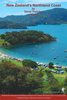
New Zealand: South Island Touring Atlas & Guide

New Zealand's South Island Touring Atlas & Guide: A4, paperback atlas and guide with descriptions of most visited areas illustrated with colour photos, detailed road maps, and street plans of main towns.The atlas opens with general information on touring the North Island and descriptions of the national parks: Arthur
RIP - This product is no longer available on our network. It was last seen on 25.09.2019

This page now acts as a permanent archive for this product. Add more information using the comments box below to ensure it can still be found by future generations.

Use our search facility to see if it is available from an alternative contributor.
  • External links may include paid for promotion
  • Availability: Out Of Stock
  • Supplier: Stanfords
  • SKU: 9781877302527
Availability: In Stock
£26.95

Product Description

New Zealand's South Island Touring Atlas & Guide: A4, paperback atlas & guide with descriptions of most visited areas illustrated with colour photos, detailed road maps, & street plans of main towns. The atlas opens with general information on touring the North Island & descriptions of the national parks: Arthur

Reviews/Comments

Add New

Price History

Vouchers

No voucher codes found.
Do you know a voucher code for this product or supplier? Add it to Insights for others to use.

Facebook

Jargon Buster

Colour - The categorised spectrum of light visable to humans
Road - a manmade lane or a path that is used to speed up travel.

Supplier Information

Stanfords
Stanfords was established in 1853 and opened their iconic Covent Garden flagship store in 1901. They have become the top retailer of maps, travel books and accessories in the UK and arguably offer the largest selection of maps and travel books worldwide. Famous names such as Captain Robert Falcon Scott, Ranulph Fiennes and Michael Palin have purchased from Stanfords. They now have a shop in Bristol and both stores together with other venues operate a calendar of events including talks, book signings and exhibitions. As a specialist map retailer, the map selection is comprehensive and includes road maps, street maps and walking maps from worldwide destinations, as well as a selection of world atlases and wall maps. Books include travel guides and travel literature. Stanfords also stock globes, from miniatures made of blue marble to magnificent floor-standing globes. The website features a selection of interesting articles on travel topics.
Page Updated: 2023-11-12 20:15:36

Community Generated Product Tags

Oh No! The productWIKI community hasn't generated any tags for this product yet!
Menu