
 United Kingdom
 France
 Germany
 Netherlands
 Sweden
 USA
USA
 Italy
Italy
 Spain
Spain
More From Contributor


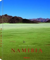
Namibia
Namibia at 1:1, 500, 000 from Nelles Verlag, with its smaller map size offering a convenient format for use when travelling. The map includes several insets with street plans and enlargements of popular tourist areas.The country is divided north/south, with a generous small overlap between the two sides. Coverage along the Caprivi Strip extends eastwards to include Livingstone and the Victoria Falls, plus the Moremi Wildlife Reserve in Botswana. The southern half also covers the Kgalagadi Transfrontier Park with the Mabuasehube Reserve. Relief shading with spot heights and names of mountain ranges and peaks very effectively presents the topography.Road network distinguishes between asphalt, gravel and dirt roads, and shows distances on most routes. Restricted access roads are clearly
marked. Railway lines and local airports are included, and the map also shows internal administrative boundaries with names of the provinces. National parks or protected areas and numerous other places of interest are very prominently highlighted. Latitude and longitude lines are drawn at intervals of 30
marked. Railway lines and local airports are included, and the map also shows internal administrative boundaries with names of the provinces. National parks or protected areas and numerous other places of interest are very prominently highlighted. Latitude and longitude lines are drawn at intervals of 30
Product Description
Reviews/Comments
Add New
Intelligent Comparison
Archived Product
Namibia Stanfords
£21.95
Archived Product
Namibia Stanfords
£9.50
Archived Product
Namibia Stanfords
£21.95
Archived Product
Namibia Stanfords
£4.99
Archived Product
Namibia Stanfords
£10.99
Archived Product
Namibia Stanfords
£5.99
Archived Product
Namibia Stanfords
£65.00
Archived Product
Namibia 4 Stanfords
£8.99
Vouchers
No voucher codes found.
Do you know a voucher code for this product or supplier? Add it to Insights for others to use.
Do you know a voucher code for this product or supplier? Add it to Insights for others to use.
 Denmark