
 United Kingdom
 France
 Germany
 Netherlands
 Sweden
 USA
USA
 Italy
Italy
 Spain
Spain
More From Contributor


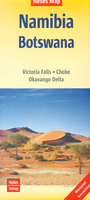
Namibia - Botswana Nelles
Namibia at 1:1, 500, 000 on a double-sided, waterproof and tear-resistant map from Nelles Verlag, with coverage of western Botswana including the Okavango Delta and Chobe NP, plus the Victoria Falls. Several insets provide street plans and enlargements of popular tourist areas.Namibia is divided north/south, with a generous small overlap; Windhoek, Swakopmund and Walvis Bay are included on both sides. Coverage along the Zambezi Region (formerly the Caprivi Strip) extends eastwards to include Livingstone and the Victoria Falls, plus northern Botswana with the Okavango Delta and Chobe National Park; the southern half also covers most of the Kgalagadi Transfrontier Park with the Mabuasehube Reserve. Relief shading with spot heights and names of mountain ranges and peaks very effectively
presents the topography. Road network distinguishes between asphalt, gravel or dirt roads and 4WD only tracks, and shows distances on many routes. Restricted access areas are clearly marked. Railway lines and local airports are included, and the map also shows internal administrative boundaries with names of the provinces. National parks or protected areas and numerous other places of interest are prominently highlighted. Latitude and longitude lines are drawn at intervals of 30’. The map has no index. Map legend includes English.Numerous insets, highlighting places of interest and selected tourist accommodation, cover: central Windhoek, Walvis Bay, Swakopmund, Keetmanshoop, Lüderitz, Tsumeb, Okahandja, and Maun. Enlargements show in greater detail Fish River Canyon,
Sossusvlei, environs of Lüderitz, Waterberg, plus the Victoria Falls including the town on the Zimbabwe side of the border.

Product Description
Reviews/Comments
Add New
Vouchers
No voucher codes found.
Do you know a voucher code for this product or supplier? Add it to Insights for others to use.
Do you know a voucher code for this product or supplier? Add it to Insights for others to use.
 Denmark