
 United Kingdom
 France
 Germany
 Netherlands
 Sweden
 USA
USA
 Italy
Italy
 Spain
Spain
More From Contributor


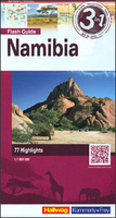
Namibia 3in1 Flash Guide
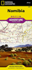
Namibia on a large, waterproof and tear-resistant map at 1:1, 000, 000 from the Swiss Hallwag/Kümmerly + Frey cartographic house, highlighting the county’s 77 best sights, each with a brief description, plus street plans of central Windhoek, Walvis Bay, Lüderitz and Swakopmund. The map is double-sided with a generous overlap and Windhoek included on both sides. The Zambezi Province (previously the Caprivi Strip) is shown on an inset, with coverage there extending to the Victoria Falls. Topography is indicated by shading and altitude colouring, with numerous spot heights and names of mountain ranges, deserts, etc. Graphics show swamps and salt pans; national parks and other protected areas are highlighted. Road classification indicates main roads with bad surface, minor roads
and selected cross-country tracks. Restricted entry sections and locations of fuel stations are marked and border crossings indicate opening times. Railway lines are shown with stations and local airports are marked. Namibia’s 77 best sights are cross-referenced to the surrounding panels of brief descriptions, many illustrated with photos. The map also highlights numerous accommodation options, graded as: hotel or B&B, guest or hunting farm, lodge or tented lodge, and campsite indicating those operated by the Namibia Wildlife resort of Namibia Community Based Tourism organizations. The map has no geographical coordinates. The index lists a selection of locations.Also included are street plans of central Windhoek, Walvis Bay, Lüderitz and Swakopmund annotated with main sights and
recommendations for hotels, restaurants, shopping, etc. Map legend and all the text include English.

Product Description
Reviews/Comments
Add New
Vouchers
No voucher codes found.
Do you know a voucher code for this product or supplier? Add it to Insights for others to use.
Do you know a voucher code for this product or supplier? Add it to Insights for others to use.
 Denmark