
 United Kingdom
 France
 Germany
 Netherlands
 Sweden
 USA
USA
 Italy
Italy
 Spain
Spain
More From Contributor
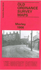


Morningside 1896
Morningside area of Edinburgh in 1896 in a fascinating series of reproductions of old Ordnance Survey plans in the Alan Godfrey Editions, ideal for anyone interested in the history of their neighbourhood or family. Selected towns in Great Britain and Ireland are covered by maps showing the extent of urban development in the last decades of the 19th and early 20th century.In this title: coverage stretches from New Craig House eastward to Blackford Hill, and from Morningside Park southward to Upper Braid Farm. Features include Morningside Road station, Royal Edinburgh Asylum, City Poorhouse, Greenbank, New Craig House, Craiglockhart station (at western margin), tramways, Falcon Hall, Morningside Cemetery, Braid Glen, St Matthew's church, Royal Hospital for Children, Braid area,
etc. On the reverse are street directory entries for Balcarres Street, Braid Road, Comiston Road, Cluny Gardens, Morningside Drive/Road/Park. About the Alan Godfrey Editions of the 25
etc. On the reverse are street directory entries for Balcarres Street, Braid Road, Comiston Road, Cluny Gardens, Morningside Drive/Road/Park. About the Alan Godfrey Editions of the 25
Product Description
Reviews/Comments
Add New
Vouchers
No voucher codes found.
Do you know a voucher code for this product or supplier? Add it to Insights for others to use.
Do you know a voucher code for this product or supplier? Add it to Insights for others to use.
 Denmark