
 United Kingdom
 France
 Germany
 Netherlands
 Sweden
 USA
USA
 Italy
Italy
 Spain
Spain
More From Contributor


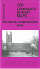

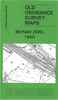


Mirfield North West: Battyeford And Roe Head 1905
Mirfield North West: Battyeford and Roe Head in 1905 in a fascinating series of reproductions of old Ordnance Survey plans in the Alan Godfrey Editions, ideal for anyone interested in the history of their neighbourhood or family. The map covers the north-western area of Mirfield, extending from Cooper Bridge station eastward to Water Royd Lane, and from Nab Lane northward to Roe Head Mill. Features include Roe Head, where the Bronte sisters went to school, the College of the Resurrection and House of the Resurrection, Nab, Christ Church Battyeford, Bracken Hill, the Three Nuns Inn, sections of the Calder and Battye Ford Cut, West Riding Flour Mills, Nun Brook Print Works, Kitson Hill, Mirfield Moor, Three Nuns Pit with tramway, Mirfield Moor Colliery, Westroyd, Taylor
Hall Brickworks, etc. On the reverse are a Battyeford directory and a commercial directory for Mirfield.About the Alan Godfrey Editions of the 25” OS Series:Selected towns in Great Britain and Ireland are covered by maps showing the extent of urban development in the last decades of the 19th and early 20th century. The plans have been taken from the Ordnance Survey mapping and reprinted at about 15 inches to one mile (1:4, 340). On the reverse most maps have historical notes and many also include extracts from contemporary directories. Most maps cover about one mile (1.6kms) north/south, one and a half miles (2.4kms) across; adjoining sheets can be combined to provide wider coverage.FOR MORE INFORMATION AND A COMPLETE LIST OF ALL AVAILABLE TITLES PLEASE CLICK ON THE SERIES LINK.
Hall Brickworks, etc. On the reverse are a Battyeford directory and a commercial directory for Mirfield.About the Alan Godfrey Editions of the 25” OS Series:Selected towns in Great Britain and Ireland are covered by maps showing the extent of urban development in the last decades of the 19th and early 20th century. The plans have been taken from the Ordnance Survey mapping and reprinted at about 15 inches to one mile (1:4, 340). On the reverse most maps have historical notes and many also include extracts from contemporary directories. Most maps cover about one mile (1.6kms) north/south, one and a half miles (2.4kms) across; adjoining sheets can be combined to provide wider coverage.FOR MORE INFORMATION AND A COMPLETE LIST OF ALL AVAILABLE TITLES PLEASE CLICK ON THE SERIES LINK.

Product Description
Reviews/Comments
Add New
Vouchers
No voucher codes found.
Do you know a voucher code for this product or supplier? Add it to Insights for others to use.
Do you know a voucher code for this product or supplier? Add it to Insights for others to use.
 Denmark