
 United Kingdom
 France
 Germany
 Netherlands
 Sweden
 USA
USA
 Italy
Italy
 Spain
Spain
More From Contributor


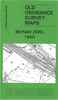

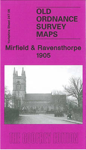
Mirfield And Ravensthorpe 1905
Mirfield and Ravensthorpe in 1905 in a fascinating series of reproductions of old Ordnance Survey plans in the Alan Godfrey Editions, ideal for anyone interested in the history of their neighbourhood or family. The map covers the central and eastern part of Mirfield, plus much of Ravensthorpe. Coverage extends from Mirfield station eastward to St Saviour`s church Ravensthorpe, and from St Mary`s church Mirfield southward to Hopton Bottom. Features include the railway with Mirfield station, Cleckheaton Junction, goods shed; Calder & Hebble Navigation with Shepley Bridge Cut, Greenwood Cut, Ledgard Bridge Dock Yard; St Mary`s church, Blake Hall, East-thorpe Villa, South Brook Mill, Holme Bank Mills, River Calder, malthouses, Memorial Hospital, Ivy Lodge, Marma Villa at
Mirfield; Low Mills, Oakland Mills, Netherfield Mill, Ravensthorpe Mills, Netherfield House (UDC Offices), St Saviour`s church at Ravensthorpe; Sands House, Cotewall, Calder Farm Reformatory, Calder New Pit south of the Calder. On the reverse is a directory of Mirfield listing private residents in 1889.About the Alan Godfrey Editions of the 25” OS Series:Selected towns in Great Britain and Ireland are covered by maps showing the extent of urban development in the last decades of the 19th and early 20th century. The plans have been taken from the Ordnance Survey mapping and reprinted at about 15 inches to one mile (1:4, 340). On the reverse most maps have historical notes and many also include extracts from contemporary directories. Most maps cover about one mile (1.6kms)
north/south, one and a half miles (2.4kms) across; adjoining sheets can be combined to provide wider coverage.FOR MORE INFORMATION AND A COMPLETE LIST OF ALL AVAILABLE TITLES PLEASE CLICK ON THE SERIES LINK.

Product Description
Reviews/Comments
Add New
Vouchers
No voucher codes found.
Do you know a voucher code for this product or supplier? Add it to Insights for others to use.
Do you know a voucher code for this product or supplier? Add it to Insights for others to use.
 Denmark