
 United Kingdom
 France
 Germany
 Netherlands
 Sweden
 USA
USA
 Italy
Italy
 Spain
Spain
More From Contributor


Middlesbrough North 1893 (Colour Edition)
Middlesbrough North in 1893 in a fascinating series of reproductions of old Ordnance Survey plans in the Alan Godfrey Editions, ideal for anyone interested in the history of their neighbourhood or family. Two versions have been published for this area. The map extends from the railway station and Zetland Street northward to the river, including a great range of iron and steel works to the north-west. Features on the 1893 version include Market Place area, St Hilda`s church, railway station, Port Clarence station and branch, Middlesbrough Iron Works, Cleveland Salt Works, Packet Wharf, No.2 Dock Yard, West Marsh Iron Works, Britannia Iron & Steel Works, North Eastern Steel Works, Acklam Iron Works, Linthorpe Iron Works, Ayrton Rolling Mills, Tees Side Iron Works, NER Marsh
Branch, Anderston Foundry, Allhusen Salt Works, NER Old Town Branch, many railway sidings, etc. On the reverse is a selection of street entries from a 1905 directory. The 1893 version is in colour, taken from the beautiful hand-coloured OS 1st Edition map.About the Alan Godfrey Editions of the 25” OS Series:Selected towns in Great Britain and Ireland are covered by maps showing the extent of urban development in the last decades of the 19th and early 20th century. The plans have been taken from the Ordnance Survey mapping and reprinted at about 15 inches to one mile (1:4, 340). On the reverse most maps have historical notes and many also include extracts from contemporary directories. Most maps cover about one mile (1.6kms) north/south, one and a half miles (2.4kms) across;
adjoining sheets can be combined to provide wider coverage.FOR MORE INFORMATION AND A COMPLETE LIST OF ALL AVAILABLE TITLES PLEASE CLICK ON THE SERIES LINK.
Product Description
Reviews/Comments
Add New
Intelligent Comparison
Archived Product
Central Middlesbrough 1892 (Colour Edition) Stanfords
£4.50
Archived Product
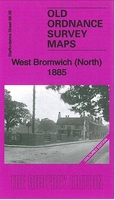
West Bromwich North 1885 (Colour Edition) Stanfords
£4.50
Archived Product
Sheffield North 1892 (Colour Edition) Stanfords
£2.95
Archived Product
Sheffield North 1892 (Colour Edition) Stanfords
£4.50
Archived Product

Halifax North 1889 (Colour Edition) Stanfords
£2.95
Archived Product

Halifax North 1889 (Colour Edition) Stanfords
£4.50
Archived Product

Leeds North West 1889 (Colour Edition) Stanfords
£4.50
Archived Product
Halifax South 1893 (Colour Edition) Stanfords
£2.95
Vouchers
No voucher codes found.
Do you know a voucher code for this product or supplier? Add it to Insights for others to use.
Do you know a voucher code for this product or supplier? Add it to Insights for others to use.
 Denmark