
 United Kingdom
 France
 Germany
 Netherlands
 Sweden
 USA
USA
 Italy
Italy
 Spain
Spain
More From Contributor


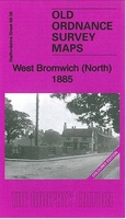
West Bromwich North 1885 (Colour Edition)
West Bromwich North in 1885 (colour edition) in a fascinating series of reproductions of old Ordnance Survey plans in the Alan Godfrey Editions, ideal for anyone interested in the history of their neighbourhood or family. Two versions have been published for this area, one in colour and the other black and white. The maps cover the northern part of West Bromwich, stretching from Churchfield northward to Hatley Heath, and westward to Blacklake. The main urban area is Hill Top in the north-western corner. Features include St James church, Balls Hill Farm, Albert Street Iron Works, Wallface Colliery (disused), tramway, stretch of GWR railway (but no stations), Blacklake Colliery, old shafts, Borough Gas Works, Oakwood Farm, White`s Farm Colliery, Waterloo Iron Works, Ridgacre
Branch Canal, Halford Branch Canal, Jesson`s Branch Canal, Hall End Colliery (in centre of map), Hall End area, Shrubbery Colliery, Churchfield House, West Bromwich Cemetery, infectious diseases hospital, Hateley Heath area with St Mary`s Mission Chapel, etc. Each map includes extracts from an 1888 directory. About the Alan Godfrey Editions of the 25” OS SeriesSelected towns in Great Britain and Ireland are covered by maps showing the extent of urban development in the last decades of the 19th and early 20th century. The plans have been taken from the Ordnance Survey mapping and reprinted at about 15 inches to one mile (1:4, 340). On the reverse most maps have historical notes and many also include extracts from contemporary directories. Most maps cover about one mile (1.6kms)
north/south, one and a half miles (2.4kms) across; adjoining sheets can be combined to provide wider coverage.FOR MORE INFORMATION AND A COMPLETE LIST OF ALL AVAILABLE TITLES PLEASE CLICK ON THE SERIES LINK.
 "Pin It")
Product Description
Reviews/Comments
Add New
Vouchers
No voucher codes found.
Do you know a voucher code for this product or supplier? Add it to Insights for others to use.
Do you know a voucher code for this product or supplier? Add it to Insights for others to use.
 Denmark