
 United Kingdom
 France
 Germany
 Netherlands
 Sweden
 USA
USA
 Italy
Italy
 Spain
Spain
More From Contributor

Michigan Handbook SUPERCEDED
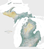
World traveler Laura Martone spends summers with her family on Michigan's Big Bear Lake. In Moon Michigan she shares her favorite Michigan experiences, from indulging at the National Cherry Festival in Traverse City to exploring Detroit's rhythmic roots and auto museums. Martone provides itineraries such as trekking through the Upper Peninsula, touring lighthouses on the Great Lake shoreline, and splurging on a luxury B&B on the popular Mackinac Island. Moon Michigan is packed with information on dining, transportation, and accommodations. Complete with details on where to ice fish, taste-test local fudge and go golfing in the Lower Peninsula, Moon Michigan gives travelers the tools they need to create a more personal and memorable experience.
Product Description
Reviews/Comments
Add New
Vouchers
No voucher codes found.
Do you know a voucher code for this product or supplier? Add it to Insights for others to use.
Do you know a voucher code for this product or supplier? Add it to Insights for others to use.
 Denmark