
 United Kingdom
 France
 Germany
 Netherlands
 Sweden
 USA
USA
 Italy
Italy
 Spain
Spain
More From Contributor

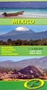

Mexico
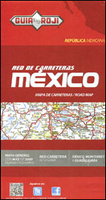
Mexico at 1:3, 450, 000 on a road map from the locally based Guia Roji, with an enlargement for the Mexico City - San Luis Potosi area, street plans of the capital, Guadalajara and Monterrey, driving times/distances maps, basic driving regulations, etc.On one side is whole country at 1:3, 450, 000. Roads are graded into six types. Driving distances are shown on main routes. Principal railway lines are includes and the map also shows internal administrative boundaries with names of the states. The plain white base makes road information easy to see but does not give much idea of the country’s topography, with names of mountain ranges in faint print and occasional spot heights. Symbols highlight selected archaeological sites and locations of cave paintings. Latitude and longitude
lines are drawn at intervals of 1°. The map has no index. On the reverse the country’s central area is shown in greater detail at 1:1, 120, 000. Coverage extend north to beyond San Luis Potosi and Madero, east to Xalapa, south beyond Iguala and west to Irapuato. Also provided are street plans of Mexico City, Guadalajara and Monterrey, all covering these cities with their outer suburbs and showing main traffic arteries, with separate enlargements for city centres.This title also includes a map of the country showing driving times and distances, a separate distance table, three panels of road signs, information on national holidays and traditional festivals, etc.Map legend and all the text are in Spanish only.
lines are drawn at intervals of 1°. The map has no index. On the reverse the country’s central area is shown in greater detail at 1:1, 120, 000. Coverage extend north to beyond San Luis Potosi and Madero, east to Xalapa, south beyond Iguala and west to Irapuato. Also provided are street plans of Mexico City, Guadalajara and Monterrey, all covering these cities with their outer suburbs and showing main traffic arteries, with separate enlargements for city centres.This title also includes a map of the country showing driving times and distances, a separate distance table, three panels of road signs, information on national holidays and traditional festivals, etc.Map legend and all the text are in Spanish only.

Product Description
Reviews/Comments
Add New
Vouchers
No voucher codes found.
Do you know a voucher code for this product or supplier? Add it to Insights for others to use.
Do you know a voucher code for this product or supplier? Add it to Insights for others to use.
 Denmark