
 United Kingdom
 France
 Germany
 Netherlands
 Sweden
 USA
USA
 Italy
Italy
 Spain
Spain
More From Contributor


Mexico
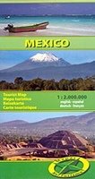
Peru at 1:2, 000, 000 on an indexed double-sided map from Mapas NaTurismo with very clear presentation of the country’s topography through relief based on satellite imagery, subtle altitude colouring and plenty of stop heights. The map divides the country north/south with a very generous overlap between the sides. Yucatan is shown as an inset, also with a good overlap with the adjoining part of the main map.Excellent use of relief shading and altitude colouring gives an almost 3-D presentation of the terrain. National parks and other protected areas are clearly marked. Additional graphics indicate swamps and salt pans.Road network includes seasonal tracks and indicates driving distances on main routes. Railway lines are included and domestic airports are marked. Symbols highlight
various places of interest including UNESCO World Heritage sites, other Maya and archaeological sites, beaches and surfing/diving sites, locations for observing local fauna, etc. Latitude and longitude lines are drawn at 1° intervals. The map is indexed and its legend includes English. An inset shows the environs on Mexico City in greater detail at 1:80, 000.
various places of interest including UNESCO World Heritage sites, other Maya and archaeological sites, beaches and surfing/diving sites, locations for observing local fauna, etc. Latitude and longitude lines are drawn at 1° intervals. The map is indexed and its legend includes English. An inset shows the environs on Mexico City in greater detail at 1:80, 000.

Product Description
Reviews/Comments
Add New
Vouchers
No voucher codes found.
Do you know a voucher code for this product or supplier? Add it to Insights for others to use.
Do you know a voucher code for this product or supplier? Add it to Insights for others to use.
 Denmark