More From Contributor

£7.99
What Will Your Melbourne Encounter Be
Browsing a grid of laneway galleries, cafes, bars & designer boutiques
Comparing

...
Archived Product
£7.99
Insight Guide Explore Melbourne is the ideal pocket companion for your trip: a full-colour guide containing 14 easy-to-follow routes in & around the city. You can discover Collins & Swanston Streets` fabulous architecture, the cultivated green space of the Royal Botanic Gardens & the fashionable seaside at St Kilda, or head off on an excursion, taking in the Yarra Valley`s wineries or the stunning scenery of the Great Ocean Road. Insight`s trademark cultural coverage sets the routes in context, with introductions to Melbourne`s exciting cuisine, great shopping, sporting heritage & key historical dates. Recommended places to eat & drink are highlighted in each route, with even more suggestions in the directory section, which also contains a wealth of useful practical information, including a range of carefully selected hotels to suit all budgets. All routes are plotted on the useful pull-out map, & evocative photography captures the essence of this most European of Australian cities. Insight Guide Explore Melbourne will lead you to the very best the city & its surrounds have to offer. ...
Archived Product
£4.99
Melbourne on a laminated, tear-resistant Insight Flexi Map, with a street plan of its central districts, a diagram of the tram network, road maps of the city with its outer suburbs & of its environs, plus extensive tourist information. On one side is a street plan at 1:15, 000 of Melbourne ...
Archived Product
£5.99
Melbourne on a laminated, tear-resistant Insight Flexi Map, with a street plan of its central districts, a diagram of the tram network, road maps of the city with its outer suburbs & of its environs, plus extensive tourist information. On one side is a street plan at 1:15, 000 of Melbourne’s central districts. Main public buildings, places of interest & selected hotels are prominently highlighted & named. The plan is indexed for streets, districts, parks, public buildings & points of interest. Also provided is a diagram of the city’s tram network. On the reverse a map at 1:120, 000 shows the city with its outer suburbs. Also provided is road map at 1:800, 000 covering Melbourne’s environs, including the beaches recommended on the map. Both maps are indexed & highlight numerous places of interest, including beaches, sport & recreational facilities, etc.A special feature of the Insight Flexi series are panels with additional tourist information:- 24 main sights, neatly grouped into sections covering Major Attractions, Shopping Areas, Beast Beaches, plus Further Afield are given brief descriptions & are prominently highlighted on the relevant maps.- Further panels provide information on Getting Around & Facts for Visitors, including tourist information offices, public holidays, opening times, money & monthly climate charts. To see the list of other titles in this series please click on the series link. ...
Archived Product
£7.99
Melbournein the Pocket Guide series from Insight provides detailed commentary on a collection of itinerary based trips in a handy pocket format. Each guide has an historical & cultural introduction, profiling the growth of the region or city. There is also a large selection of localised & pedestrian friendly tour itineraries designed to take in the major sites, as well as a chapter on excursions to other destinations within easy reach. Further sections detail leisure activities including shopping, eating out, nightlife, festivals & local events with accompanying addresses & contact details where relevant. There is also practical guidance on transport, local services, language & accommodation. Each guide also has a large selection of colour photographs & a pull-out pocket map giving an overview of the region. ...
Archived Product
£9.99
Melbourne’s central districts on an indexed street plan from ITMB with tram routes shown with line numbers & stops, highlighting for important buildings & selected hotels, plus diagrams of the commuter rail & tram networks, etc. The plan is very clearly laid out, prominently showing main traffic arteries, the lines of the Yarra Trams network including the route of the City Circle Free Tram around the CBD district, & the stations of the Connex Melbourne commuter railways. Important buildings are named & the plan also highlights locations of selected hotels, shopping centres, cultural institutions, consulates, etc. Also provided are diagrams of the tram & the commuter rail networks, plus a small road map showing the city with its outer suburbs. ...
Archived Product
£4.99
Durable & waterproof, with a handy slipcase & an easy-fold format, Lonely Planet Melbourne City Map is your conveniently-sized passport to traveling with ease. Get more from your map & your trip with images & information about top city attractions, transport maps, itinerary suggestions, extensive street & site index, & practical travel tips & directory. With this easy-to-use, full colour navigation tool in your rear pocket, you can truly get to the heart of Melbourne. Covers City Centre, Docklands, Southbank, Williamstown, South Melbourne, Port Melbourne, Albert Park, South Yarra, Prahran, Windsor, East Melbourne, Richmond, Fitzroy, Collingwood, Carlton, North Melbourne, St Kilda. ...
Archived Product
£6.99
Melbourne in the Luxe guides series, which are slim & small enough to fit easily in a pocket or handbag. Information is distilled from elite suggestions by city residents, specially selected for their style, knowledge & expertise. Luxe guides aim at the upper end of the market & subjectively edit to choose the very best recommendations for shopping, restaurants, leisure options & nightlife. Half day shopping & activity itineraries are suggested for you to mix & match your visit to suit your timetable. When folded close the cardboard guide slots into its own protective plastic frame. Vanity Fair magazine calls them “delightful, de-lovely, & deluxe”, & that’s just what they are. ...
Archived Product
£14.99
Melbourne is a right bobby dazzler, but unlike her flashier sister Sydney, she ain`t one to show off her goodies
- most of her
...
Archived Product
£3.99
Melbourne Pop Out Map: pop-up city street map of Melbourne city centre
- folded pocket size travel map with transit map included
...
Archived Product

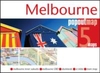
Melbourne Insight Smart Guide

Melbourne in the Smart Guide series from Insight is a streamlined version of travel information, in a concise format arranged in three sections - Areas, A-Z and Atlas. Areas and districts in and around town are described before the guide moves on to an A-Z detailing of attractions and services, from accommodation to transportation via history and nightlife. The guide has some language tips, a climate chart and an overview of top attractions shown on its fly-leaf. A selective, indexed mini Atlas of a few maps at the back of each guide helps place sites and attractions for the tourist and each guide is illustrated with colour photographs throughout.
RIP - This product is no longer available on our network. It was last seen on 25.09.2019

This page now acts as a permanent archive for this product. Add more information using the comments box below to ensure it can still be found by future generations.

Use our search facility to see if it is available from an alternative contributor.
  • Availability: Out Of Stock
  • Supplier: Stanfords
  • SKU: 9789812823113
Availability: In Stock
£6.99

Product Description

Melbourne in the Smart Guide series from Insight is a streamlined version of travel information, in a concise format arranged in three sections
- Areas, A-Z & Atlas. Areas & districts in & around town are described before the guide moves on to an A-Z detailing of attractions & services, from accommodation to transportation via history & nightlife. The guide has some language tips, a climate chart & an overview of top attractions shown on its fly-leaf. A selective, indexed mini Atlas of a few maps at the back of each guide helps place sites & attractions for the tourist & each guide is illustrated with colour photographs throughout.

Reviews/Comments

Add New

Intelligent Comparison

Oooops!
We couldn't find anything!
Perhaps this product's unique.... Or perhaps we are still looking for comparisons!
Click to bump this page and we'll hurry up.

Price History

Vouchers

No voucher codes found.
Do you know a voucher code for this product or supplier? Add it to Insights for others to use.

Facebook

Jargon Buster

History - Anything that happens in the past. An acedemic subject.
Colour - The categorised spectrum of light visable to humans
Language - the method of communication used in different areas. Humans and computers have many different languages.
Accommodation - A room in which someone can live in, for example in a hotel
Language - The way humans communicate either written and spoken.

Supplier Information

Stanfords
Stanfords was established in 1853 and opened their iconic Covent Garden flagship store in 1901. They have become the top retailer of maps, travel books and accessories in the UK and arguably offer the largest selection of maps and travel books worldwide. Famous names such as Captain Robert Falcon Scott, Ranulph Fiennes and Michael Palin have purchased from Stanfords. They now have a shop in Bristol and both stores together with other venues operate a calendar of events including talks, book signings and exhibitions. As a specialist map retailer, the map selection is comprehensive and includes road maps, street maps and walking maps from worldwide destinations, as well as a selection of world atlases and wall maps. Books include travel guides and travel literature. Stanfords also stock globes, from miniatures made of blue marble to magnificent floor-standing globes. The website features a selection of interesting articles on travel topics.
Page Updated: 2023-11-12 20:15:36

Community Generated Product Tags

Oh No! The productWIKI community hasn't generated any tags for this product yet!
Menu