
 United Kingdom
 France
 Germany
 Netherlands
 Sweden
 USA
USA
 Italy
Italy
 Spain
Spain
More From Contributor


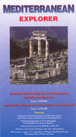
Mediterranean Explorer
Mediterranean Sea at 1:4, 700, 000 on a tourist map from the Ocean Explorer Publications designed to present both the region’s geography and information on its unrivalled number of historical and cultural sights, many illustrated with colour photos.On one side is a map of the Mediterranean including the Black Sea, showing the surrounding mainland with colouring to indicate its topography. Political boundaries, cities and towns, and main sights are marked. Enlargements show the Adriatic and the Aegean in greater detail. Surrounding the map are notes on various aspects of the Mediterranean Basin and its place in the development of western civilization. Also provided are brief biographies of main historical figures associated with the region from Alexander the Great to Atatürk.The
whole of the reverse side is covered by brief descriptions of the region’s numerous sites arranged by country, plus a time line from the Giza pyramids to the Six Day War in 1967 and the Turkish invasion of northern Cyprus in 1974.
whole of the reverse side is covered by brief descriptions of the region’s numerous sites arranged by country, plus a time line from the Giza pyramids to the Six Day War in 1967 and the Turkish invasion of northern Cyprus in 1974.

Product Description
Reviews/Comments
Add New
Vouchers
No voucher codes found.
Do you know a voucher code for this product or supplier? Add it to Insights for others to use.
Do you know a voucher code for this product or supplier? Add it to Insights for others to use.
 Denmark