
 United Kingdom
 France
 Germany
 Netherlands
 Sweden
 USA
USA
 Italy
Italy
 Spain
Spain
More From Contributor


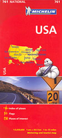
USA Michelin
USA at 1:3, 450, 000 on a large indexed map from Michelin providing an overview of the road network on a base with very effective presentation of the country’s topography, a table of state highway signs, etc.The base map has relief shading and altitude colouring to give a very clear picture of the country’s topography; the Rockies, Appalachian Mountains, etc. National Parks and selected other protected areas, as well as Indian lands are prominently highlighted. The map shows roads from interstate to state highways, plus selected local roads, with distances in miles and on major routes also in kilometres. National Parkways, e.g. the Blue Ridge Parkway, are highlighted. State boundaries are clearly marked and a separate table shows state highways signs in all the states. Town
and cities of special tourist interest are highlighted. Coverage includes Alaska and Hawaii shown as insets. Latitude and longitude lines are drawn at 5° intervals. The index is on the reverse and includes a list of main national parks.Also provided is a time zone map, plus state-by-state information panel with flags, details of population, area, date of accession to the Union, state symbols, etc.
and cities of special tourist interest are highlighted. Coverage includes Alaska and Hawaii shown as insets. Latitude and longitude lines are drawn at 5° intervals. The index is on the reverse and includes a list of main national parks.Also provided is a time zone map, plus state-by-state information panel with flags, details of population, area, date of accession to the Union, state symbols, etc.

Product Description
Reviews/Comments
Add New
Vouchers
No voucher codes found.
Do you know a voucher code for this product or supplier? Add it to Insights for others to use.
Do you know a voucher code for this product or supplier? Add it to Insights for others to use.
 Denmark