
 United Kingdom
 France
 Germany
 Netherlands
 Sweden
 USA
USA
 Italy
Italy
 Spain
Spain
More From Contributor


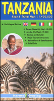
Tanzania
Tanzania at 1:1, 400, 000 from Harms Verlag with beautifully drawn cartography very effectively presenting the country’s landscape and vegetation, plus street plans of central Dar Es Salam and Arusha, and a distance table.The country’s topography is very clearly shown by colouring and subtle but very effective relief shading, plus numerous stop heights. More than usual amount of information is given on the vegetation and landscape: mangroves, swamps, periodical swamps, forests, tropical rain forests, salt and soda lakes (both seasonal and permanent), coral reefs, etc. Road network indicates sections not passable during the wet season. Railways, airfields and aerodromes, and ferry connections on both Lake Victoria and Lake Tanganyika are marked. The map shows national parks
and game reserves, and symbols highlight places of interest, accommodation from hotels to campsites, beaches with diving and sailing facilities, etc. Latitude and longitude are marked in the margins at 20’ intervals and the map also has a UTM grid. Map legend includes English.Two insets show plans of Dar Es Salam and Arusha, indicating hotels, medical facilities, etc. The map includes the whole of Rwanda and Burundi with the same topographic detail and tourist information as in Tanzania. Also provided is a comprehensive distance table.
and game reserves, and symbols highlight places of interest, accommodation from hotels to campsites, beaches with diving and sailing facilities, etc. Latitude and longitude are marked in the margins at 20’ intervals and the map also has a UTM grid. Map legend includes English.Two insets show plans of Dar Es Salam and Arusha, indicating hotels, medical facilities, etc. The map includes the whole of Rwanda and Burundi with the same topographic detail and tourist information as in Tanzania. Also provided is a comprehensive distance table.

Product Description
Reviews/Comments
Add New
Vouchers
No voucher codes found.
Do you know a voucher code for this product or supplier? Add it to Insights for others to use.
Do you know a voucher code for this product or supplier? Add it to Insights for others to use.
 Denmark