
 United Kingdom
 France
 Germany
 Netherlands
 Sweden
 USA
USA
 Italy
Italy
 Spain
Spain
More From Contributor


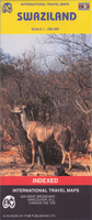
Swaziland ITMB
General map of the country with a street plan of Mbabane, an index of place names, a distance table, and notes on the country’s geography, history, economy and tourism. Altitude colouring shows Swaziland’s topography. Internal administrative boundaries are shown with names of the provinces. Road network includes unsurfaced roads and tracks. National parks and reserves are marked and symbols indicate the location of petrol stations, tourist offices, hotels, rest houses and campsites, museums and places of interest, etc. Latitude and longitude grid is shown at 15` intervals.The map also includes an inset with a street plan of Mbabane, a distance table, extensive notes on the country’s history, etc, and annual rainfall and temperature charts. Outside Swaziland’s
boundaries information is limited to main connecting roads only, with no topography.
boundaries information is limited to main connecting roads only, with no topography.

Product Description
Reviews/Comments
Add New
Vouchers
No voucher codes found.
Do you know a voucher code for this product or supplier? Add it to Insights for others to use.
Do you know a voucher code for this product or supplier? Add it to Insights for others to use.
 Denmark