
 United Kingdom
 France
 Germany
 Netherlands
 Sweden
 USA
USA
 Italy
Italy
 Spain
Spain
More From Contributor


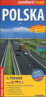
Poland Road Map
Poland on a laminated so waterproof and tear-resistant, indexed, double-sided road map at 1:750, 000 from the Warsaw-based ExpressMap, with detailed presentation of the road network. The map divides the country north/south with a small overlap between the sides. Road network is finely graded into 11 types, clearly indicates road numbers and border crossings, and shows driving distances on main and secondary routes. Railway lines are included and local airports are marked. The map is designed to provide a good presentation of the road network rather than to highlight tourist sites, so only national parks are marked. Topography is shown by unobtrusive relief shading with colouring for the woodlands. The map has no geographical coordinates. Map legend includes English.The map is
laminated in a format similar to the old cloth-dissected maps so it can be easily and repeatedly folded and re-folded into 11x24cm or larger sections without any damage.Please note: this is a slightly reduced version of the publishers’ road map of Poland at 1:700, 000, so some place names and the index are in small font size.
laminated in a format similar to the old cloth-dissected maps so it can be easily and repeatedly folded and re-folded into 11x24cm or larger sections without any damage.Please note: this is a slightly reduced version of the publishers’ road map of Poland at 1:700, 000, so some place names and the index are in small font size.

Product Description
Reviews/Comments
Add New
Vouchers
No voucher codes found.
Do you know a voucher code for this product or supplier? Add it to Insights for others to use.
Do you know a voucher code for this product or supplier? Add it to Insights for others to use.
 Denmark