
 United Kingdom
 France
 Germany
 Netherlands
 Sweden
 USA
USA
 Italy
Italy
 Spain
Spain
More From Contributor

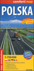

Poland Road Map
Poland on an indexed, double-sided road map at 1:700, 000 from the Warsaw-based ExpressMap, with clear and detailed presentation of the road network. An enlargement covers the Upper Silesia conurbation around Katowice in greater detail at 1:385, 000.The map divides the country north/south with a good overlap between the sides. Road network is finely graded into 10 types, clearly indicates road numbers and border crossings, and shows driving distances on main and secondary routes. Railway lines are included and local airports are marked. The map is designed to provide a good presentation of the road network rather than to highlight tourist sites, so only national parks are marked. Topography is shown by unobtrusive relief shading with colouring for the woodlands. The map has no
geographical coordinates. Map legend includes English.
geographical coordinates. Map legend includes English.
Product Description
Reviews/Comments
Add New
Vouchers
No voucher codes found.
Do you know a voucher code for this product or supplier? Add it to Insights for others to use.
Do you know a voucher code for this product or supplier? Add it to Insights for others to use.
 Denmark