
 United Kingdom
 France
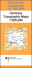
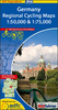
 Germany
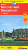
 Netherlands
 Sweden
 USA
USA
 Italy
Italy
 Spain
Spain
More From Contributor
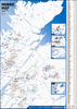


Munster City Pocket Plan
About Falk City Pocket Plans:Street maps covering a slightly smaller area than that represented on the Falk Extra edition, thus folding down to a more handy size (10 x 17cm). Some of them are drawn with a varying scale which, for clarity, presents the city centre at a slightly larger scale than the outer districts.Main landmarks and public buildings are indicated, also one-way streets, car parks and all the public transport facilities eg. tram & bus routes, U-bahns.These plans of larger cities include a separate map of the town centre at a more detailed scale and a diagram of the U-Bahn and the suburban rail network. The plans also show the postal divisions and have an extensive street index on the reverse side which, where appropriate, shows individual postal codes for each
street.Also included is a smaller scale map of the city and its immediate environs, showing main roads and railways.Map legend includes English.
street.Also included is a smaller scale map of the city and its immediate environs, showing main roads and railways.Map legend includes English.

Product Description
Reviews/Comments
Add New
Vouchers
No voucher codes found.
Do you know a voucher code for this product or supplier? Add it to Insights for others to use.
Do you know a voucher code for this product or supplier? Add it to Insights for others to use.
 Denmark