More From Contributor

£13.99
This map of Munkedal Lysekil Tjorn in 1:50, 000 is part of a series of topographic maps from Norstedts Kartforlaget which


...
Archived Product
£16.99
A beautifully drawn graphic novel that illuminates the conflicted land of Kashmir, through a young boy`s childhood. Seven-year-old Munnu is growing up in Indian-administered Kashmir. Life revolves around his family: Mama, Papa, sister Shahnaz, brothers Adil & Akhtar &, his favourite, older brother Bilal. It also revolves around Munnu`s two favourite things
- sugar & drawing. But Munnu`s is a childhood experienced against the backdrop of conflict. Bilal`s classmates are crossing over into the Pakistan-administered portion of Kashmir to be trained to resist the `occupation`; Papa & Bilal are regularly taken by the military to identification parades where informers will point out `terrorists`; Munnu`s school is closed; close neighbours are killed & the homes of Kashmiri Hindu families lie abandoned, as once close, mixed communities have ruptured under the pressure of Kashmir`s divisions. Munnu is an amazingly personal insight into everyday life in Kashmir. Closely based on Malik Sajad`s own childhood & experiences, it is a beautiful, evocatively drawn graphic novel that questions every aspect of the Kashmir situation
- the faults & responsibilities of every side, the history of the region, the role of Britain & the West, the possibilities for the future. It opens up the story of this contested & conflicted l&, while also giving a brilliantly close, funny & warm-hearted portrait of a boy`s childhood & coming-of-age.

...
Archived Product
£9.50
Topographical survey of Belgium at 1:20, 000 from Nationaal Geografisch Instituut / Institut Géographique National, the country’s national survey organization. Each 20K map covers one quarter of the corresponding 1:50, 000 map (with adjustments in the border & coastal areas). The maps provide all the information expected of topographic mapping at this scale & in addition have an unusually large amount of vegetation and/or land use information (different types of woodlands, gardens, orchards, heath, etc). The maps have a 1-km UTM grid, with margin ticks for latitude & longitude at intervals of 1`. Map legend & a glossary of terms used on the maps include English. Stanfords keeps as regular stock 20K maps for the World War I battlefields around the Ypres, Messines & Passchendaele, & for the area of the Battle of Waterloo. The 1:20, 000 survey covers the whole of Belgium & maps for other regions can be supplied as special orders. To see the list of titles in this series please click on the series link.PLEASE NOTE: the Long-Distance Footpaths Map of Belgium at 1:300, 000 which shows the division of Belgium into the 50K survey sheets can also be used to see in more detail coverage by the 20K maps. ...
Archived Product
£7.95
Scotlands’ Munros (summits over 3000 feet / 914m), Corbetts (over 2500 feet / 762m), Grahams (2000 feet / 610m), plus the Donalds (hills over 2000 feet in Central or Southern Scotl&, highlighted on an overview map of the country & accompanied by section-by-section lists. The base map presents Scotland’s topography by unobtrusive relief shading & shows the network of main road & rail connections. Each type of the summit is indicated by a symbol & accompanied by its number used in the accompanying lists. Separate lists of Munros, Corbetts, Grahams & Donalds are arranged by region & include space to record the date when the summit was climbed. Additional notes deal with the most recent changes in the classification. Current edition of this map include the revisions in the Munro Tables in 2009 & 2011. ...
Archived Product
£12.99
Elegant pictorial wall chart from the Guide Us company showing the Munros, Scotland’s 282 mountains over 3000 feet (914.4 meters) high. The chart (size 59.5 x 84cm / 23.5 x 33” approx) shows all 17 Munro groups, Loch Fyne to Loch Tay (FT), Loch Tay to Rannoch Moor (TR), Glen Orchy to Loch Leven (OL), Loch Linnhe to Loch Ericht (LE), Loch Ericht to Drumochter (ED), Drumochter to Glen Shee (DS), Glen Shee to Mount Keen (SK), The Cairngorms (CG), Glen Roy to The Monadh Liath (RL), Loch Eil to Glen Shiel (ES), Glen Affric to Glen Shiel (AS), Glen Cannich to Glen Carron (CC), Glen Carron to Glen Torridon (CT), Loch Maree to Loch Broom (MB), Loch Broom to Cromarty Firth (BC), Loch Broom to Cape Wrath (BW) & The Islands (IS). Each group is defined by a different colour, with an enlargement for the Ben Nevis area, plus insets for Mull & Skye to include Ben More & the peaks of the Cuillin Hills. The map shows the Scottish Highlands with rivers & lochs, main towns & cities, principal road & rail connections, plus major long-distance walking routes: the West Highland Way, the Great Glen Way & the Speyside Way. All the peaks, from Ben Nevis to Beinn Teallach, are numbered & cross-referenced to a table which lists the 282 mountains with their altitude in metres & feet, plus colour-coding for the group each Munro belongs to. The table also features a box to tick off each Munro as it is completed. The chart is printed on high quality 170gsm paper. ...
Archived Product
£14.95
Walking the Munros Vol. 1: Southern, Central & Western Highlands guide from Cicerone Press presenting 69 routes over 139 Munro summits, with detailed route descriptions, custom-made 1:100, 000 map extracts, access & accommodation recommendations, etc. The guide covers areas 1 to 5 shown on our Coverage image; each has roughly a similar number of routes except for just one on the Isle of Mull. Each area is presented in the guide on an overview map showing the locations of the individual walks. Detailed route descriptions give OS grid references for important points & are accompanied by a custom-made contoured map extracts at 1:100, 000 & information panels with grading, map recommendations, access & accommodation suggestions, etc. The publishers recommend either Ordnance Survey Explorer maps or titles from Harvey Map Services, all available from Stanfords’ website. Brief introductory chapter

Includes::
general information about the delights of collecting all the 283 Muros, whilst appendices provide indices of the summits by height & by name, a bibliography, & useful contact details.

...
Archived Product
£14.00
Steve Kew’s Cicerone guide to Walking the Munros
- Volume 2
- Northern Highlands & Cairngorms is part of a two volume series

...
Archived Product
£8.99
Munster on a topographic map at 1:200, 000 from the Bundesamt für Kartographie und Geodäsie, Germany’s federal mapping agency. The map covers an area of Approx. 100 x 90km. This map is belongs to a series of 58 topographic maps from Bundesamt für Kartographie und Geodäsie, the federal cartographic agency of Germany responsible for topographic mapping at 1:200, 000 & maps at smaller scales (the more detailed topographic & leisure maps are prepared & published by the survey organizations of the individual states). Cartography is from the 200K topographic survey & the maps have very elegant, modern look whilst retaining the traditional German presentation of names of smaller towns & villages in italics. Contours are at 12, 5m intervals, enhanced by relief shading, with colouring for woodlands, moors, marches, vineyards & hop plantations. Waterways & rivers are also described in detail, with currents, waterfalls, dams, & jetties clearly marked. Road network, graded into five types, highlights in colour national & regional roads; no driving distances are marked Railway network is also shown in detail, with stations, goods only lines, etc. The maps show administrative boundaries of states & counties, & have a UTM grid plus margin ticks for latitude & longitude at 2’ intervals. Map legend is in German only. PLEASE NOTE: maps in this series provide an excellent presentation of the areas covered by them, with plenty of place names & detailed representation of the road network, & will appeal to anyone who likes quality cartography, but they are not necessarily the best option for holiday & business travel. To see other titles in this series please click on the series link. ...
Archived Product
£6.50
About Falk City Pocket Plans: Street maps covering a slightly smaller area than that represented on the Falk Extra edition, thus folding down to a more handy size (10 x 17cm). Some of them are drawn with a varying scale which, for clarity, presents the city centre at a slightly larger scale than the outer districts. Main landmarks & public buildings are indicated, also one-way streets, car parks & all the public transport facilities eg. tram & bus routes, U-bahns. These plans of larger cities include a separate map of the town centre at a more detailed scale & a diagram of the U-Bahn & the suburban rail network. The plans also show the postal divisions & have an extensive street index on the reverse side which, where appropriate, shows individual postal codes for each street. Also included is a smaller scale map of the city & its immediate environs, showing main roads & railways. Map legend

Includes::
English.

...
Archived Product
£10.99
Munsterland on a waterproof, tear-resistant, GPS compatible cycling map at 1:75, 000 from the ADFC (Allgemeiner Deutscher Fahrrad-Club
-
...
Archived Product

Munros

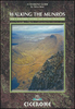
The Munros are mountains in Scotland with a height of over 3000ft and take their name from the first list of such hills published in 1891 by Victorian mountaineer Sir Hugh Munro, 4th Baronet of Lindertis. Revised several times in the years since, most recently in 2012, the official list now features 282 peaks. This guide is for anyone who wants to climb these mountains and aims to provide reliable routes and tips for ascending them safely. The Munros will ensure you reach parts of Scotland you might otherwise overlook, spend memorable evenings in pubs, bothies and wild camps, and have encounters with other walkers, locals and wildlife that enhance the adventure regardless of whether you get to the top of one Munro or all of them.
RIP - This product is no longer available on our network. It was last seen on 25.09.2019

This page now acts as a permanent archive for this product. Add more information using the comments box below to ensure it can still be found by future generations.

Use our search facility to see if it is available from an alternative contributor.
  • External links may include paid for promotion
  • Availability: Out Of Stock
  • Supplier: Stanfords
  • SKU: 9781907025273
Availability: In Stock
£12.99

Product Description

The Munros are mountains in Scotland with a height of over 3000ft & take their name from the first list of such hills published in 1891 by Victorian mountaineer Sir Hugh Munro, 4th Baronet of Lindertis. Revised several times in the years since, most recently in 2012, the official list now features 282 peaks. This guide is for anyone who wants to climb these mountains & aims to provide reliable routes & tips for ascending them safely. The Munros will ensure you reach parts of Scotland you might otherwise overlook, spend memorable evenings in pubs, bothies & wild camps, & have encounters with other walkers, locals & wildlife that enhance the adventure regardless of whether you get to the top of one Munro or all of them.

Reviews/Comments

Add New

Intelligent Comparison

Oooops!
We couldn't find anything!
Perhaps this product's unique.... Or perhaps we are still looking for comparisons!
Click to bump this page and we'll hurry up.

Price History

Vouchers

No voucher codes found.
Do you know a voucher code for this product or supplier? Add it to Insights for others to use.

Facebook

Jargon Buster

Adventure - an undertaking of an exciting challenge or experience.
Reliable - Something that is consistently good and can be trusted.

Supplier Information

Stanfords
Stanfords was established in 1853 and opened their iconic Covent Garden flagship store in 1901. They have become the top retailer of maps, travel books and accessories in the UK and arguably offer the largest selection of maps and travel books worldwide. Famous names such as Captain Robert Falcon Scott, Ranulph Fiennes and Michael Palin have purchased from Stanfords. They now have a shop in Bristol and both stores together with other venues operate a calendar of events including talks, book signings and exhibitions. As a specialist map retailer, the map selection is comprehensive and includes road maps, street maps and walking maps from worldwide destinations, as well as a selection of world atlases and wall maps. Books include travel guides and travel literature. Stanfords also stock globes, from miniatures made of blue marble to magnificent floor-standing globes. The website features a selection of interesting articles on travel topics.
Page Updated: 2023-11-12 20:15:36

Community Generated Product Tags

Oh No! The productWIKI community hasn't generated any tags for this product yet!
Menu