
 United Kingdom
 France
 Germany
 Netherlands
 Sweden
 USA
USA
 Italy
Italy
 Spain
Spain
More From Contributor


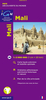
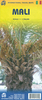
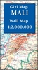


Mali Gizi Map
Mali at 1:2, 000, 000 from Gizi Map with excellent presentation of the country’s topography, an enlargement for the Dogon Plateau, street plans of Bamako and Timbuktu, all showing places of interest, plus an extensive index.Topography is shown by altitude colouring with spot heights and plenty of names of mountain ranges and other geographical features. Additional graphics show sandy or rocky deserts, swamps and flood plains, salt flats and seasonal wadis. Also marked and named are numerous water wells in the desert areas, and oasis. National parks and other protected areas are highlighted. Road network includes desert tracks, indicates border crossings and gives distances on main routes. The railway line to Bamako, local airports and ports along the Niger River are also shown,
as well as the country’s administrative divisions with names of the provinces. The map highlights numerous places of interest and indicates locations with tourist accommodation. The map has latitude and longitude lines drawn at intervals of 1° and an extensive index. Map legend includes English.An enlargement at 1:1, 500, 000 shows the Dogon Plateau in greater detail. The Bamako area is presented at 1:50, 000 naming main streets and neighbourhoods, with the city centre also shown at 1:12, 000. A more general plan covers Timbuktu/Tombouctou at 1:10, 000. All three plans highlight sights, hotels, medical facilities, etc.* This title is also available as a wall map.
as well as the country’s administrative divisions with names of the provinces. The map highlights numerous places of interest and indicates locations with tourist accommodation. The map has latitude and longitude lines drawn at intervals of 1° and an extensive index. Map legend includes English.An enlargement at 1:1, 500, 000 shows the Dogon Plateau in greater detail. The Bamako area is presented at 1:50, 000 naming main streets and neighbourhoods, with the city centre also shown at 1:12, 000. A more general plan covers Timbuktu/Tombouctou at 1:10, 000. All three plans highlight sights, hotels, medical facilities, etc.* This title is also available as a wall map.

Product Description
Reviews/Comments
Add New
Vouchers
No voucher codes found.
Do you know a voucher code for this product or supplier? Add it to Insights for others to use.
Do you know a voucher code for this product or supplier? Add it to Insights for others to use.
 Denmark