
 United Kingdom
 France
 Germany
 Netherlands
 Sweden
 USA
USA
 Italy
Italy
 Spain
Spain
More From Contributor


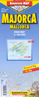
Majorca
Majorca and Palma de Mallorca on a clear and informative, waterproof and tear-resistant map from Berndtson, with both the road map and the street plan indexed and highlighting the island’s 15 top rated sites and other places of interest, as well as providing general tourist information. On one side a map of the island shows its road network, including selected cart tracks and footpaths, indicating locations of petrol stations. Road numbering reflects the change to the local system of “Ma” numbers. Scenic routes are highlighted. A wide range of symbols mark various places of interest, including beaches, campsites, viewpoints, windmills, sport and recreational facilities, etc. 15 of the island’s main sights are marked, with a separate panel providing brief descriptions.
Topography is shown by subtle relief shading. The index has a separate list of places of interest and beaches. The map has no geographical coordinates.On the reverse is a street plan of Palma de Mallorca at 1:7, 000, covering the city’s historic centre and the adjoining districts. One way streets, car parks, places of interest and selected hotels are highlighted. Street index includes lists of sights, consulates, parks, etc. Also included is a diagram of the metro line.The map also provides panels with climate details month by month and other useful tourist information. The map is printed on light, waterproof and tear-resistant plastic paper.Map legend includes English. All descriptions and notes are in English only.
Topography is shown by subtle relief shading. The index has a separate list of places of interest and beaches. The map has no geographical coordinates.On the reverse is a street plan of Palma de Mallorca at 1:7, 000, covering the city’s historic centre and the adjoining districts. One way streets, car parks, places of interest and selected hotels are highlighted. Street index includes lists of sights, consulates, parks, etc. Also included is a diagram of the metro line.The map also provides panels with climate details month by month and other useful tourist information. The map is printed on light, waterproof and tear-resistant plastic paper.Map legend includes English. All descriptions and notes are in English only.

Product Description
Reviews/Comments
Add New
Vouchers
No voucher codes found.
Do you know a voucher code for this product or supplier? Add it to Insights for others to use.
Do you know a voucher code for this product or supplier? Add it to Insights for others to use.
 Denmark