
 United Kingdom
 France
 Germany
 Netherlands
 Sweden
 USA
USA
 Italy
Italy
 Spain
Spain
More From Contributor


Czech Republic F&B
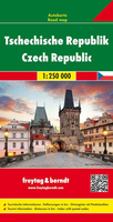
Czech Republic at 1:250, 000 on a large double-sided road map from Freytag & Berndt with enlargements showing in greater detail access and main roads across the country’s eight main cities: Prague, Brno, Plzen, Ceské Budejovice, Karlovy Vary, Ústí nad Labem, Olomouc and Ostrava. The map divides the country east/west with a small overlap between the sides, with the easternmost part east of Ostrava shown as an inset at the same scale as the main map. Relief shading and spot heights show the country’s topography, with colouring for woodlands and a large number of names of geographical features such as mountain chains. National Parks are shows, as well as restricted entry military areas.Road network includes small local roads, gives driving distances on main and many secondary
routes, and shows locations of petrol stations. Railway lines are included and local airports are marked. A range of symbols highlight various places of cultural and historical interest, campsites, sport and recreational facilities, etc. Latitude and longitude lines are marked at intervals of 20’. Extensive index attached to the map cover lists locations with their postcodes. Multilingual map legend includes English.Also provided are eight enlargements at 1:100, 000 showing in greater detail road access and main traffic arteries across Prague, Brno, Plzen, Ceské Budejovice, Karlovy Vary, Ústí nad Labem, Olomouc and Ostrava.
routes, and shows locations of petrol stations. Railway lines are included and local airports are marked. A range of symbols highlight various places of cultural and historical interest, campsites, sport and recreational facilities, etc. Latitude and longitude lines are marked at intervals of 20’. Extensive index attached to the map cover lists locations with their postcodes. Multilingual map legend includes English.Also provided are eight enlargements at 1:100, 000 showing in greater detail road access and main traffic arteries across Prague, Brno, Plzen, Ceské Budejovice, Karlovy Vary, Ústí nad Labem, Olomouc and Ostrava.

Product Description
Reviews/Comments
Add New
Vouchers
No voucher codes found.
Do you know a voucher code for this product or supplier? Add it to Insights for others to use.
Do you know a voucher code for this product or supplier? Add it to Insights for others to use.
 Denmark