
 United Kingdom
 France
 Germany
 Netherlands
 Sweden
 USA
USA
 Italy
Italy
 Spain
Spain
More From Contributor


Czech Republic ITMB
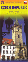
Czech Republic at 1:370, 000 on a double-sided, indexed map from ITMB presenting the country’s road network on a base with altitude colouring, plus an enlargement showing road access to central Prague and a street plan of the city.The map divides the country east/west with a small overlap between the sides. Driving distances are marked on main roads. Railway lines are included and local airports are marked. Symbols indicate various places of interest, including campsites, UNESCO World Heritage sites, etc. Latitude and longitude lines are drawn at 1° intervals. Each side has a separate index.Also provided is a map showing main roads and railway/metro connections across Prague, plus a street plan of the city centre, both annotated with places of interest.

Product Description
Reviews/Comments
Add New
Vouchers
No voucher codes found.
Do you know a voucher code for this product or supplier? Add it to Insights for others to use.
Do you know a voucher code for this product or supplier? Add it to Insights for others to use.
 Denmark