
 United Kingdom
 France
 Germany
 Netherlands
 Sweden
 USA
USA
 Italy
Italy
 Spain
Spain
More From Contributor

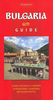


Bulgaria ITMB
Double-sided, waterproof, indexed map of Bulgaria at 1:375, 000 with an enlargement of Sofia. The map shows the country’s road and rail networks, as well as local airports. Numerous points of interest are highlighted including national parks; national boundaries are marked and names of administrative regions prominently shown; terrain is indicated by simple colouring, as are populated areas.The map also includes a street plan of Central Sofia, annotated with places of interest and facilities.For the main map, all names presented in the original Cyrillic with phonetic English translations beside them; the enlargement of Sofia only displays street names in their English phonetic translation.The main map is fully-indexed.

Product Description
Reviews/Comments
Add New
Vouchers
No voucher codes found.
Do you know a voucher code for this product or supplier? Add it to Insights for others to use.
Do you know a voucher code for this product or supplier? Add it to Insights for others to use.
 Denmark