
 United Kingdom
 France
 Germany
 Netherlands
 Sweden
 USA
USA
 Italy
Italy
 Spain
Spain
More From Contributor


Aruba
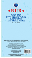
Aruba at 1:28, 000 on an indexed map from the Caribbean-based cartographer Michal Kasprowski highlighting numerous diving sites and various places of interest, plus indexed street plans of Oranjestad and San Nicolas.Topography is shown by altitude colouring with spot heights; the area of the Arikok National Park is clearly marked. Road network indicates main roads and shows secondary roads and local tracks or footpaths. Recommended biking and hiking trails are highlighted. Symbols indicate various facilities and places of interest including beaches, sugar mills, petrol stations, etc. Along the coast numerous diving sites are marked. Latitude and longitude lines are marked at 2’ intervals. Map legend is in English.Also provided are indexed street plans of Oranjestad (including access
to the islands international airport) and San Nicolas. One index covers both the main map and the street plans.
to the islands international airport) and San Nicolas. One index covers both the main map and the street plans.

Product Description
Reviews/Comments
Add New
Vouchers
No voucher codes found.
Do you know a voucher code for this product or supplier? Add it to Insights for others to use.
Do you know a voucher code for this product or supplier? Add it to Insights for others to use.
 Denmark