
 United Kingdom
 France
 Germany
 Netherlands
 Sweden
 USA
USA
 Italy
Italy
 Spain
Spain
More From Contributor


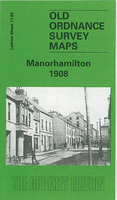
Manorhamilton 1908
Manorhamilton in 1908 in a fascinating series of reproductions of old Ordnance Survey plans in the Alan Godfrey Editions, ideal for anyone interested in the history of their neighbourhood or family. The map is double-sided. Most of the town of Manorhamilton is shown, and coverage extends eastward to Curley Bridge and the station. The main map covers the Main Street area of town, where features also include church, ruined church, Sycamore Lodge, Owenmore River, St Clare`s Hall, Workhouse, railway with station, engine shed and full track layout, part of Donagh More district, Ramooney district, Curley Bridge. On the reverse is part of the adjacent sheet 7.16 extending coverage north, and this includes Fair Green, ruined castle, St Clare`s RC church, Sheela More`s Bridge, Bee
Park, etc. Skreeny House is just cut off by the margin. Also included is a trade directory for Manorhamilton in c.1910.About the Alan Godfrey Editions of the 25” OS Series:Selected towns in Great Britain and Ireland are covered by maps showing the extent of urban development in the last decades of the 19th and early 20th century. The plans have been taken from the Ordnance Survey mapping and reprinted at about 15 inches to one mile (1:4, 340). On the reverse most maps have historical notes and many also include extracts from contemporary directories. Most maps cover about one mile (1.6kms) north/south, one and a half miles (2.4kms) across; adjoining sheets can be combined to provide wider coverage.FOR MORE INFORMATION AND A COMPLETE LIST OF ALL AVAILABLE TITLES PLEASE CLICK ON THE
SERIES LINK.

Product Description
Reviews/Comments
Add New
Vouchers
No voucher codes found.
Do you know a voucher code for this product or supplier? Add it to Insights for others to use.
Do you know a voucher code for this product or supplier? Add it to Insights for others to use.
 Denmark