
 United Kingdom
 France
 Germany
 Netherlands
 Sweden
 USA
USA
 Italy
Italy
 Spain
Spain
More From Contributor


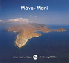


Mani - Tenaro Anavasi 8.43
Mani: Tenaro area in a series of waterproof and tear-resistant hiking maps at scales varying from 1:50, 000 to 1:10, 000, with a UTM grid for GPS users. Contour interval varies depending on the scale, on most maps it is 20m. Relief shading, spot heights, springs, seasonal streams and, in most titles, landscape/land-use variations, e.g. forests, orchards, or vineyards provide additional information on the terrain. Place names are given in both Greek and Latin script.Local footpaths, hostels and mountain huts are clearly marked. For road users intermediate driving distances and petrol stations are shown. Symbols highlight places of interest, including archaeological sites, churches and monasteries, etc. The maps have a UTM grid and margin ticks for latitude and longitude. Map
legend includes English.*In this title:* an area from Cape Kipoula and Kokala - on the west and east coast respectively - to the southern tip of the Mani peninsula. Contour interval is 20m. Additional information includes bus stops. On the reverse is a simplified version of the same map without the topographic detail, simply highlighting roads and hiking routes, annotated to describe historical features and landmarks to aid navigation. An enlargement depicts in greater detail the vicinity of the ancient settlement of the Tenarians and the Poseidon and Apollo Sanctuary remains near Cape Tenaro.
legend includes English.*In this title:* an area from Cape Kipoula and Kokala - on the west and east coast respectively - to the southern tip of the Mani peninsula. Contour interval is 20m. Additional information includes bus stops. On the reverse is a simplified version of the same map without the topographic detail, simply highlighting roads and hiking routes, annotated to describe historical features and landmarks to aid navigation. An enlargement depicts in greater detail the vicinity of the ancient settlement of the Tenarians and the Poseidon and Apollo Sanctuary remains near Cape Tenaro.

Product Description
Reviews/Comments
Add New
Vouchers
No voucher codes found.
Do you know a voucher code for this product or supplier? Add it to Insights for others to use.
Do you know a voucher code for this product or supplier? Add it to Insights for others to use.
 Denmark