
 United Kingdom
 France
 Germany
 Netherlands
 Sweden
 USA
USA
 Italy
Italy
 Spain
Spain
More From Contributor


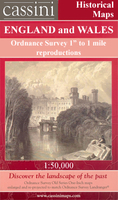
Malton And Pickering
Map No. 100, Malton and Pickering, in the Ordnance Survey Landranger series at 1:50, 000, including Norton-on-Derwent, Thixendale, Harton, Strensall, Thornton-le-Clay, Whitwell-on-the-Hill, Sutton-on-the Forest, Linton-on Ouse, Tholthorpe, Stillington, Whenby, Easingwold, Hutton Sessay, Brandsby, Coneysthorpe, Hovingham, Slingsby, Rillington, Thornton-le-Dale, Kirby Misperton, Oswaldkirk, Ampleforth, Byland Abbey, Bagby, Felixkirk, Old Byland, Rievaulx, Helmsley, Kirkbymoorside, Cropton, Lockton, Stape, Hutton-le-Hole, Low Mill, Rosedale Abbey, Fangdale Beck, Hawnby and Kepwick, with the North Yorkshire Moors National Park, Cleveland Hills and the Cleveland Way. Edition C3; Revised 1996; Revised for selected changes 2002, 2003, 2008; Copyright
date 2008 This title is also available on our website in a waterproof and tear-resistant version.Maps in this series are only published folded. Stanfords can also print flat versions of Ordnance Survey maps through the OS Select system, centring the map on a location of your choice and with a picture provided by you on the cover. For more information please click on the link at the bottom of this description.About Ordnance Survey
date 2008 This title is also available on our website in a waterproof and tear-resistant version.Maps in this series are only published folded. Stanfords can also print flat versions of Ordnance Survey maps through the OS Select system, centring the map on a location of your choice and with a picture provided by you on the cover. For more information please click on the link at the bottom of this description.About Ordnance Survey
Product Description
Reviews/Comments
Add New
Intelligent Comparison
Archived Product
Malton And Pickering 1857-1861 Stanfords
£9.99
Archived Product

Malton And Pickering 1924-1925 Stanfords
£9.99
Archived Product

Malton And Pickering 1903-1904 Stanfords
£9.99
Archived Product
Malton And Pickering WATERPROOF Stanfords
£10.39
Archived Product
Malton And Pickering OS ACTIVE Map Stanfords
£9.09
Vouchers
No voucher codes found.
Do you know a voucher code for this product or supplier? Add it to Insights for others to use.
Do you know a voucher code for this product or supplier? Add it to Insights for others to use.
 Denmark