More From Contributor
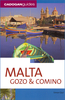
£12.99
Explores the fortress capital of Valletta, buit on a promontory into the sea
- walks the narrow streets of Vittoriosa & uncovers
...
Archived Product
£12.99
Malta, Gozo & Comino is the Sunflower Landscapes guide to exploring the best walking & touring possibilities on each isl&. The guide covers a range of routes including walks on each of the islands. A double-sided, fold-out touring map of Malta gives an overview of the isl&, basic street outlines of Victoria & Comino & the locations of each walk. Detailed information about touring by hired car or public transport, as well as on foot, is provided, helping walkers to navigate & plan day-trips. Shorter strolls are also included as an alternative for each main route for those seeking more leisurely days out. The guide is structured in two main parts ...
Archived Product
£13.99
Malta, Gozo & Comino in the Cadogan guide series; covering a range of destinations – primarily in Europe
- & combining solid research,
...
Archived Product
£9.99
Malta, Gozo & Comino in the Marco Polo Spiral Guides series is a practical guide presenting the most important things to see & do in the islands in a nutshell, & aimed at travellers who don’t have a lot of time to prepare & research for a trip. The guide highlights the top 10 sights, suggests tours & great ideas for exciting days out, & features colour photographs & a pull-out regional map & atlas pages. The guide opens with introductory chapters offering general information about the region, its history, art, geography & the people & things that make it worth visiting. Then, the guide divides the area into sections, & for each offers more specific information organised by Getting Your Bearings, Perfect Days giving examples of planned itineraries, the Top 10, Don’t Miss & At Your Leisure. There are planned day itineraries for each area including the best places to eat & drink along the way, accompanied by local map extracts & dotted with useful tips. An additional chapter offers inspirations for walks & tours. The guide concludes with general & practical information, regional atlas pages & a removable pull-out map, conveniently stored in a plastic pocket on the back cover. The format is designed with practicality in mind; the spiral binding & the colour coding makes it easy to keep the book open where is needed & render orientation fast & easy, ideal for travellers on the go. ...
Archived Product
£12.99
Malta, Gozo & Comino is the Sunflower Landscapes guide to exploring the best walking & touring possibilities on each isl&. The guide covers a range of routes including walks on each of the islands. A double-sided, fold-out touring map of Malta gives an overview of the isl&, basic street outlines of Victoria & Comino & the locations of each walk. Detailed information about touring by hired car or public transport, as well as on foot, is provided, helping walkers to navigate & plan day-trips. Shorter strolls are also included as an alternative for each main route for those seeking more leisurely days out. The guide is structured in two main parts – Touring & Walking – that explore each route with detailed references to public transport & car directions to make each walk more accessible. 3 Car-touring routes are included, covering Malta’s resorts, beaches & historic towns, its antiquities, fishing villages & gardens & also a tour of Gozo. Each describes a route by car with suggestions for stop-off places & things to see on the way, including any picnicking sites. 33 suggestions for the best picnic stops are included at the start of the book & these are cross-referenced with the fold-out map & walk descriptions. The ‘ Walking’ section

Includes::
27 recommended walks, many of which are circular tours. 22 of the walks cover Malta, there are 4 on Gozo & also one on Comino. A detailed introduction provides information on waymarking & maps, a walkers’ checklist, what to take, weather, photography, where to stay, Maltese pronunciation & place names, nuisances & hazards & a country code for walkers & motorists. Each walk begins with information about distance, difficulty grading, waymarking, how to get there, suggested clothing & equipment, language hints & shorter & alternative routes to the main walk. Appendices provide information on Bus, Helicopter & Ferry Timetables in addition to useful emergency telephone numbers. Colour photographs & individually adapted map extracts accompany each route.

...
Archived Product
£2.95
Malton & Norton in 1926 in a fascinating series of reproductions of old Ordnance Survey plans in the Alan Godfrey Editions, ideal for anyone interested in the history of their neighbourhood or family. Selected towns in Great Britain & Ireland are covered by maps showing the extent of urban development in the last decades of the 19th & early 20th century. In this title: the map covers three townships: Old & New Malton, & the sister town of Norton on the other side of the Derwent. The town centre of Malton, i.e. New Malton, gets the most complete coverage, including the Town Hall, St Michael's church, St Leonard's church, Yorkergate, Castlegate, Wheelgate, Newbiggin, Horse Market Road, Poor Law Institution. Coverage extends west along Castle Howard Road & Middlecave Road as far as Middlecave House. Old Malton Road extends north-east past the site of the old Roman Fort to Old Malton, partly shown on the map, with the church & Abbey House at the margin. South of the Derwent in Norton are the railway station, Commercial Street, Church Street, Wood Street, Wold Road, with the map extending south as far as the cemetery. On the reverse are lists of private residents for Malton & Norton from a 1905 directory. About the Alan Godfrey Editions of the 25 ...
Archived Product
£5.59
Map No. 100, Malton & Pickering, in the Ordnance Survey Landranger series at 1:50, 000, including Norton-on-Derwent, Thixendale, Harton, Strensall, Thornton-le-Clay, Whitwell-on-the-Hill, Sutton-on-the Forest, Linton-on Ouse, Tholthorpe, Stillington, Whenby, Easingwold, Hutton Sessay, Brandsby, Coneysthorpe, Hovingham, Slingsby, Rillington, Thornton-le-Dale, Kirby Misperton, Oswaldkirk, Ampleforth, Byland Abbey, Bagby, Felixkirk, Old Byl&, Rievaulx, Helmsley, Kirkbymoorside, Cropton, Lockton, Stape, Hutton-le-Hole, Low Mill, Rosedale Abbey, Fangdale Beck, Hawnby & Kepwick, with the North Yorkshire Moors National Park, Cleveland Hills & the Cleveland Way. Edition C3; Revised 1996; Revised for selected changes 2002, 2003, 2008; Copyright date 2008 This title is also available on our website in a waterproof & tear-resistant version. Maps in this series are only published folded. Stanfords can also print flat versions of Ordnance Survey maps through the OS Select system, centring the map on a location of your choice & with a picture provided by you on the cover. For more information please click on the link at the bottom of this description. About Ordnance Survey ...
Archived Product
£9.99
Map No. 100, Malton & Pickering 1857-1861, in the Cassini Historical Series of old Ordnance Survey mapping of England & Wales at 1:50, 000 in a format designed to offer a convenient comparison with the present day coverage from the OS, & most locations in three different editions. Old historical maps have been combined so that the sheet lines correspond to the current Landranger series & reproduced with the scale changed from one inch to one mile to 1:50, 000. Most locations are covered by three separate maps, showing how the area has changed over the decades, with selected major cities also presented in a fourth edition. * Old Series: the first detailed survey mapping dating for most areas from the first half of the 19th century, in black & white & with relief shown by hachuring.* Revised New Series from 1880s/1900s, with some colouring & a mixture of hachuring & contour lines.* Popular Edition from the inter-war years, with contour lines & colouring to indicate woodlands, parks, etc.* New Popular Edition from the late 1940s, reproduced in the Cassini series for the major cities. Each map

Includes::
notes on the development of Ordnance Survey & the various series produced by them. For those interested in maps & cartography in general, the Cassini series also provides a fascinating insight into how Ordnance Survey cartographic style has developed over a period of over 100 years. Coverage

Includes::
present day Norton-on-Derwent, Thixendale, Harton, Strensall, Thornton-le-Clay, Whitwell-on-the-Hill, Sutton-on-the Forest, Linton-on Ouse, Tholthorpe, Stillington, Whenby, Easingwold, Hutton Sessay, Brandsby, Coneysthorpe, Hovingham, Slingsby, Rillington, Thornton-le-Dale, Kirby Misperton, Oswaldkirk, Ampleforth, Byland Abbey, Bagby, Felixkirk, Old Byl&, Rievaulx, Helmsley, Kirkbymoorside, Cropton, Lockton, Stape, Hutton-le-Hole, Low Mill, Rosedale Abbey, Fangdale Beck, Hawnby & Kepwick, with the North Yorkshire Moors National Park, Cleveland Hills & the Cleveland Way.* PLEASE NOTE: Stanfords can also print on request mapping from all four series *centring the map on a location of your choice.* For more information please click on the link below.


...
Archived Product
£14.99
Map No. 100, Malton & Pickering 1857-1925 (3-map set), in the Cassini Historical Series of old Ordnance Survey mapping of England & Wales at 1:50, 000 in a format designed to offer a convenient comparison with the present day coverage from the OS, & most locations in three different editions. Old historical maps have been combined so that the sheet lines correspond to the current Landranger series & reproduced with the scale changed from one inch to one mile to 1:50, 000. Most locations are covered by three separate maps, showing how the area has changed over the decades, with selected major cities also presented in a fourth edition. Old Series: the first detailed survey mapping dating for most areas from the first half of the 19th century, in black & white & with relief shown by hachuring. Revised New Series from 1880s/1900s, with some colouring & a mixture of hachuring & contour lines. Popular Edition from the inter-war years, with contour lines & colouring to indicate woodlands, parks, etc. New Popular Edition from the late 1940s, reproduced in the Cassini series for the major cities. Each map

Includes::
notes on the development of Ordnance Survey & the various series produced by them. For those interested in maps & cartography in general, the Cassini series also provides a fascinating insight into how Ordnance Survey cartographic style has developed over a period of over 100 years. Coverage

Includes::
present day Norton-on-Derwent, Thixendale, Harton, Strensall, Thornton-le-Clay, Whitwell-on-the-Hill, Sutton-on-the Forest, Linton-on Ouse, Tholthorpe, Stillington, Whenby, Easingwold, Hutton Sessay, Brandsby, Coneysthorpe, Hovingham, Slingsby, Rillington, Thornton-le-Dale, Kirby Misperton, Oswaldkirk, Ampleforth, Byland Abbey, Bagby, Felixkirk, Old Byl&, Rievaulx, Helmsley, Kirkbymoorside, Cropton, Lockton, Stape, Hutton-le-Hole, Low Mill, Rosedale Abbey, Fangdale Beck, Hawnby & Kepwick, with the North Yorkshire Moors National Park, Cleveland Hills & the Cleveland Way. PLEASE NOTE: Stanfords can also print on request mapping from all four series centring the map on a location of your choice. For more information please click on the link below.


...
Archived Product
£9.99
Map No. 100, Malton & Pickering 1903-1904, in the Cassini Historical Series of old Ordnance Survey mapping of England & Wales at 1:50, 000 in a format designed to offer a convenient comparison with the present day coverage from the OS, & most locations in three different editions. Old historical maps have been combined so that the sheet lines correspond to the current Landranger series & reproduced with the scale changed from one inch to one mile to 1:50, 000. Most locations are covered by three separate maps, showing how the area has changed over the decades, with selected major cities also presented in a fourth edition. * Old Series: the first detailed survey mapping dating for most areas from the first half of the 19th century, in black & white & with relief shown by hachuring.* Revised New Series from 1880s/1900s, with some colouring & a mixture of hachuring & contour lines.* Popular Edition from the inter-war years, with contour lines & colouring to indicate woodlands, parks, etc.* New Popular Edition from the late 1940s, reproduced in the Cassini series for the major cities. Each map

Includes::
notes on the development of Ordnance Survey & the various series produced by them. For those interested in maps & cartography in general, the Cassini series also provides a fascinating insight into how Ordnance Survey cartographic style has developed over a period of over 100 years. Coverage

Includes::
present day Norton-on-Derwent, Thixendale, Harton, Strensall, Thornton-le-Clay, Whitwell-on-the-Hill, Sutton-on-the Forest, Linton-on Ouse, Tholthorpe, Stillington, Whenby, Easingwold, Hutton Sessay, Brandsby, Coneysthorpe, Hovingham, Slingsby, Rillington, Thornton-le-Dale, Kirby Misperton, Oswaldkirk, Ampleforth, Byland Abbey, Bagby, Felixkirk, Old Byl&, Rievaulx, Helmsley, Kirkbymoorside, Cropton, Lockton, Stape, Hutton-le-Hole, Low Mill, Rosedale Abbey, Fangdale Beck, Hawnby & Kepwick, with the North Yorkshire Moors National Park, Cleveland Hills & the Cleveland Way.* PLEASE NOTE: Stanfords can also print on request mapping from all four series *centring the map on a location of your choice.* For more information please click on the link below.


...
Archived Product

Malta, Walking In

Walking in Malta: 33 Routes on Malta, Gozo and Comino from Cicerone Press covering both country walks and heritage trails in Valletta, Rabat and Victoria. 24 of the walks are on Malta itself, with 8 on Gozo, plus a tour of Comino.Detailed descriptions of the country walks are accompanied by extracts from the Maltese topographic survey at 1:25, 000 overprinted with the route and provide information on access to the walk by public transport. The heritage town walks are shown on street plans.The guides includes an introductory section to Malta, including advice on accommodation, travel across the country, wildlife and protected area, etc, plus appendices with Malta
RIP - This product is no longer available on our network. It was last seen on 25.09.2019

This page now acts as a permanent archive for this product. Add more information using the comments box below to ensure it can still be found by future generations.

Use our search facility to see if it is available from an alternative contributor.
  • Availability: Out Of Stock
  • Supplier: Stanfords
  • SKU: 9781852847197
Availability: In Stock
£14.00

Product Description

Walking in Malta: 33 Routes on Malta, Gozo & Comino from Cicerone Press covering both country walks & heritage trails in Valletta, Rabat & Victoria. 24 of the walks are on Malta itself, with 8 on Gozo, plus a tour of Comino. Detailed descriptions of the country walks are accompanied by extracts from the Maltese topographic survey at 1:25, 000 overprinted with the route & provide information on access to the walk by public transport. The heritage town walks are shown on street plans. The guides

Includes::
an introductory section to Malta, including advice on accommodation, travel across the country, wildlife & protected area, etc, plus appendices with Malta

Reviews/Comments

Add New

Intelligent Comparison

Oooops!
We couldn't find anything!
Perhaps this product's unique.... Or perhaps we are still looking for comparisons!
Click to bump this page and we'll hurry up.

Price History

Vouchers

No voucher codes found.
Do you know a voucher code for this product or supplier? Add it to Insights for others to use.

Facebook

Jargon Buster

Accommodation - A room in which someone can live in, for example in a hotel
Transport - Something that carries people or goods.

Supplier Information

Stanfords
Stanfords was established in 1853 and opened their iconic Covent Garden flagship store in 1901. They have become the top retailer of maps, travel books and accessories in the UK and arguably offer the largest selection of maps and travel books worldwide. Famous names such as Captain Robert Falcon Scott, Ranulph Fiennes and Michael Palin have purchased from Stanfords. They now have a shop in Bristol and both stores together with other venues operate a calendar of events including talks, book signings and exhibitions. As a specialist map retailer, the map selection is comprehensive and includes road maps, street maps and walking maps from worldwide destinations, as well as a selection of world atlases and wall maps. Books include travel guides and travel literature. Stanfords also stock globes, from miniatures made of blue marble to magnificent floor-standing globes. The website features a selection of interesting articles on travel topics.
Page Updated: 2023-11-12 20:15:36

Community Generated Product Tags

Oh No! The productWIKI community hasn't generated any tags for this product yet!
Menu