More From Contributor

£7.99
Marco Polo Pocket Guide Mallorca: the Travel Guide with Insider Tips. Explore Mallorca with this handy, pocket-sized, authoritative guide, packed with Insider Tips. Discover boutique hotels, authentic restaurants, the island`s trendiest places, & get tips on shopping & what to do on a limited budget. There are plenty of ideas for travel with kids, & a summary of all the festivals & events that take place. Let Marco Polo show you all this wonderful Spanish island has to offer... Mallorca, the largest of the Balearic Islands, attracts all kinds of people: artists, pop stars, dropouts & even kings, but especially tourists. No other Mediterranean destination offers the variety of Mallorca. See beautiful bays, long beaches, dramatic rocky coasts, sophisticated marinas. Witness the numerous legacies of past powers & civilisations that have left their mark on the isl&. &, of course, Mallorca offers numerous attractions: water sports & mountain biking can be just as much a part of your holiday as great cuisine, hip beach bars & romantic sunsets. This is Mallorca! Your Marco Polo Mallorca Pocket Guide
Includes:: Insider Tips
- we show you the hidden gems & little known secrets that offer a real insight into this heavenly isl&. Be spoilt for choice at some of the finest fish restaurants, discover a hidden-away beach & stay in a medieval monastery, our Insider Tips reveal authentic Mallorca. Best of
- find the best things to do for free, the best `only in` Mallorca experiences, the best things to do if it rains & the best places to relax & spoil yourself. Sightseeing
- all of the top sights are organised by areas of the island so you can easily plan your trip. Discovery Tours
- 4 specially tailored tours that will get you to the heart of Mallorca either on foot or by car. Strap on your boots for a half-day hike in the footsteps of smugglers or hire a car to explore the rocky coast & interior plateaus. Mallorca in full-colour
- Marco Polo Pocket Guide Mallorca

Includes::
full-colour photos throughout the guide bringing the island to life offering you a real taste of what you can see & enjoy on your trip. Touring App
- new for 2018, you can download any of the Discovery Tours to your smartphone, complete with the detailed route description & map exactly as featured in the guide, free of charge. The maps can be used offline too, so no roaming charges. The perfect navigational tool with distance indicators & landmarks highlighting the correct direction to travel in as well as GPS coordinates along the way. Enjoy stress-free sightseeing & never get lost again! Road Atlas & pull-out map
- we`ve included a detailed road atlas & a handy, pull-out map so you can pop the guide in your bag for a full-on sightseeing day or head out with just the map to enjoy your Discovery Tour. Useful Spanish phrases
- the essential words & phrases are included to help you get by. Trust Marco Polo Pocket Guide Mallorca to show you around this fabulous Mediterranean isl&. The comprehensive coverage & unique insights will ensure you experience everything Mallorca has to offer & more. The special tips, personal insights & unusual experiences will help you make the most of your trip
- just arrive & enjoy.


...
Archived Product
£9.99
Marco Polo Spiral Guides are for travelers who have little time to prepare for a trip, don t want to miss anything, like to be inspired by great ideas for exciting days out & love all things ultra-practical & easy to use. Top 10 sights: From the top down to make it easy to prioritise! Don t miss: Each chapter highlights the absolute must-sees for each area. Tips for every day: Perfectly planned travel itineraries for each area including the best places to eat & drink along the way. Fun feature articles: Help to set the scene & get under the skin of a destination to see what makes it tick. Top 10 reasons to come back: For those undecided about a return visit there is a list of Top 10 reasons to come back again! Colour coded: A handy colour coding system aids fast & easy orientation. Street Atlas & pull out map: The best of both worlds! Some people prefer an atlas while others prefer a separate map Marco Polo Spiral Guides have both!” ...
Archived Product
£8.99
Fully detailed Mallorca adventures with our new Mallorca North & Mountains Tour & Trail Super-Durable Map 6th edition by David Brawn & Walk! Mallorca guide book by Charles Davis. Our new 6th edition gives you a super detailed, up to date, map of the Tramuntana region stretching from Peguera-Costa Calma- Santa Ponca in the west then running along the mountainous region to the very tip of the Formentor peninsula at Cap Formentor. With a size of 1, 080mm by 600mm at 40, 000 scale on a double sided map sheet you get a lot of Mallorca on this map while still being easy to read thanks to our Tour & Trail design standards. Those essential features of petrol stations, refreshment stops, miradors & off-road parking are easily seen while our background altitude shading plus 50 & 100 metre contours & spot heights bring this beautiful landscape to life. Special `concertina map fold` means your map unfolds quickly, & more importantly folds back to its compact pocket size easily & quickly. Super-Durable means we have printed the map on ` Polyart` to produce a lightweight map that feels like silk but is as tough as old boots to outlast the worst of conditions & fold up like new after every use. All the 53 walking routes from our Walk! Mallorca guide book & the route of the GR221 long distance trail are specially highlighted making these walking routes easier to find on the map & easier to follow on the ground. If you are planning Mallorca adventures on & around the Tramuntana then this is the essential map for you. ...
Archived Product
£5.99
Menorca North & Mountains Tour & Trail is an indexed, fully updated, double sided map at a scale of 1:40, 000 predominantly designed for walkers but of use to motorists too. The newly opened GR221 hiking route has been especially walked for inclusion in this most recent update of the map. Main & minor roads, dirt tracks, footpaths, trails & rail lines are all very clearly marked. Petrol stations & dedicated parking facilities are shown, as are rest stops & picnic areas. Camp sites & hotels are indicated, as well as historical sites. Longitude & latitude co-ordinates are given at one minute intervals, relief shading is provided, as are spot heights. Current edition of this map was published in 2009. ...
Archived Product
£8.99
Mallorca North & Mountains Tour & Trail is an updated, waterproof, double sided map at a scale of 1:40, 000 designed primarily for walkers on the isl&, with particular emphasis on the new GR221 hiking route. Other publisher choice walking routes are also indicated on the map. Main & minor roads, dirt tracks, footpaths & trails are all very clearly marked. Petrol stations & dedicated parking facilities are shown, as are rest stops & picnic areas. Camp sites & hotels are indicated, as well as historical sites & places of interest. Longitude & latitude co-ordinates are given at one minute intervals, relief shading is provided, as are spot heights. Current edition of this map was published in 2009. ...
Archived Product
£14.99
Mallorca North Walking & Cycling Map & Guide set from Editorial Alpina, with a double-sided, contoured & GPS compatible map at 1:25, 000, plus a booklet with English language descriptions of 90 hiking routes from various locations. The map covers two areas on the north-eastern coast of Mallorca: one side Cap de Formentor with Cap des Pinar between Pollença & Alcúdia, plus on the reverse Cap de Ferrutx with Artá & Capdepera. Contours at 10m intervals enhanced by relief shading & vegetation colouring present the topography. An overprint highlights waymarked local hiking trails & GR routes, mountain bike trails indicating difficult sections, plus cycling routes. Symbols show different types of accommodation including campsites, climbing sites, locations of car parks & petrol stations, etc. the maps have a 1km UTM grid. Map legend

Includes::
English.PLEASE NOTE: the same two maps but printed separately & presented without the booklet are also available as Mallorca North 2-Map Set.

...
Archived Product
£4.99
Mallorca in the Pocket Guide series from Berlitz; a collection of handy, pocket-sized guides dedicated to an extensive range of cities, regions & countries worldwide. Written in narrative form, individual guides explore the history, main sights & attractions, food & drink, accommodation & local culture of the destination in detail. Each Berlitz pocket guide has a similar format, with colour-coded sections helping readers locate information quickly in addition to distinctive chapters exploring the city or region. An introduction outlines the destination for visitors & a section dedicated to 'A Brief History' actually explores the area in relative depth. A where to go chapter is organized by region & city & is written in prose form with references to individual sites highlighted in bold for clarity. There are also further suggestions on where & when to eat. Recommendations for leisure activities in the region, including sport, nightlife & shopping, are also provided & tailored accordingly for each destination. Handy travel tips are listed alphabetically in a dedicated section, providing practical guidance & helping visitors make the most of their stay. The main hotels, particularly for cities, are also listed in an accommodation section, offering a brief overview with approximate price bandings & relevant contact details. ...
Archived Product
£5.99
Mallorca is a beautiful isl&. Long sandy beaches & isolated rocky coves are framed by sapphire seas & backed by dramatic mountain peaks, while olive groves & vineyards are found in the interior. The largest of Spain`s Balearic Islands, Mallorca also offers a wealth of attractions, ranging from watersports to wine-tasting. Berlitz Pocket Guide Mallorca is a concise, full-colour travel guide that gives you reliable, user-friendly information on the isl&, alongside vivid photography. Berlitz Mallorca Pocket Guide:- Where To Go details all the key sights on the isl&, from the lovely town of Deia to inland Valldemossa, while handy maps on the cover flaps help you find your way around, & are cross-referenced to the text.- Top 10 Attractions gives a run-down of the best sights to take in on your trip, including the Coves del Drac, Sineu Market & Fundacío Pilar i Joan Miró.- Perfect Day provides an itinerary for one day on the isl&.- What To Do is a snapshot of ways to spend your spare time, including arts, shopping, & the best tapas.- Essential information on Mallorca`s culture, including a brief history of the isl&.- Eating Out covers the island`s best cuisine.- Curated listings of the best hotels & restaurants.- A-Z of all the practical information you`ll need. ...
Archived Product
£3.99
Mallorca Pop-Out Map from Compass Maps in a series designed to provide two maps in a handy format to fit neatly all but the smallest pockets. Two cover flaps open up to reveal two maps: the whole island & a street plan of central Palma, both annotated with various places of interest. The Mallorca map also

Includes::
a list of beaches indicating what facilities can be found there. Additional maps on the cover flaps show the Bay of Palm with its various resorts & beaches, Serra de Tramuntana, & the whole of the Balearic Islands with ferry connections.PLEASE NOTE: current edition of this title shows the old road numbering system on the isl&.

...
Archived Product
£9.99
Mallorca at 1:100, 000 on a double-sided cycling map from Publicpress printed on sturdy, waterproof & tear-resistant plastic paper. An overprint highlights several cycling routes & circular tours. The map is double-sided, dividing the island east-west with a very generous overlap between the sides. Topography is indicated only by spot heights, although gradient marking are shown on steep roads. The overprint on the road network indicates regional cycle paths, as well as roads with “fairly busy” & “very busy” motorized traffic. Symbols mark locations of cycle hire & repair facilities, campsites/guest houses/youth hostels, selected inns & restaurants, sport & recreational facilities, beaches, etc. The map also shows 13 circular tours & seven routes, providing each one with a brief description. UTM coordinates are shown in the margins, with 5km crosshairs on the map itself. Map legend & all the relevant text include English. ...
Archived Product

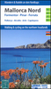
Mallorca North Reise Know-How

Northern Mallorca at 1:40, 000 in a series of four GPS compatible, double-sided maps from Reise Know-How printed on light, waterproof and tear-resistant synthetic paper, with very clear presentation of the road network, plus selected hiking and cycling routes.Maps in this series have contours at 100m intervals, enhanced by altitude colouring, with plenty of names of mountain ranges, peaks, etc. Road network includes local roads and cart tracks; driving distances are shown on main and selected secondary routes. A wide range of symbols highlight various places of interest, including campsites and mountain shelters, archaeological and historical sites, viewpoints, beaches and surfing/diving sites, botanical gardens, etc.For hikers the maps show hiking trails indicating easy,
moderate or difficult routes. Also highlighted are recommended cycling routes, with the maps indicating roads closed to cyclists. Each map is double-sided, indexed, and has both a UTM and a latitude/longitude (interval 2’) grid. Map legend includes English.To see the other titles in this series please click on the series link.
RIP - This product is no longer available on our network. It was last seen on 25.09.2019

This page now acts as a permanent archive for this product. Add more information using the comments box below to ensure it can still be found by future generations.

Use our search facility to see if it is available from an alternative contributor.
  • External links may include paid for promotion
  • Availability: Out Of Stock
  • Supplier: Stanfords
  • SKU: 9783831770977
Availability: In Stock
£10.50

Product Description

Northern Mallorca at 1:40, 000 in a series of four GPS compatible, double-sided maps from Reise Know-How printed on light, waterproof & tear-resistant synthetic paper, with very clear presentation of the road network, plus selected hiking & cycling routes. Maps in this series have contours at 100m intervals, enhanced by altitude colouring, with plenty of names of mountain ranges, peaks, etc. Road network

Includes::
local roads & cart tracks; driving distances are shown on main & selected secondary routes. A wide range of symbols highlight various places of interest, including campsites & mountain shelters, archaeological & historical sites, viewpoints, beaches & surfing/diving sites, botanical gardens, etc. For hikers the maps show hiking trails indicating easy, moderate or difficult routes. Also highlighted are recommended cycling routes, with the maps indicating roads closed to cyclists. Each map is double-sided, indexed, & has both a UTM & a latitude/longitude (interval 2’) grid. Map legend

Includes::
English. To see the other titles in this series please click on the series link.

Reviews/Comments

Add New

Price History

Vouchers

No voucher codes found.
Do you know a voucher code for this product or supplier? Add it to Insights for others to use.

Facebook

Jargon Buster

GPS - Global Positioning System - Global position using satellites
Paper - A thin sheet mainly used for writing. Available in a variety of colours. Made mainly from wood pulp.
Hiking - An outdoor activity envolving walking in nature
Waterproof - Resistant to water, usualy specified by depth in metres
Network - A link and communication between things. Often computers or people.
Road - a manmade lane or a path that is used to speed up travel.
Resistant - Something that can repel against something.
Altitude - Something that can be quite high in relation to sea or ground level.
Wide - Something with a large width.

Supplier Information

Stanfords
Stanfords was established in 1853 and opened their iconic Covent Garden flagship store in 1901. They have become the top retailer of maps, travel books and accessories in the UK and arguably offer the largest selection of maps and travel books worldwide. Famous names such as Captain Robert Falcon Scott, Ranulph Fiennes and Michael Palin have purchased from Stanfords. They now have a shop in Bristol and both stores together with other venues operate a calendar of events including talks, book signings and exhibitions. As a specialist map retailer, the map selection is comprehensive and includes road maps, street maps and walking maps from worldwide destinations, as well as a selection of world atlases and wall maps. Books include travel guides and travel literature. Stanfords also stock globes, from miniatures made of blue marble to magnificent floor-standing globes. The website features a selection of interesting articles on travel topics.
Page Updated: 2023-11-12 20:15:36

Community Generated Product Tags

Oh No! The productWIKI community hasn't generated any tags for this product yet!
Menu