
 United Kingdom
 France
 Germany
 Netherlands
 Sweden
 USA
USA
 Italy
Italy
 Spain
Spain
More From Contributor


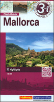
Mallorca Flash Map/Guide
Mallorca on a large, waterproof and tear-resistant map at 1:80, 000 from the Swiss Hallwag/Kümmerly + Frey cartographic house, highlighting the island’s 77 best sights, each with a brief description, plus a street plan of central Palma de Mallorca. The map is double-sided, with a very generous overlap and Palma included on both sides.Topography of Mallorca’s mountains is well presented by contours at 40m intervals with additional shading, plus colouring and/or graphics for woodlands, vineyards, etc. Road network includes small local roads and selected country tracks. Scenic routes are highlighted. 77 best sights are cross-referenced to the surrounding panels of brief descriptions, many illustrated with photos. The map has no geographical coordinates. The index lists a
selection of towns.Also included are small a street plan of Palma de Mallorca highlighting main sights, selected hotels, restaurants, etc. Map legend and all the text include English.
selection of towns.Also included are small a street plan of Palma de Mallorca highlighting main sights, selected hotels, restaurants, etc. Map legend and all the text include English.

Product Description
Reviews/Comments
Add New
Vouchers
No voucher codes found.
Do you know a voucher code for this product or supplier? Add it to Insights for others to use.
Do you know a voucher code for this product or supplier? Add it to Insights for others to use.
 Denmark