
 United Kingdom
 France
 Germany
 Netherlands
 Sweden
 USA
USA
 Italy
Italy
 Spain
Spain
More From Contributor


Mallorca Cycling Map
Mallorca at 1:100, 000 on a double-sided cycling map from Editorial Alpina printed on light, waterproof and tear-resistant plastic paper. Roads are classified according to density of traffic and six route profiles are included.The map is double-sided, dividing the island east-west with a small overlap between the sides. Topography is shown by altitude colouring with spot heights and roads are annotated with gradient markings giving the percentage of incline.Roads likely to be used by cyclists are classified according to the density of traffic: light, medium and heavy. Additional annotations provide information for particular sections, e.g. heavy traffic during certain parts of the day/week, tunnel without lights, etc. Nine routes, from 36km to 141km long are provided with 10km/100m
of altitude profiles. Also marked are selected mountain bike trails which connect to the road network.The map also shows locations of bike hire and repairs shops (contact details are provided), selected bars and restaurants, viewpoints, places of interest, etc. UTM grid is printed at 10 km intervals.Map legend and all the relevant text include English.
of altitude profiles. Also marked are selected mountain bike trails which connect to the road network.The map also shows locations of bike hire and repairs shops (contact details are provided), selected bars and restaurants, viewpoints, places of interest, etc. UTM grid is printed at 10 km intervals.Map legend and all the relevant text include English.
Product Description
Reviews/Comments
Add New
Intelligent Comparison
Archived Product
Halland Cycling Map Stanfords
£19.99
Archived Product
Mallorca Flexi Map Stanfords
£4.99
Archived Product
Mallorca Flexi Map Stanfords
£4.99
Archived Product
Mallorca Flexi Map Stanfords
£5.99
Archived Product
Harz Cycling Map Stanfords
£10.99
Archived Product
Malaren East Cycling Map Stanfords
£19.99
Archived Product
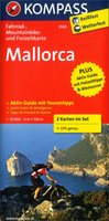
Mallorca 2-Map Cycling Set Stanfords
£15.50
Archived Product
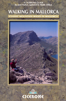
Mallorca Walking Stanfords
£15.95
Vouchers
No voucher codes found.
Do you know a voucher code for this product or supplier? Add it to Insights for others to use.
Do you know a voucher code for this product or supplier? Add it to Insights for others to use.
 Denmark