More From Contributor

£9.99
Hiking map of the north western part of Mallorca, from the northern outskirts of Palma de Mallorca to Polença. Contours with spot heights & relief shading present the topography of the area. Places of interest are highlighted. The map shows local footpaths & is accompanied by a booklet with descriptions, in Spanish, English & German, of seventeen hiking excursions from four to six hours long. ...
Archived Product
£14.99
The central part of Mallorca’s Serra de Tramuntana mountains on a contoured & GPS-compatible map at 1:25, 000 from Editorial Alpina, highlighting numerous local hiking trails & the course of the GR221 long-distance trail, climbing & canyoning sites, refuges & campsites, etc. Accompanying booklet

Includes::
English-language descriptions of several recommended routes. The map has contours at 10m intervals, relief shading & numerous spot heights, plus colouring to show different types of vegetation. An overprint highlights walking trails, indicating routes which are not waymarked and/or steep & difficult to follow. Several trails are cross-referenced to their descriptions in the accompanying booklet. Symbols indicate mountain refuges, campsites & other accommodation, climbing & canyoning sites, etc. Road network shows car parks, petrol stations & local bus stops. The map has a 1-km UTM grid plus latitude & longitude margin ticks at 1’ intervals. Map legend

Includes::
English. The booklet, with 24 pages in English, also provides contact details for mountain refuges & other useful information sources. To see other titles in Editorial Alpina’s extensive series of walking maps of Spain, including more titles covering Mallorca, please click on the series link.


...
Archived Product
£14.99
The northern part of Mallorca’s Serra de Tramuntana mountains on a contoured & GPS-compatible map at 1:25, 000 from Editorial Alpina, highlighting numerous local hiking trails & the course of the GR221 long-distance trail, climbing & canyoning sites, refuges & campsites, etc. Accompanying booklet

Includes::
English-language descriptions of several recommended routes. The map has contours at 10m intervals, relief shading & numerous spot heights, plus colouring to show different types of vegetation. An overprint highlights walking trails, indicating routes which are not waymarked and/or steep & difficult to follow. Several trails are cross-referenced to their descriptions in the accompanying booklet. Symbols indicate mountain refuges, campsites & other accommodation, climbing & canyoning sites, etc. Road network shows car parks, petrol stations & local bus stops. The map has a 1-km UTM grid plus latitude & longitude margin ticks at 1’ intervals. Map legend

Includes::
English. An enlargement shows the Sanctuari de Lluc area in greater detail at 1:10, 000. The booklet, with 30 pages in English, also provides contact details for mountain refuges & other useful information sources. To see other titles in Editorial Alpina’s extensive series of walking maps of Spain, including more titles covering Mallorca, please click on the series link.


...
Archived Product
£14.99
The southern part of Mallorca’s Serra de Tramuntana mountains on a contoured & GPS-compatible map at 1:25, 000 from Editorial Alpina, highlighting numerous local hiking trails & the course of the GR221 long-distance trail, climbing & canyoning sites, refuges & campsites, etc. Accompanying booklet

Includes::
English-language descriptions of several recommended routes. The map has contours at 10m intervals, relief shading & numerous spot heights, plus colouring to show different types of vegetation. An overprint highlights walking trails, indicating routes which are not waymarked and/or steep & difficult to follow. Several trails are cross-referenced to their descriptions in the accompanying booklet. Symbols indicate mountain refuges, campsites & other accommodation, climbing & canyoning sites, etc. Road network shows car parks, petrol stations & local bus stops. The map has a 1-km UTM grid plus latitude & longitude margin ticks at 1’ intervals. Map legend

Includes::
English. The booklet, with 20 pages in English, also provides contact details for mountain refuges & other useful information sources. To see other titles in Editorial Alpina’s extensive series of walking maps of Spain, including more titles covering Mallorca, please click on the series link.


...
Archived Product
£8.99
Pocket-sized full-colour guide, designed for short-break holidays. Describes walks & excursions for all-comers, with recommended restaurants en route serving local dishes (with sample menus & recipes). Other sections: planning your trip, getting around, food shopping (including health food), local markets, glossary, web sites. ...
Archived Product
£17.99
Mallorca on a set of four double-sided, contoured & GPS compatible maps at 1:35, 000 from Kompass with exceptionally detailed presentation of the topography, extensive overprint for hiking trails & cycling routes, accommodation & places of interest, etc, plus street plans of central Palma de Mallorca, Platja de Palma, Sóller, Alcúdia/ Port d’ Alcúdia, Port de Pollença, Artà & Felanitx. Landscape is presented by contours at 20m intervals enhanced by shading & graphic relief for rocky areas, plus colouring and/or graphics for woodlands, vineyards, etc. The overprint highlighting hiking paths indicates steep sections & routes partly requiring climbing experience, as well as the course of the GR221 long-distance trail. Cycle routes & mountain bike trails are also highlighted & symbols indicate campsites, youth hostels, mountain refuges, selected isolated hotels & inns, sport & recreational facilities, plus a wide range of other places of interest. Road network shows toll roads, entry restrictions, car parks & resting places, & stops of the island’s bus network. The map has a 1km UTM grid. Street plans indicate various facilities such as cash points, pharmacies, shopping centres, etc. Map legend

Includes::
English. PLEASE NOTE: Kompass also show Mallorca at 1:75, 000 on a one-sheet, double-sided map but with less detailed presentation of the topography & recreational possibilities.

...
Archived Product
£14.99
Mallorca’s central plain with the south-eastern & eastern coast on a waterproof & tear-resistant, double-sided, contoured & GPS compatible map at 1:50, 000 from Editorial Alpina, highlighting hiking trails plus cycling & mountain biking routes, including 27 recommendations with English language descriptions in the accompanying booklet. The double-sided map has contours at 20m intervals with additional altitude colouring. Hiking & cycling routes are highlighted & mountain bike trails are graded according to three degrees of difficulty. Road network indicates picturesque routes & symbols show campsites, hotels or inns, tourist information offices, wine cellars, viewpoints, climbing sites, etc. The map has a 5km UTM grid. Two locations, the Randa area north of Llucmajor plus the hills south-east of Felanitx are also presented on more detailed enlargements. PLEASE NOTE: this title comes with only one map, double-sided to cover two areas of the isl&, hence the publishers’ somewhat confusing note on the booklet covers referring to two maps.A separate booklet provides general information & practical advice, plus divides the area covered by the map into three region, recommending in each one a selection of hiking trails, mountain biking locations & scenic routes along the roads. Map legend & all the text include English. To see other titles in Editorial Alpina’s coverage of Mallorca & the rest of Spain, please click on the series link. ...
Archived Product
£8.99
Mallorca at 1:100, 000 on a double-sided cycling map from Editorial Alpina printed on light, waterproof & tear-resistant plastic paper. Roads are classified according to density of traffic & six route profiles are included. The map is double-sided, dividing the island east-west with a small overlap between the sides. Topography is shown by altitude colouring with spot heights & roads are annotated with gradient markings giving the percentage of incline. Roads likely to be used by cyclists are classified according to the density of traffic: light, medium & heavy. Additional annotations provide information for particular sections, e.g. heavy traffic during certain parts of the day/week, tunnel without lights, etc. Nine routes, from 36km to 141km long are provided with 10km/100m of altitude profiles. Also marked are selected mountain bike trails which connect to the road network. The map also shows locations of bike hire & repairs shops (contact details are provided), selected bars & restaurants, viewpoints, places of interest, etc. UTM grid is printed at 10 km intervals. Map legend & all the relevant text include English. ...
Archived Product
£5.59
Mallorca in the Directions series from Rough Guides; pocket-sized guides to a range of international regions & cities, practically designed to help visitors make the most of their trip. Ideal for shorter breaks of around a week, the guides cover the principal areas, towns & neighbourhoods within a region or city. Each section contains concise listings for what to see & do, as well as details of selected restaurants, caf ...
Archived Product
£9.50
Eastern Mallorca at 1:40, 000 in a series of four GPS compatible, double-sided maps from Reise Know-How printed on light, waterproof & tear-resistant plastic paper, with very clear presentation of the road network, plus selected hiking & cycling routes. The map has been updated in 2010 & shows the new road numbering system used on the isl&. Maps in this series have contours at 100m intervals, enhanced by altitude colouring, with plenty of names of mountain ranges, peaks, etc. Road network

Includes::
local roads & cart tracks; driving distances are shown on main & selected secondary routes. A wide range of symbols highlight various places of interest, including campsites & mountain shelters, archaeological & historical sites, viewpoints, beaches & surfing/diving sites, botanical gardens, etc. For hikers the maps show hiking trails indicating easy, moderate or difficult routes. Also highlighted are recommended cycling routes, with the maps indicating roads closed to cyclists. Each map is double-sided, indexed, & has both a UTM & A latitude/longitude (interval 2

...
Archived Product

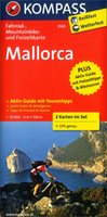
Mallorca 2-Map Cycling Set

Mallorca in a set of two double-sided, waterproof and tear-resistant, contoured and GPS compatible cycling maps at 1:75, 000 from Kompass highlighting cycling trails; plus symbols for hire facilities, various accommodation options, places of interest, etc. The lamination allows for additional write on / wipe off highlighting with suitable marked pens without damaging the maps.Topography is presented by contours at 100m intervals with hill shading. The routes are prominently highlighted, indicating waymarked and unmarked cycle routes plus mountain bike trails. Symbols indicate various accommodation options including youth hostels and campsites, cycle hire points, sport and recreational facilities, places of interest, etc. The maps have a 1km UTM grid. PLEASE NOTE: the set includes
a German language guide to the island – the guide is not available in English. The legend for all the information on the maps includes English.
RIP - This product is no longer available on our network. It was last seen on 25.09.2019

This page now acts as a permanent archive for this product. Add more information using the comments box below to ensure it can still be found by future generations.

Use our search facility to see if it is available from an alternative contributor.
  • External links may include paid for promotion
  • Availability: Out Of Stock
  • Supplier: Stanfords
  • SKU: 9783850266840
Availability: In Stock
£15.50

Product Description

Mallorca in a set of two double-sided, waterproof & tear-resistant, contoured & GPS compatible cycling maps at 1:75, 000 from Kompass highlighting cycling trails; plus symbols for hire facilities, various accommodation options, places of interest, etc. The lamination allows for additional write on / wipe off highlighting with suitable marked pens without damaging the maps. Topography is presented by contours at 100m intervals with hill shading. The routes are prominently highlighted, indicating waymarked & unmarked cycle routes plus mountain bike trails. Symbols indicate various accommodation options including youth hostels & campsites, cycle hire points, sport & recreational facilities, places of interest, etc. The maps have a 1km UTM grid. PLEASE NOTE: the set

Includes::
a German language guide to the island – the guide is not available in English. The legend for all the information on the maps

Includes::
English.

Reviews/Comments

Add New

Intelligent Comparison

Oooops!
We couldn't find anything!
Perhaps this product's unique.... Or perhaps we are still looking for comparisons!
Click to bump this page and we'll hurry up.

Price History

Vouchers

No voucher codes found.
Do you know a voucher code for this product or supplier? Add it to Insights for others to use.

Facebook

Jargon Buster

GPS - Global Positioning System - Global position using satellites
Waterproof - Resistant to water, usualy specified by depth in metres
Set - a group of items usually related to one another. Some objects cannot function without the complete set of items.
Language - the method of communication used in different areas. Humans and computers have many different languages.
Resistant - Something that can repel against something.
Accommodation - A room in which someone can live in, for example in a hotel
Wipe - To rub a cloth (or similar) along something generally to clean or dry
Language - The way humans communicate either written and spoken.

Supplier Information

Stanfords
Stanfords was established in 1853 and opened their iconic Covent Garden flagship store in 1901. They have become the top retailer of maps, travel books and accessories in the UK and arguably offer the largest selection of maps and travel books worldwide. Famous names such as Captain Robert Falcon Scott, Ranulph Fiennes and Michael Palin have purchased from Stanfords. They now have a shop in Bristol and both stores together with other venues operate a calendar of events including talks, book signings and exhibitions. As a specialist map retailer, the map selection is comprehensive and includes road maps, street maps and walking maps from worldwide destinations, as well as a selection of world atlases and wall maps. Books include travel guides and travel literature. Stanfords also stock globes, from miniatures made of blue marble to magnificent floor-standing globes. The website features a selection of interesting articles on travel topics.
Page Updated: 2023-11-12 20:15:36

Community Generated Product Tags

Oh No! The productWIKI community hasn't generated any tags for this product yet!
Menu