More From Contributor

£6.95
Topographic coverage of mainland Spain at 1:50, 000 in the MTN50 (Mapa Topográfico Nacional) series from the Centro Nacional de Información Geografica, the country’s civilian survey organization. The maps have contours at 20m intervals, enhanced by relief shading, plus colouring and/or graphics to show different types of terrain, vegetation or land use. Boundaries of national parks & other protected areas are marked. In addition to all the usual information featured on topographic mapping at this scale, detailed presentation of the road & rail networks, rural tracks & paths, etc, the maps also show campsites & mountain refuges. On more recent editions some GRs, the official long-distance hiking routes, are also marked (although not as clearly as on hiking maps from other publishers). Each map covers 29.5x 18.5 km (with adjustments in the border or coastal areas). The maps have a 1-km UTM grid, plus margin ticks for latitude & longitude at 1` intervals. Map legend is in Spanish only.HOW TO CHOOSE THE RIGHT 50K MAP: all the titles in CNIG’s 200K Provincial Road Maps series at 1:200, 000 are overprinted with the grid for the 1:50, 000 maps & can be used to see the area covered by each 50K title. TO SEE THE LIST OF TITLES IN THIS SERIES PLEASE CLICK ON THE SERIES LINK.PLEASE NOTE
- MAP TITLES: the grids shown on our website serve both the civilian & the military 1:50, 000 topographic series. Although the areas covered by maps in both series are identical (apart from some border or coastal sheets), occasionally map titles differ – only one title is shown on the grid, usually the military one. In Galicia, the Basque country & in the Catalan speaking areas the tendency now is to use local place names rather than the often better known Castilian ones. Where possible, both versions are included in our titles. Map titles listed on our website are based on information received by us at the time of publication, but sometimes maps arrive showing a completely different title! As long as the map number is as ordered, the correct map has been supplied.
...
Archived Product
£6.50
Topographic coverage of mainland Spain at 1:25, 000 published by the Centro Nacional de Información Geograficá, the country’s civilian survey organization. The maps have contours at 10m intervals & colouring and/or graphics to show different types of vegetation or land use. Boundaries of national parks & other protected areas are marked. In addition to all the usual information shown on topographic maps at this scale, detailed presentation of the road & rail networks, rural tracks & paths, etc, the maps also show campsites. The maps have a 1-km UTM grid, with margin ticks for latitude & longitude at 1` intervals. Map legend is in Spanish only.PLEASE NOTE: our grid for the whole of Spain is in preparation
- in the meantime, for areas other than those shown on the attached grid please use CNIG’s topographic survey at 1:50, 000 by searching for ‘SI00000832’. Each 25K map covers one quarter of the corresponding 50K map, with the numbering system: I = NW quarter, II = NE quarter, III = SW quarter & IV = SE quarter. CNIG maps in the Provincial Road Maps series at 1:200, 000 are overprinted with the grid for the 1:50, 000 survey & can be used to see the area covered by each 50K or 25K title in more detail. To see the list of titles in this series please click on the series grid
- for map numbers not yet listed on our website please contact us by email.

...
Archived Product
£6.95
Topographic coverage of the Balearic Islands at 1:50, 000 in the MTN50 (Mapa Topográfico Nacional) series from the Instituto Geográfico Nacional – Centro Nacional de Información Geografica, the country’s civilian survey organization. The maps have contours at 20m intervals, enhanced by relief shading, plus colouring and/or graphics to show different types of terrain, vegetation or land use. Boundaries of national parks & other protected areas are marked. In addition to all the usual information featured on topographic mapping at this scale: detailed presentation of the road & rail networks, rural tracks & paths, etc, the maps also show campsites & mountain refuges. On more recent editions some GRs, the official long-distance hiking routes, are also marked (although not as clearly as on hiking maps from other publishers). The MTN50 series was begun in late 1990s. Each map covers 28.5x 18.5 km (with adjustments in the coastal areas). The maps have a 1-km UTM grid, plus margin ticks for latitude & longitude at 1` intervals. Map legend is in Spanish only. To see other titles in this series please click on the series link. ...
Archived Product
£15.95
A detailed, colour survey map from the Portuguese Military Survey's M782 series. Each map in this series has contours at 20m intervals with supplementary contours at 10m intervals. One major advantage the military mapping has over the civilian equivalent is that the legend is in English as well as Portuguese. This legend

Includes::
roads, railways, buildings, spot heights, vegetation type, fluvial information, scree, dunes, churches, ruins, etc. Latitude & longitude ticks are show at 10' intervals. Recently revised sheets also have a UTM grid at 100m intervals. Vertical Datum: Mean Sea Level at Cascais Harbour Projection: Transverse Mercator

...
Archived Product
£14.95
Macao, an archipelago attached to China, is a place whose name is redolent with myth, legend & history. Established by the Portuguese in 1557, Macao`s role as the Portuguese trading base for East Asia, & also as the outpost for the Christian Church in the area, meant that since its very beginning it has been a region where disparate peoples & beliefs have met, mingled & learned to co-exist. Its position, conveniently located on China`s doorstep, ensured that trade flourished; it became a rich warehouse, where more goods were exchanged than anywhere else in the world. It was also a place of debauchery & turpitude, with gambling dives, opium dens, secret pleasure houses & an astonishingly successful smuggling industry. Administered by China since 1999, after two decades of intensive development Macao today has been transformed. From the end of World War ii until the 1980s, however, time seemed to stand still, & the city, preserved for a while from modernity, possessed a unique charm. In this Macao, East & West lived together in harmony: curved Chinese roofs, Corinthian columns & cast-iron balconies could be found side by side; statues of the Virgin were matched by little red shrines dedicated to local divinities; & beautiful Portuguese palaces were allowed to slip into elegant decay. It is this lost Macao, a dormant city of illusion, that Philippe Pons`s evocative text recovers. ...
Archived Product
£17.99
Topographic survey of Portugal at 1:50, 000 from the Instituto Geográfico Português, the country’s civilian survey organisation. The maps have contours at 25m intervals & in addition to the standard features shown on topographic mapping at this scale also indicate various types of vegetation (vineyards, olive groves, etc). Each sheet covers an area of 32 x 20km (20 x 12.5miles approx). The maps have latitude & longitude margin ticks at 1’ intervals & UTM coordinates for the map corners – each sheet also shows conversion details from BBLx (Bessel-Bonnie system, Datum Lisbon) to UTM. Map legend is in Portuguese only.EDITION DATES: most titles in this series have now been updated in the 1990s or later. To see all the titles in this series please click on the series link. ...
Archived Product
£18.00
Admiralty Collection is a range of beautiful historic chart replicas from UK Hydrographic Office Archive in Taunton, Somerset. Admiralty have now discontinued this series. The maps listed here are the last remaining copies & unfortunately we will not be able to order more. If you need any further information or help choosing a print, you can email us at maritime@stanfords.co.uk. ...
Archived Product
£15.00
Macarons are the aristocrats of pastry; these brightly coloured, mini meringues, daintily sandwiched together with gooey fillings, have become a holy grail for cookery fanatics & there are even food blogs dedicated to them. Like Pierre Herme`s famous macarons, it would be difficult for any macaron book to surpass this one & indeed the hardback edition has been a universal bestseller (still in print 978-1-908117-23-6). There are 208 pages of recipes & beautiful food photography, & because making macarons is mostly about technique, rather than just a standard recipe, readers will appreciate the 32-step-by-step photo-illustrated instructions for making shells & fillings. All the classics are here like dark chocolate, praline, coffee, & pistachio, but others feature the more unusual macarons that Herme is justly famous for: Isfahan is one, with lychee, rose & raspberry, Arabesque with apricot & pistachio, Satine with passion fruit, orange & cream cheese, Mandarin & pink pepper, black truffles, balsamic vinegar as well as a bright-green macaron filled with fresh mint. ...
Archived Product
£28.00
In the middle of the twentieth century, Pierre Des Fontaines, cousin of Louis Ernest Laduree, created the first Laduree macaron by having the genius to stick two macaron biscuits together & fill them with a flavourful ganache they are still prepared the same way today. Every season Laduree celebrates this little round delicacy crunchy on the outside & soft inside, a perfect balance of aromas & textures by creating new flavours. Each year the palette of flavours & colours grows, from the classic chocolate or raspberry to celebratory macarons; unique flavours inspired by exotic destinations, fashion designers, perfumes & so on. This book presents, for the first time, all of the eighty Laduree macarons, their flavours & inspirations &, of course, all of the recipes on how to make them at home including a practical, step-by-step section illustrating exactly how Ladurees chefs make the famous biscuits & the ganache fillings, so you can be assured of success. ...
Archived Product
£4.99
Macau on a laminated, tear-resistant Insight Flexi Map, with street plans of Macau itself plus of Taipa & Coloane Islands, a road map of the surrounding region including Hong Kong & Guangzhou, plus extensive tourist information. On one side is a street plan of Macau at 1:10, 000. Main public buildings, places of interest & selected hotels are prominently highlighted & named. The plan is indexed for streets, districts, parks, hotels, points of interest & public buildings. All names: streets, districts, buildings, sights, etc. are shown both in Latin alphabet & in Chinese characters. On the reverse is a map presenting the islands of Taipa & Coloane at 1:45, 000, highlighting various sights & indexed for streets, parks, hotels & points of interest. Also included is a map of a wider region around Macau at 1:1, 500, 000, including Hong Kong & Guangzhou. Both maps give all names in Latin alphabet only.A special feature of the Insight Flexi series are panels with additional tourist information: 27 main sights, neatly grouped into sections covering Major Sights, Recommended Museums, Churches & Temples, Casinos & Nightlife, plus Other Sights, are given brief descriptions & are prominently highlighted on the relevant maps. Further panels provide information on Getting Around & Facts for Visitors, including tourist information offices, public holidays, opening times, money, telecommunications & monthly climate charts. ...
Archived Product

Macao

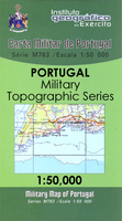
Topographic survey of Portugal at 1:50, 000 from the Instituto Geográfico do Exército, the country’s military survey organisation. The maps have contours at 20m intervals and in addition to the standard features shown on topographic mapping at this scale also indicate various types of terrain or vegetation (sand, terraces, rocks, woodlands, vineyards, etc). Each sheet covers an area of 32 x 20km (20 x 12.5 miles approx). The maps have a 1-km UTM grid plus latitude and longitude coordinates for the map corners. Map legend and a glossary of terms used on the maps include English.EDITION DATES: most titles in this series date from 1990s or later.To see all the titles in this series please click on the series link.
RIP - This product is no longer available on our network. It was last seen on 25.09.2019

This page now acts as a permanent archive for this product. Add more information using the comments box below to ensure it can still be found by future generations.

Use our search facility to see if it is available from an alternative contributor.
  • Availability: Out Of Stock
  • Supplier: Stanfords
  • SKU: 9789892100050
Availability: In Stock
£17.99

Product Description

Topographic survey of Portugal at 1:50, 000 from the Instituto Geográfico do Exército, the country’s military survey organisation. The maps have contours at 20m intervals & in addition to the standard features shown on topographic mapping at this scale also indicate various types of terrain or vegetation (s&, terraces, rocks, woodlands, vineyards, etc). Each sheet covers an area of 32 x 20km (20 x 12.5 miles approx). The maps have a 1-km UTM grid plus latitude & longitude coordinates for the map corners. Map legend & a glossary of terms used on the maps include English.EDITION DATES: most titles in this series date from 1990s or later. To see all the titles in this series please click on the series link.

Reviews/Comments

Add New

Intelligent Comparison

Oooops!
We couldn't find anything!
Perhaps this product's unique.... Or perhaps we are still looking for comparisons!
Click to bump this page and we'll hurry up.

Price History

Vouchers

No voucher codes found.
Do you know a voucher code for this product or supplier? Add it to Insights for others to use.

Facebook

Jargon Buster

Date - A day on a calendar
Date - A social activity whith a current or potential partner
Km - Kilometre. A unit of measurement equal to 1000 metres.

Supplier Information

Stanfords
Stanfords was established in 1853 and opened their iconic Covent Garden flagship store in 1901. They have become the top retailer of maps, travel books and accessories in the UK and arguably offer the largest selection of maps and travel books worldwide. Famous names such as Captain Robert Falcon Scott, Ranulph Fiennes and Michael Palin have purchased from Stanfords. They now have a shop in Bristol and both stores together with other venues operate a calendar of events including talks, book signings and exhibitions. As a specialist map retailer, the map selection is comprehensive and includes road maps, street maps and walking maps from worldwide destinations, as well as a selection of world atlases and wall maps. Books include travel guides and travel literature. Stanfords also stock globes, from miniatures made of blue marble to magnificent floor-standing globes. The website features a selection of interesting articles on travel topics.
Page Updated: 2023-11-12 20:15:36

Community Generated Product Tags

Oh No! The productWIKI community hasn't generated any tags for this product yet!
Menu