
 United Kingdom
 France
 Germany
 Netherlands
 Sweden
 USA
USA
 Italy
Italy
 Spain
Spain
More From Contributor


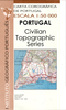
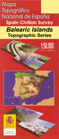
Macanor CNIG Topo 700
Topographic coverage of the Balearic Islands at 1:50, 000 in the MTN50 (Mapa Topográfico Nacional) series from the Instituto Geográfico Nacional – Centro Nacional de Información Geografica, the country’s civilian survey organization. The maps have contours at 20m intervals, enhanced by relief shading, plus colouring and/or graphics to show different types of terrain, vegetation or land use. Boundaries of national parks and other protected areas are marked. In addition to all the usual information featured on topographic mapping at this scale: detailed presentation of the road and rail networks, rural tracks and paths, etc, the maps also show campsites and mountain refuges. On more recent editions some GRs, the official long-distance hiking routes, are also marked (although
not as clearly as on hiking maps from other publishers). The MTN50 series was begun in late 1990s. Each map covers 28.5x18.5 km (with adjustments in the coastal areas). The maps have a 1-km UTM grid, plus margin ticks for latitude and longitude at 1` intervals. Map legend is in Spanish only.To see other titles in this series please click on the series link.
not as clearly as on hiking maps from other publishers). The MTN50 series was begun in late 1990s. Each map covers 28.5x18.5 km (with adjustments in the coastal areas). The maps have a 1-km UTM grid, plus margin ticks for latitude and longitude at 1` intervals. Map legend is in Spanish only.To see other titles in this series please click on the series link.

Product Description
Reviews/Comments
Add New
Vouchers
No voucher codes found.
Do you know a voucher code for this product or supplier? Add it to Insights for others to use.
Do you know a voucher code for this product or supplier? Add it to Insights for others to use.
 Denmark