More From Contributor
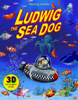
£11.19
Laminated waterproof edition of a detailed topographic map of Ludlow from the Ordnance Survey Explorer series, covering Tenbury Wells & Cleobury Mortimer. Edition A2; Publication date December 2010 About this series: These highly detailed maps show all the administrative boundaries, settlements as small as isolated farms, the road network down to unfenced roads & country tracks, & field boundaries (hedges & drystone walls) which make navigation across the countryside much easier. Steep gradients on roads are indicated. Various landmarks, e.g. powerlines, archaeological sites, windmills, churches & lighthouses are shown & additional graphics indicate natural terrain features such as cliffs, scree, mud & vegetation variations. The contour interval is 5 metres in the lower parts of the country & 10 metres in the uplands, & spot heights are marked. Each map covers an area of 30 x 20km (i.e. approx. 19 x 12 miles), with some double-sided maps covering more, as indicated in the individual descriptions. The maps are fully GPS compatible, with the National Grid shown at 1km intervals & latitude & longitude indicated by margin ticks at 1'. The Explorer series has replaced the earlier, green-cover Pathfinder maps. The Explorer series is now complete & covers all of Engl&, Wales & Scotl&. Some sheets for popular areas like the National Parks are still branded as Outdoor Leisure (OL) maps, but are now included in this series as the cartography is the same as that in the Explorer Maps. The Explorer maps offer a substantial improvement on the Pathfinder series, with greater use of colour, larger area per map, & stronger emphasis on information for ramblers & tourists. This series is ideal for walking & other outdoor pursuits & each map shows a large amount of information for ramblers & tourists. Public rights of way are shown (except in Scotland), together with other routes with public access: National Trails & Recreational Paths, permitted paths & bridleways, & selected cycle routes. Open access land created under the Countryside & Rights of Way Act 2000 is marked. Tourist information

Includes::
caravan & camp sites, Park & Ride locations, recreation/leisure/sport centres, museums, historic buildings, English Heritage & National Trust sites, rural pubs, etc. The map legend is in English only, except for the tourist information content which is also in French & German.

...
Archived Product
£3.50
Ludlow, Tembury & District 1897 in a series of reproductions of Ordnance Survey’s famous ” Inch to the Mile” maps published in the Alan Godfrey Editions to provide a historical record of England & Wales in the second half of 19th & early 20th century. In this title coverage stretches from Leintwardine eastward to Tenbury Wells, & from Bromfield southward to the outskirts of Leominster. Other locations include: in HEREFORDSHIRE Adforton, Aston, Aymestrey, Burrington, Collington, Downton on the Rock, Elton, Eye, Eyton, Hatfield, Kimbolton, Kingsl&, Leinthall Starkes, Little Hereford, Lucton, Middleton on the Hill, Orleton, Pudleston, Richards Castle, Rochford, Shobdon, Thornbury, Wigmore & Yarpole; in SHROPSHIRE Ashford Bowdler, Ashford Carbonell, Bitterley, Boraston, Burford, Caynham, Corley, Greet, Hope Baggot, Hopton Waters, Milson, Neen Sollars & Whitton; plus in WORCESTERSHIRE Hanley Child & Stoke Bliss. On the reverse is a detailed map of Woofferton Junction including part of Brimfield. About the Alan Godfrey Editions of the OS Inch to the Mile Maps: the maps provide an invaluable overview of a wider area, typically 18 x 12 miles (29 x 19 kms approx.), & offer historical mapping for small towns & villages not covered by the more detailed series for which the Godfrey Editions are better known. On the reverse all the maps have historical notes & most titles also include a more detailed, large scale map of a small town or a village in the area. To see other titles in this series please click on the series link. ...
Archived Product
£7.99
This is a raucous & brilliantly insane road trip of epic proportions, from the Booker Prize-winning author of Vernon God Little. DBC Pierre`s second novel charts the unlikely meeting between East & West that follows Ludmila Derev`s appearance on a Russian Brides website. Determined to save her family from starvation in the face of marauding troops, Ludmila`s journey into the world & womanhood is an odyssey of sour wit, even sourer vodka, & a Soviet tractor possibly running on goat`s piss. Meanwhile, thousands of miles to the West, the Heath twins are separated after 33 years conjoined at the abdomen. Released for the first time into the community, they are suddenly plunged into a round-the-clock world churning with opportunity, rowdy with the chatter of freedom, democracy, self-empowerment & sex. A wild picaresque dripping with flavours of British bacon & nasty Russian vodka, Ludmila`s Broken English is a tale of tangoing twins on a journey into the unknown. ...
Archived Product
£16.99
Topographic survey of Sweden at 1:50, 000, the Terrängkartan, from the Lantmäteriet, covering most of the country in 244 double-sided maps. Please note: the mountainous regions of central & northern Sweden are not covered by this series but presented in a separate “ Fjällkartan
- Mountain Map” series also listed on our website. Each 1:50, 000 topographic survey map covers an area of 37.5 x 40km. The maps have contours at 5 metre intervals, plus relief shading & graphics for rocky outcrops & boulders. Further graphics and/or colouring show different types of land use or vegetation (forests, arable l&, orchards, marshes, peat bogs, etc). An unusual feature of this survey is the colouring indicating buildings below or above two storeys high & “leisure/holiday homes”. The maps indicate privately maintained roads & include all other information expected of topographic survey at this scale. The maps have a 1-km UTM grid, plus latitude & longitude lines 5’ intervals. Map legend

Includes::
English. For coverage of the country’s most visited hiking areas in central & northern Sweden please see Lantmäteriet’s Mountain Map series, listed separately on our website.


...
Archived Product
£16.99
Sverigeserien is an outdoor map series consisting of 116 sheets with coverage of southern & central Sweden & the northern coastline. The map is suitable for outdoor activities such as hiking, excursions, trail running, hunting, fishing, riding, cycling, mountain biking, paddling, skating & much more. Every sheet covers an area of 45x 68km. These topographical maps in scale 1:50 000 contain all the information needed for outdoor activities: Terrain information, hiking trails, illuminated tracks, camping, shelters, golf courses, leisure baths, historical remains, roads in different categories, railway lines & much more. Easy to read topography with contour lines, vertical interval 5 m. Sverigeserien is a high-quality map series & is durable for frequent use! Updated content with map data from Lantmäteriet (National Land Survey of Sweden) & printed on Polyart which is water & tear resistant. This means that the map can be folded repeatedly without breaking & can withstand the challenging weather in Sweden during both winter & summer. Legend is in Swedish, English & German. ...
Archived Product
£10.99
Monk`s energetic enterprise is remarkable for the interweaving of the philosophical & the emotional aspects of Wittgenstein`s life` Sunday Times. ` Ray Monk`s reconnection of Wittgenstein`s philosophy with his life triumphantly carries out the Wittgensteinian task of ”changing the aspect” of Wittgenstein`s work, getting us to see it in a new way` Sunday Telegraph. ` This biography transforms Wittgenstein into a human being` Independent on Sunday. ` It is much to be recommended` Observer. ` Monk`s biography is deeply intelligent, generous to the ordinary reader... It is a beautiful portrait of a beautiful life` Guardian. ...
Archived Product
£11.50
Ludwigsstadt in a series of GPS compatible recreational editions of the Bavarian topographic survey at 1:25, 000, with waymarked hiking trails & cycling routes, campsites & youth hostels, etc. Coverage

Includes::
Teuschnitz, Pressig, Tettau, Steinbach a. Wald, Gräfenthal, Probstzella. Contours used in this map vary between 5 to 20m according to the terrain, with 20m interval predominantly used for hilly areas. Varied colouring show different types of landscape: woods, vineyards, fields etc. Maps in this series feature extensive overprint highlighting local & long-distance footpaths & cycle routes, including King Ludwig Way or different variants of the Way of St James, indicating their way marking. Symbols highlight different types of accommodation (campsites, youth hostels, refuges, etc), sport & recreational facilities, various places of interest, etc. The maps have a 1-km UTM grid. Map legend & all the text are in German only. To see other titles in this series please click on the series link.

...
Archived Product
£19.99
Lugano
- Lake Lugano
- Locarno area at 1:50, 000 in a series of waterproof & tear-resistant, contoured mountain biking maps

...
Archived Product
£19.99
Lugano
- Locarno area at 1:60, 000 in Kümmerly + Frey’s series of cycling maps published in co-operation with the Association
...
Archived Product
£18.99
33 specially selected hiking trails in the southernmost part of the Ticino canton presented at 1:50, 000 on a waterproof & tear-resistant, contoured & GPS compatible map from the Hallwag/Kümmerly + Frey group, with route profiles, grading for the severity of the terrain & the degree of fitness required, etc. Coverage

Includes::
Lugano, Locarno with the northern part of Lake Maggiore, & the Mendrisiotto area south of Lake Lugano. The cartography provides an excellent picture of the terrain through contours at 25-metre intervals enhanced by shading, graphic relief for exposed rock, & colouring for glaciers & woodlands. All local footpaths are on the maps, but the overprint specifically highlights 33 trails selected by the publishers in collaboration with Geo-tracks. The colouring of each trail indicates the degree of fitness needed, from “no physical shape required” to “extremely high level of physical fitness necessary”. The trails start near a railway station or a bus stop (the colouring of the road network indicates routes with public transport & locations of individual bus stops). The maps have the lines of the Swiss national grid at 1-km intervals. On the reverse each trail has a route profile, its grading according to severity of the terrain & the degree of fitness required to attempt it, details of length & approximate timing, the change in altitude on assent & descent, plus a brief description. Map legend

Includes::
English; all the text on the reverse is in German. Each title also

Includes::
a code for a free download onto a smartphone. To see other titles in this series please click on the series link.USEFUL TIP: the same cartography, reduced slightly to 1:60, 000, is used in Kümmerly + Frey’s hiking series with highlighting for all the waymarked trails rather than, as in this series, just a selection of 33 special routes recommended by the publishers.


...
Archived Product

Ludwig The Sea Dog

Ludwig and friends live in a world of books. One day, a postcard arrives; Ludwig`s friend, Peter the penguin, has a broken submarine and needs Ludwig`s help - under the sea. How can a dog who lives in a book explore the underwater world? Maybe with a bit of fairy tale magic and some help from his friends.This is the second 3D picture book from the author of Ludwig the Space Dog. Get ready for an adventure in another dimension.
RIP - This product is no longer available on our network. It was last seen on 25.09.2019

This page now acts as a permanent archive for this product. Add more information using the comments box below to ensure it can still be found by future generations.

Use our search facility to see if it is available from an alternative contributor.
  • Availability: Out Of Stock
  • Supplier: Stanfords
  • SKU: 9781783708000
Availability: In Stock
£12.99

Product Description

Ludwig & friends live in a world of books. One day, a postcard arrives; Ludwig`s friend, Peter the penguin, has a broken submarine & needs Ludwig`s help
- under the sea. How can a dog who lives in a book explore the underwater world? Maybe with a bit of fairy tale magic & some help from his friends. This is the second 3D picture book from the author of Ludwig the Space Dog. Get ready for an adventure in another dimension.

Reviews/Comments

Add New

Intelligent Comparison

Oooops!
We couldn't find anything!
Perhaps this product's unique.... Or perhaps we are still looking for comparisons!
Click to bump this page and we'll hurry up.

Price History

Vouchers

No voucher codes found.
Do you know a voucher code for this product or supplier? Add it to Insights for others to use.

Facebook

Jargon Buster

Friends - A close associate or a popular US based sitcom about a group of friends
World - A physical grouping, commonly used to describe earth and everything associated with ti
Day - The time it takes a planet or other space objects to complete one rotation.
Adventure - an undertaking of an exciting challenge or experience.
Dimension - The shape or measurements of something.

Supplier Information

Stanfords
Stanfords was established in 1853 and opened their iconic Covent Garden flagship store in 1901. They have become the top retailer of maps, travel books and accessories in the UK and arguably offer the largest selection of maps and travel books worldwide. Famous names such as Captain Robert Falcon Scott, Ranulph Fiennes and Michael Palin have purchased from Stanfords. They now have a shop in Bristol and both stores together with other venues operate a calendar of events including talks, book signings and exhibitions. As a specialist map retailer, the map selection is comprehensive and includes road maps, street maps and walking maps from worldwide destinations, as well as a selection of world atlases and wall maps. Books include travel guides and travel literature. Stanfords also stock globes, from miniatures made of blue marble to magnificent floor-standing globes. The website features a selection of interesting articles on travel topics.
Page Updated: 2023-11-12 20:15:36

Community Generated Product Tags

Oh No! The productWIKI community hasn't generated any tags for this product yet!
Menu