
 United Kingdom
 France
 Germany
 Netherlands
 Sweden
 USA
USA
 Italy
Italy
 Spain
Spain
More From Contributor


Low Fell 1895
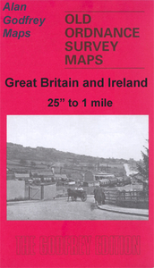
Low Fell in 1895 in a fascinating series of reproductions of old Ordnance Survey plans in the Alan Godfrey Editions, ideal for anyone interested in the history of their neighbourhood or family. Selected towns in Great Britain and Ireland are covered by maps showing the extent of urban development in the last decades of the 19th and early 20th century.In this title: the map covers Low Fell, on the south side of Gateshead, and much of the area now covered by the Team Valley Trading Estate. Low Fell itself is on the eastern side of the map. Coverage stretches from Kells Lane westward across the Team valley to Farnacres and Norwood, and from Saltwellpark Mansion southward to the Chow Dene. The NER main line runs north-south through the map, including Low Fell station. Features include St
Helen's church, Saltwell Hall, Whinney House, Saltwell Cottage, Derwent Crook, Saltwell Side, Tileshed Wood, a stretch of the Team Colliery Wagonway, tramway. An 1894 directory of Low Fell is included. About the Alan Godfrey Editions of the 25
Helen's church, Saltwell Hall, Whinney House, Saltwell Cottage, Derwent Crook, Saltwell Side, Tileshed Wood, a stretch of the Team Colliery Wagonway, tramway. An 1894 directory of Low Fell is included. About the Alan Godfrey Editions of the 25
Product Description
Reviews/Comments
Add New
Intelligent Comparison
Archived Product
Low Fell 1895 Stanfords
£3.50
Vouchers
No voucher codes found.
Do you know a voucher code for this product or supplier? Add it to Insights for others to use.
Do you know a voucher code for this product or supplier? Add it to Insights for others to use.
 Denmark